
| Memorials | : | 0 |
| Location | : | Atlanta, Fulton County, USA |
| Website | : | www.pacesferryunitedmethodist.com |
| Coordinate | : | 33.8538670, -84.4381500 |
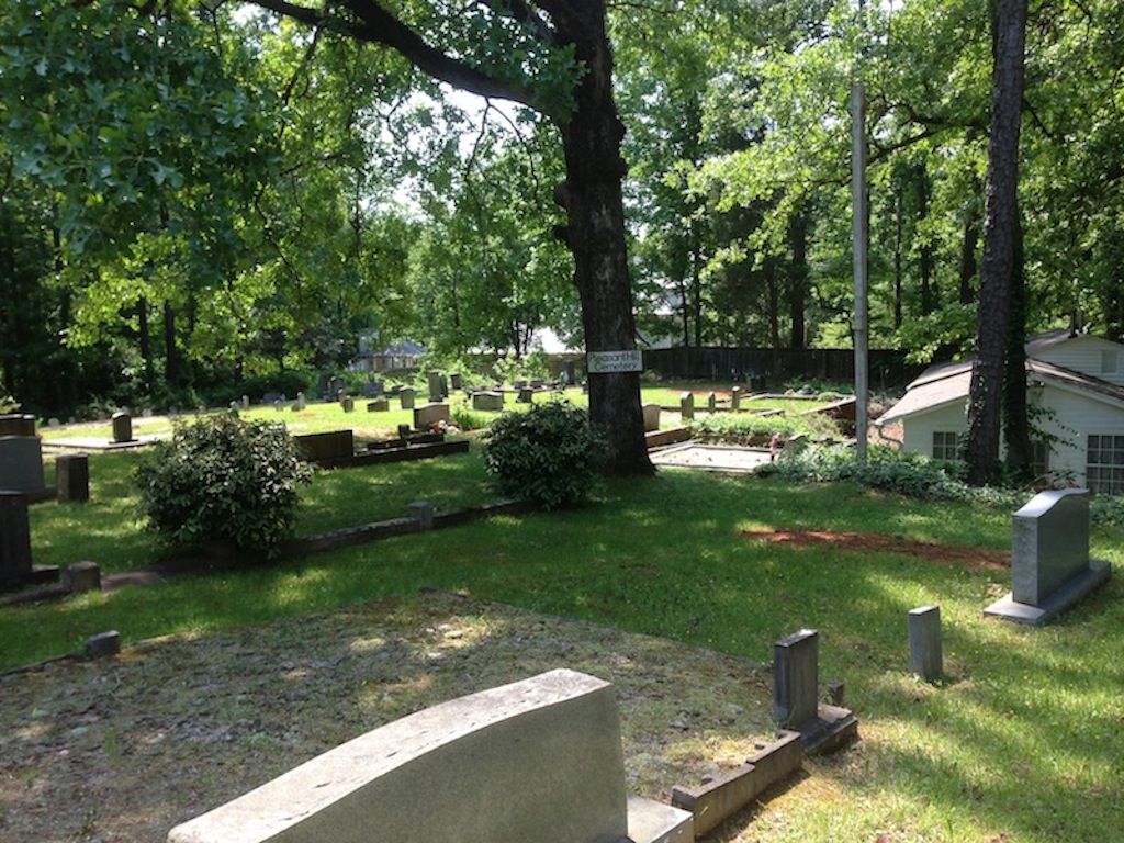
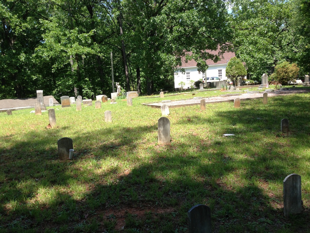
| Description | : | Adjacent to Paces Ferry Methodist Church. Perhaps half of the graves in this cemetery are not marked. There are head and foot markers without names. There are numerous depressions without any markers. Unclear how many graves are here. GA Historical Plaque reads: "On 29 September 1877 William Brown donated one acre of land at the intersection of Paces Ferry and Mount Paran Roads for the purpose of establishing and building a church. Pleasant Hill Methodist Church was first served by a circuit rider Minister, one of whom was Reverend W. J. Roland. During the week the church houses the Pleasant Hill Private Academy.... Read More |
frequently asked questions (FAQ):
-
Where is Pleasant Hill Cemetery?
Pleasant Hill Cemetery is located at 3612 Paces Ferry Road NW Atlanta, Fulton County ,Georgia , 30327USA.
-
Pleasant Hill Cemetery cemetery's updated grave count on graveviews.com?
0 memorials
-
Where are the coordinates of the Pleasant Hill Cemetery?
Latitude: 33.8538670
Longitude: -84.4381500
Nearby Cemetories:
1. Saint Anne's Episcopal Church Memorial Garden
Atlanta, Fulton County, USA
Coordinate: 33.8395200, -84.4184900
2. Trinity Presbyterian Church Memorial Gardens
Atlanta, Fulton County, USA
Coordinate: 33.8374180, -84.4173650
3. Collins-Lloyd Cemetery
Cobb County, USA
Coordinate: 33.8327160, -84.4611560
4. Pace Family Cemetery
Vinings, Cobb County, USA
Coordinate: 33.8692017, -84.4689026
5. Vinings Cemetery
Vinings, Cobb County, USA
Coordinate: 33.8657990, -84.4721985
6. Smith Family Cemetery
Atlanta, Fulton County, USA
Coordinate: 33.8221100, -84.4344900
7. Holy Spirit Catholic Church Memorial Garden
Atlanta, Fulton County, USA
Coordinate: 33.8771400, -84.4113540
8. First Saint John's Baptist Church Cemetery
Smyrna, Cobb County, USA
Coordinate: 33.8428400, -84.4748000
9. New Hope African Methodist Episcopal Cemetery
Atlanta, Fulton County, USA
Coordinate: 33.8376200, -84.4042500
10. Northside United Methodist Church Memorial Garden
Atlanta, Fulton County, USA
Coordinate: 33.8313500, -84.4060600
11. Montgomery Family Cemetery
Atlanta, Fulton County, USA
Coordinate: 33.8190890, -84.4517760
12. Harmony Grove Cemetery
Buckhead, Fulton County, USA
Coordinate: 33.8440800, -84.3919200
13. Collins Springs Primitive Baptist Church Cemetery
Smyrna, Cobb County, USA
Coordinate: 33.8368988, -84.4816971
14. Fulton County Almshouse Cemetery
Buckhead, Fulton County, USA
Coordinate: 33.8694740, -84.3905110
15. Casey's Hill Cemetery
Atlanta, Fulton County, USA
Coordinate: 33.8108660, -84.4460890
16. Sardis United Methodist Church Cemetery
Atlanta, Fulton County, USA
Coordinate: 33.8577900, -84.3840400
17. Bethel Baptist Church Cemetery
Smyrna, Cobb County, USA
Coordinate: 33.8842010, -84.4788971
18. Mount Paran Baptist Church Cemetery
Atlanta, Fulton County, USA
Coordinate: 33.8866000, -84.3999700
19. Peachtree Presbyterian Church Columbarium
Atlanta, Fulton County, USA
Coordinate: 33.8473360, -84.3826100
20. Crest Lawn Cemetery
Atlanta, Fulton County, USA
Coordinate: 33.8064003, -84.4428024
21. Cathedral of Saint Philip Memorial Garden
Atlanta, Fulton County, USA
Coordinate: 33.8301000, -84.3874300
22. Hooper-McWilliams Family Cemetery
Smyrna, Cobb County, USA
Coordinate: 33.8213196, -84.4825439
23. Riverview Memorial Park
Smyrna, Cobb County, USA
Coordinate: 33.8199997, -84.4828033
24. Winecoff Hotel Historical Marker
Atlanta, Fulton County, USA
Coordinate: 33.8248610, -84.3877780