
| Memorials | : | 2 |
| Location | : | Jefferson County, USA |
| Coordinate | : | 38.2129790, -85.6373220 |
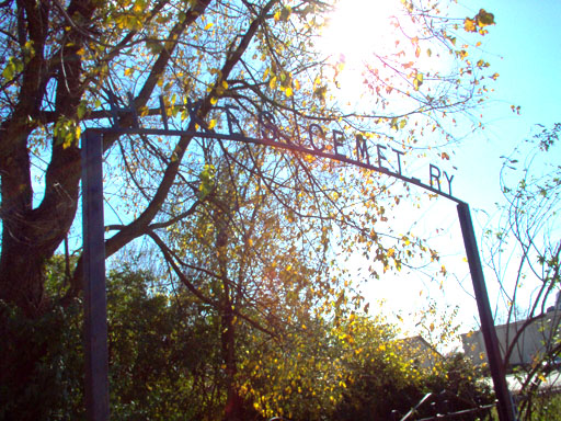
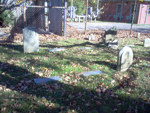
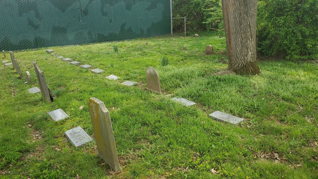
| Description | : | Hikes Lane, between 3028 (St. Michael’s Church) and 3042 (St. Barnabas Church), Catty-corner across the street from 3029 Hikes Lane The cemetery is on a busy street, with lots of cars speeding by noisily, but the cemetery itself is well-maintained. It is doubtful that anyone driving by would know it was there. You can park at St. Michael’s or St. Barnabas and then start walking from one church to the other. Even that way, I almost missed it. The cemetery is located on what would have been the property of the Hikes family. Three Hikes houses are nearby. All are on... Read More |
frequently asked questions (FAQ):
-
Where is Hikes Cemetery?
Hikes Cemetery is located at Jefferson County ,Kentucky ,USA.
-
Hikes Cemetery cemetery's updated grave count on graveviews.com?
2 memorials
-
Where are the coordinates of the Hikes Cemetery?
Latitude: 38.2129790
Longitude: -85.6373220
Nearby Cemetories:
1. Burks Family Cemetery
Saint Matthews, Jefferson County, USA
Coordinate: 38.2318130, -85.6408060
2. Hikes Cemetery
Newburg, Jefferson County, USA
Coordinate: 38.1979310, -85.6597710
3. Brown Family Cemetery
Saint Matthews, Jefferson County, USA
Coordinate: 38.2375660, -85.6331750
4. Floyd-Breckinridge Cemetery
Plymouth Village, Jefferson County, USA
Coordinate: 38.2366982, -85.6489029
5. Parks Cemetery
Plymouth Village, Jefferson County, USA
Coordinate: 38.2377280, -85.6486690
6. Resthaven Memorial Cemetery
Louisville, Jefferson County, USA
Coordinate: 38.1850014, -85.6342468
7. Kennedy Graveyard
Louisville, Jefferson County, USA
Coordinate: 38.2261920, -85.6049040
8. Green Haven Cemetery Of Louisville
Louisville, Jefferson County, USA
Coordinate: 38.1806810, -85.6372500
9. Doup Family Cemetery
Louisville, Jefferson County, USA
Coordinate: 38.2211500, -85.6821200
10. Petersburg Newburg Cemetery
Jefferson County, USA
Coordinate: 38.1846660, -85.6674710
11. Bullitt Family Cemetery
Louisville, Jefferson County, USA
Coordinate: 38.2463450, -85.6135210
12. Funk Cemetery
Forest Hills, Jefferson County, USA
Coordinate: 38.2153500, -85.5878160
13. Community of Christ Scripture Garden
Forest Hills, Jefferson County, USA
Coordinate: 38.2117500, -85.5834480
14. Arterburn Cemetery
Saint Matthews, Jefferson County, USA
Coordinate: 38.2552000, -85.6609900
15. Louisville Presbyterian Seminary Memorial Garden
Louisville, Jefferson County, USA
Coordinate: 38.2387380, -85.6861190
16. Hite Family Cemetery
Louisville, Jefferson County, USA
Coordinate: 38.1835790, -85.5867700
17. Duncan Family Cemetery
Fern Creek, Jefferson County, USA
Coordinate: 38.1721230, -85.6004910
18. Anderson Family Cemetery
Louisville, Jefferson County, USA
Coordinate: 38.2356520, -85.5775420
19. Garr Family Cemetery
Louisville, Jefferson County, USA
Coordinate: 38.2319880, -85.5745940
20. Phillips-Durrett-Clark Cemetery
Louisville, Jefferson County, USA
Coordinate: 38.2052780, -85.7052780
21. Prather Cemetery
Louisville, Jefferson County, USA
Coordinate: 38.2096570, -85.7075220
22. Lawrence Family Cemetery
Hurstbourne, Jefferson County, USA
Coordinate: 38.2515259, -85.5847015
23. Simpson Memorial Gardens
Jeffersontown, Jefferson County, USA
Coordinate: 38.1889944, -85.5719833
24. Newburg Christian Church Cemetery
Okolona, Jefferson County, USA
Coordinate: 38.1596720, -85.6628800