
| Memorials | : | 0 |
| Location | : | Saint Matthews, Jefferson County, USA |
| Coordinate | : | 38.2375660, -85.6331750 |
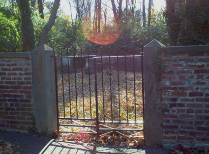
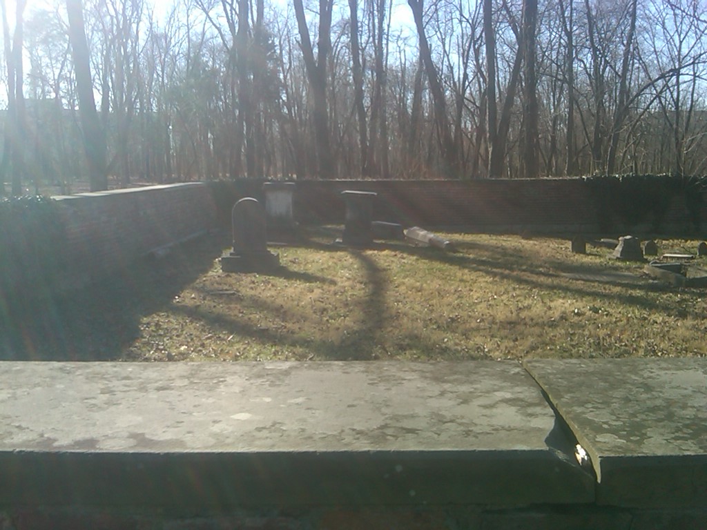
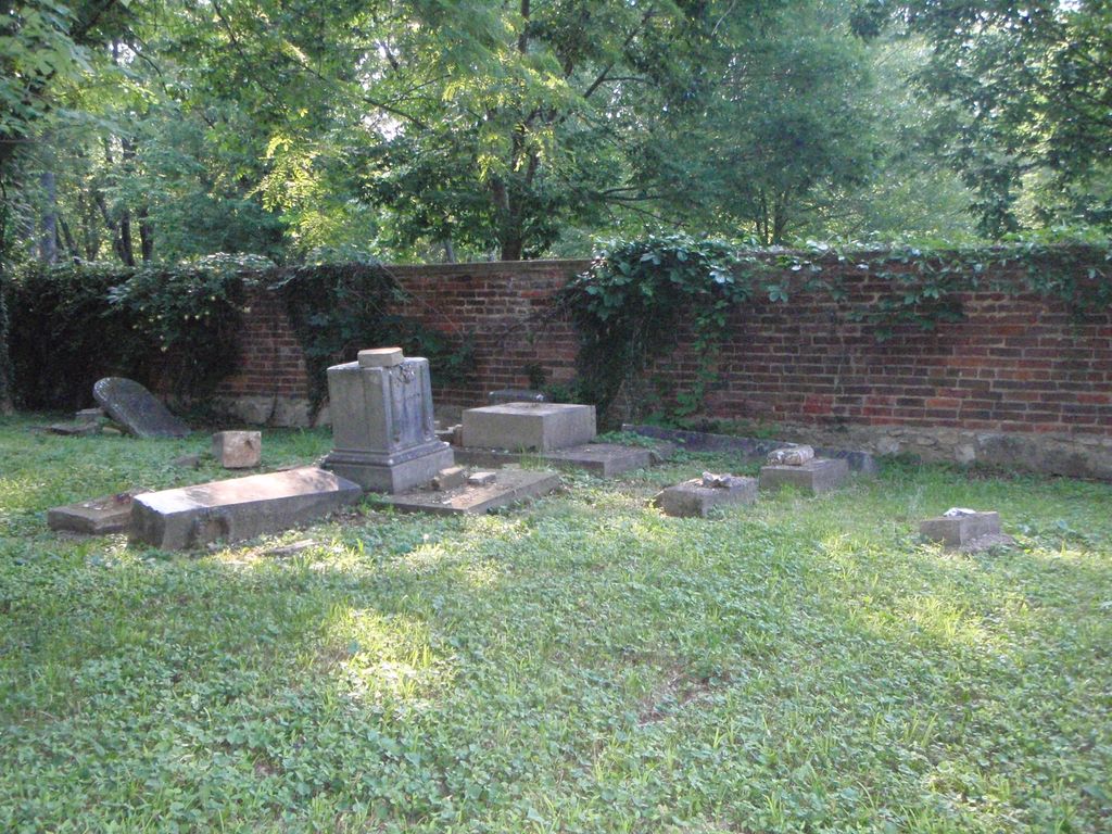
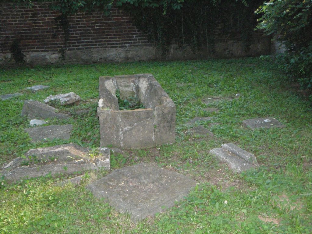
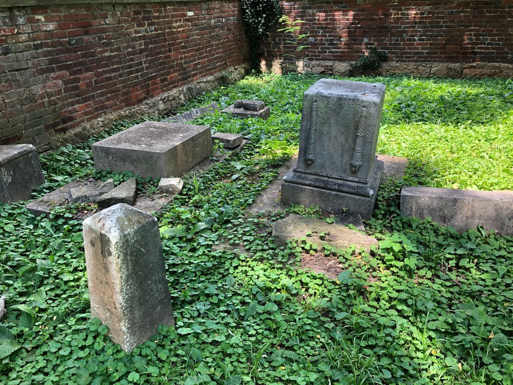
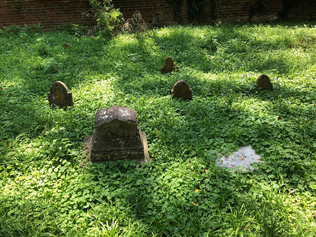
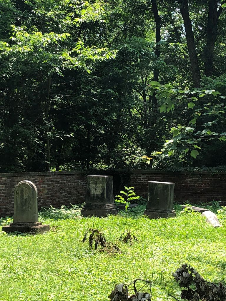
| Description | : | Brown Park, on Browns Lane just past the intersection of Sherburn Lane This cemetery is in very poor condition. The gate is padlocked, but the hinges are broken. The wall is in good shape, and the grass is cut, but the cemetery looks like it has been ransacked. Stones are toppled and broken, and crypts have been opened and are empty. (6/10/2015). James Brown’s home, Wildwood Farm, is listed as the James Brown House on the National Register of Historic Places. His son’s home, the Theodore Brown House (now the Inn at Woodhaven, a bed and breakfast) is nearby, and is... Read More |
frequently asked questions (FAQ):
-
Where is Brown Family Cemetery?
Brown Family Cemetery is located at Browns Lane Saint Matthews, Jefferson County ,Kentucky ,USA.
-
Brown Family Cemetery cemetery's updated grave count on graveviews.com?
0 memorials
-
Where are the coordinates of the Brown Family Cemetery?
Latitude: 38.2375660
Longitude: -85.6331750

Nearby Cemetories:
1. Burks Family Cemetery
Saint Matthews, Jefferson County, USA
Coordinate: 38.2318130, -85.6408060
2. Parks Cemetery
Plymouth Village, Jefferson County, USA
Coordinate: 38.2377280, -85.6486690
3. Floyd-Breckinridge Cemetery
Plymouth Village, Jefferson County, USA
Coordinate: 38.2366982, -85.6489029
4. Bullitt Family Cemetery
Louisville, Jefferson County, USA
Coordinate: 38.2463450, -85.6135210
5. Hikes Cemetery
Jefferson County, USA
Coordinate: 38.2129790, -85.6373220
6. Kennedy Graveyard
Louisville, Jefferson County, USA
Coordinate: 38.2261920, -85.6049040
7. Arterburn Cemetery
Saint Matthews, Jefferson County, USA
Coordinate: 38.2552000, -85.6609900
8. Christ Church United Methodist Memorial Garden
Louisville, Jefferson County, USA
Coordinate: 38.2740750, -85.6446790
9. Herr Cemetery #3
Louisville, Jefferson County, USA
Coordinate: 38.2756430, -85.6391020
10. Lawrence Family Cemetery
Hurstbourne, Jefferson County, USA
Coordinate: 38.2515259, -85.5847015
11. Louisville Presbyterian Seminary Memorial Garden
Louisville, Jefferson County, USA
Coordinate: 38.2387380, -85.6861190
12. Doup Family Cemetery
Louisville, Jefferson County, USA
Coordinate: 38.2211500, -85.6821200
13. Funk Cemetery
Forest Hills, Jefferson County, USA
Coordinate: 38.2153500, -85.5878160
14. Anderson Family Cemetery
Louisville, Jefferson County, USA
Coordinate: 38.2356520, -85.5775420
15. Hikes Cemetery
Newburg, Jefferson County, USA
Coordinate: 38.1979310, -85.6597710
16. Garr Family Cemetery
Louisville, Jefferson County, USA
Coordinate: 38.2319880, -85.5745940
17. Community of Christ Scripture Garden
Forest Hills, Jefferson County, USA
Coordinate: 38.2117500, -85.5834480
18. Ormsby Graveyard
Lyndon, Jefferson County, USA
Coordinate: 38.2653600, -85.5800600
19. Resthaven Memorial Cemetery
Louisville, Jefferson County, USA
Coordinate: 38.1850014, -85.6342468
20. Hackberry Cemetery
Louisville, Jefferson County, USA
Coordinate: 38.2514500, -85.7032170
21. Green Haven Cemetery Of Louisville
Louisville, Jefferson County, USA
Coordinate: 38.1806810, -85.6372500
22. Berry Hill Cemetery
Louisville, Jefferson County, USA
Coordinate: 38.2943910, -85.6404680
23. Petersburg Newburg Cemetery
Jefferson County, USA
Coordinate: 38.1846660, -85.6674710
24. Murray-Young Cemetery
Lyndon, Jefferson County, USA
Coordinate: 38.2901887, -85.5873743