
| Memorials | : | 1 |
| Location | : | Hart County, USA |
| Coordinate | : | 37.3778710, -85.9997390 |
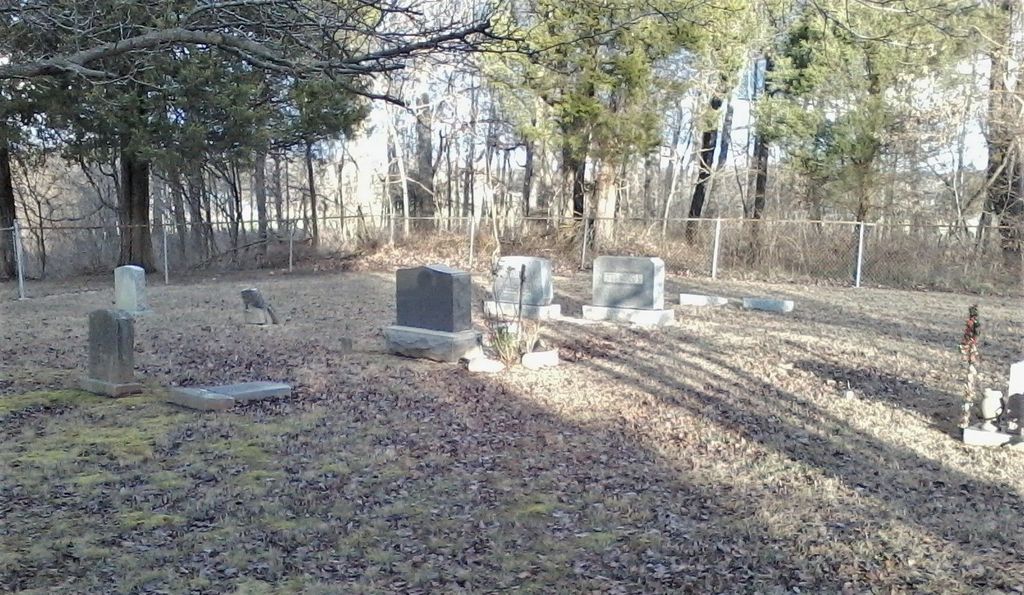
| Description | : | Described by Gorin as, "From 31W in Bonnieville, take Hwy 728 west for 5.9 miles. The cemetery is behind a tobacco barn. The cemetery is not visible from the highway until you have passed it. There was a Hodges Cemetery sign on Hwy 728 but the sign is now missing. It is a small cemetery measuring about 60’ by 70’. Fenced, immaculate and well landscaped. Judge Can noted it was on the farm of the late Bedford Reynolds, then Elmo Hodges in the 1960’s." |
frequently asked questions (FAQ):
-
Where is Hodges Cemetery #1?
Hodges Cemetery #1 is located at Priceville Road (Kentucky State Highway 728) Hart County ,Kentucky , 42765USA.
-
Hodges Cemetery #1 cemetery's updated grave count on graveviews.com?
0 memorials
-
Where are the coordinates of the Hodges Cemetery #1?
Latitude: 37.3778710
Longitude: -85.9997390
Nearby Cemetories:
1. Caswell Cemetery
Hart County, USA
Coordinate: 37.3796997, -86.0180969
2. Craddock Cemetery
Hart County, USA
Coordinate: 37.3838997, -86.0278015
3. Solomon Kessinger Farm Cemetery
Lines Mill, Hart County, USA
Coordinate: 37.3612400, -86.0366500
4. Copelin Cemetery
Hart County, USA
Coordinate: 37.4222200, -86.0067000
5. Camp Ground Cemetery
Bonnieville, Hart County, USA
Coordinate: 37.3753014, -85.9417038
6. Little Flock Cemetery
Hart County, USA
Coordinate: 37.3321440, -85.9885710
7. Wooden Cemetery
Upton, Hardin County, USA
Coordinate: 37.4268879, -86.0299260
8. Weldon Cemetery
Bonnieville, Hart County, USA
Coordinate: 37.3835790, -85.9235330
9. Broadford Baptist Church Cemetery
Broad Ford, Grayson County, USA
Coordinate: 37.3753610, -86.0792530
10. Dorsey Farm Cemetery
Cub Run, Hart County, USA
Coordinate: 37.3178150, -86.0305550
11. Jim Bob Jaggers Cemetery
Cub Run, Hart County, USA
Coordinate: 37.3315540, -86.0576250
12. Mount Vernon Cemetery
Bonnieville, Hart County, USA
Coordinate: 37.3656490, -85.9150230
13. Day Family Cemetery
Cub Run, Hart County, USA
Coordinate: 37.3212469, -86.0541680
14. Lone Oak Cemetery New
Lone Oak, Grayson County, USA
Coordinate: 37.4249590, -86.0716630
15. Lone Oak Church Cemetery
Lone Oak, Grayson County, USA
Coordinate: 37.4246200, -86.0724900
16. Old Lone Oak Cemetery
Lone Oak, Grayson County, USA
Coordinate: 37.4294100, -86.0677050
17. Bonnieville Catholic Cemetery
Bonnieville, Hart County, USA
Coordinate: 37.3704720, -85.9058850
18. Cleaver
Upton, Hardin County, USA
Coordinate: 37.4494080, -85.9696730
19. Jericho Cemetery
Cub Run, Hart County, USA
Coordinate: 37.3280560, -86.0711110
20. Ream's Chapel Cemetery
Cub Run, Hart County, USA
Coordinate: 37.3201790, -86.0621796
21. Miller Family Cemetery
Kessinger, Hart County, USA
Coordinate: 37.3066930, -85.9605070
22. Wilkerson Temple Methodist Church Cemetery
Kessinger, Hart County, USA
Coordinate: 37.3062450, -85.9613960
23. Quinn Cemetery
Bonnieville, Hart County, USA
Coordinate: 37.3954310, -85.9039170
24. Concord Baptist Church Cemetery
Bonnieville, Hart County, USA
Coordinate: 37.3432230, -85.9112350