
| Memorials | : | 34 |
| Location | : | Lone Oak, Grayson County, USA |
| Coordinate | : | 37.4294100, -86.0677050 |
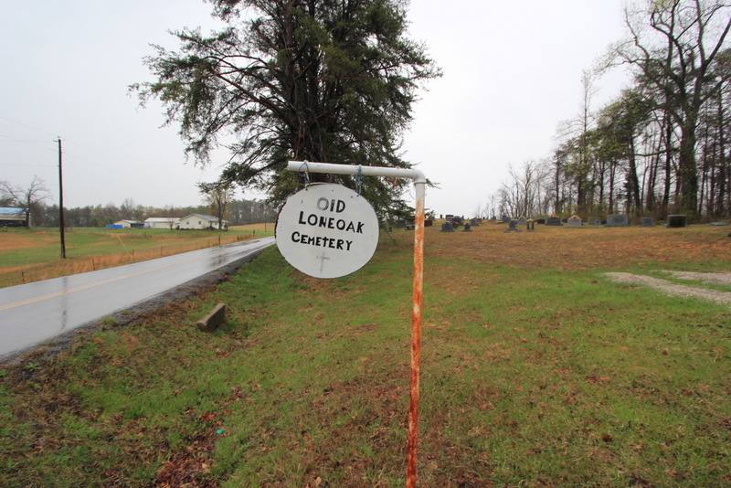
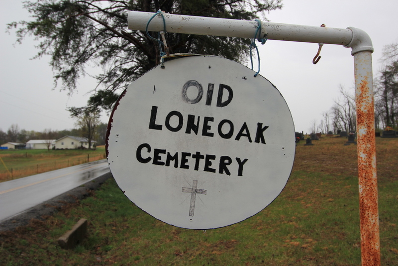
| Description | : | From Clarkson, Kentucky in Grayson County, take Kentucky State Hwy 224 (Millerstown Rd) east to Millerstown, Kentucky. Before crossing the bridge at Millerstown, you would make a right onto State Highway 479 (Wax Rd) and head south towards Lone Oak, Kentucky. Take State Highway 470 (Wax Rd) 1.4 miles until you reach the Old Lone Oak Cemetery on the left hand side of the road. The cemetery is about 50 feet from the side of the road. You will see a small, round white sign with black letters hanging from white PVC pipe that says “Old Lone Oak Cemetery”. ... Read More |
frequently asked questions (FAQ):
-
Where is Old Lone Oak Cemetery?
Old Lone Oak Cemetery is located at Lone Oak, Grayson County ,Kentucky ,USA.
-
Old Lone Oak Cemetery cemetery's updated grave count on graveviews.com?
34 memorials
-
Where are the coordinates of the Old Lone Oak Cemetery?
Latitude: 37.4294100
Longitude: -86.0677050
Nearby Cemetories:
1. Lone Oak Cemetery New
Lone Oak, Grayson County, USA
Coordinate: 37.4249590, -86.0716630
2. Lone Oak Church Cemetery
Lone Oak, Grayson County, USA
Coordinate: 37.4246200, -86.0724900
3. Millerstown Baptist Church Cemetery
Millerstown, Grayson County, USA
Coordinate: 37.4460500, -86.0529390
4. Pleasant Valley Cemetery
Grayson County, USA
Coordinate: 37.4113020, -86.0962890
5. Wooden Cemetery
Upton, Hardin County, USA
Coordinate: 37.4268879, -86.0299260
6. Carbytown Cemetery
Hardin County, USA
Coordinate: 37.4632988, -86.0528030
7. Little Flock Missionary Baptist Church Cemetery
Grayson County, USA
Coordinate: 37.4511330, -86.1127150
8. Mount Zion Christian Church Cemetery
Grayson County, USA
Coordinate: 37.4749410, -86.0721560
9. Copelin Cemetery
Hart County, USA
Coordinate: 37.4222200, -86.0067000
10. J. H. Haycraft Cemetery
Snap, Grayson County, USA
Coordinate: 37.3998054, -86.1174112
11. John S Haycraft Cemetery
Snap, Grayson County, USA
Coordinate: 37.3976080, -86.1225690
12. Broadford Baptist Church Cemetery
Broad Ford, Grayson County, USA
Coordinate: 37.3753610, -86.0792530
13. Craddock Cemetery
Hart County, USA
Coordinate: 37.3838997, -86.0278015
14. Skaggs Cemetery
Millerstown, Grayson County, USA
Coordinate: 37.4302710, -86.1421900
15. Akers Valley Catholic Cemetery
Flint Hill, Hardin County, USA
Coordinate: 37.4886920, -86.0446040
16. Caswell Cemetery
Hart County, USA
Coordinate: 37.3796997, -86.0180969
17. Gibson Cemetery
Hilltop, Grayson County, USA
Coordinate: 37.3997880, -86.1444310
18. Mount Moriah Cemetery
Grayson County, USA
Coordinate: 37.4661080, -86.1403670
19. Little Clifty United Methodist Church Cemetery
Clarkson, Grayson County, USA
Coordinate: 37.4854620, -86.1212950
20. Rock Creek Church Cemetery
Rock Creek, Grayson County, USA
Coordinate: 37.4322150, -86.1572220
21. Solomon Kessinger Farm Cemetery
Lines Mill, Hart County, USA
Coordinate: 37.3612400, -86.0366500
22. Hodges Cemetery #1
Hart County, USA
Coordinate: 37.3778710, -85.9997390
23. Cleaver
Upton, Hardin County, USA
Coordinate: 37.4494080, -85.9696730
24. Logsdon Family Cemetery
Iberia, Grayson County, USA
Coordinate: 37.3721936, -86.1421142