
| Memorials | : | 1 |
| Location | : | Yorkville, Gibson County, USA |
| Coordinate | : | 36.0495580, -89.0985780 |
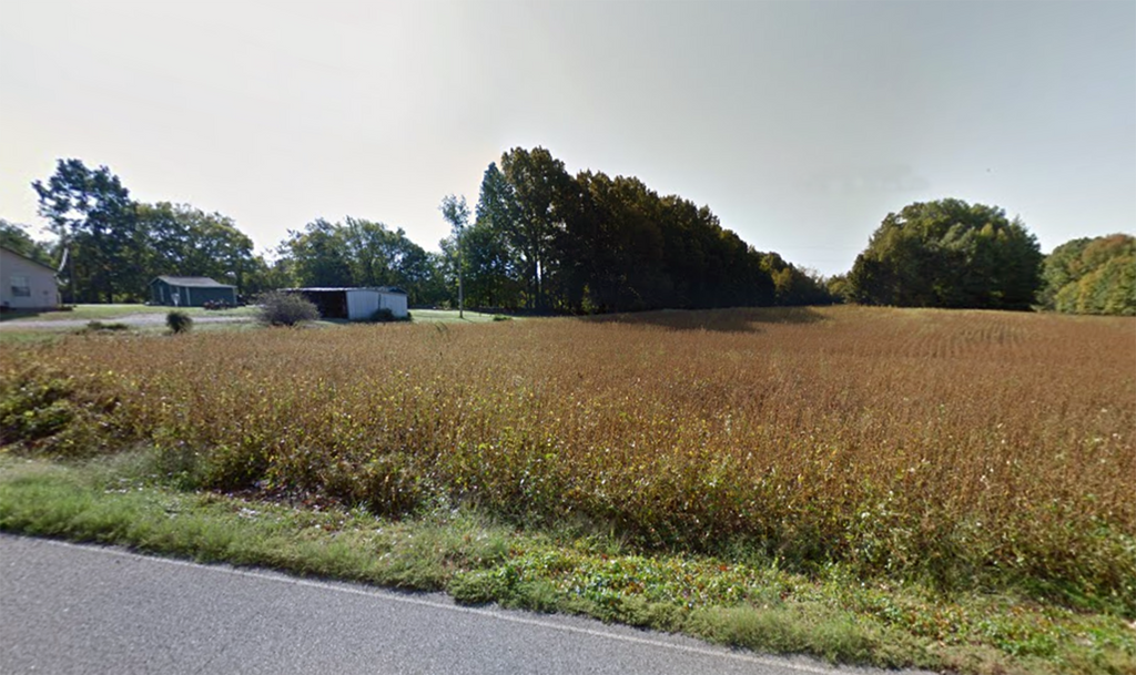
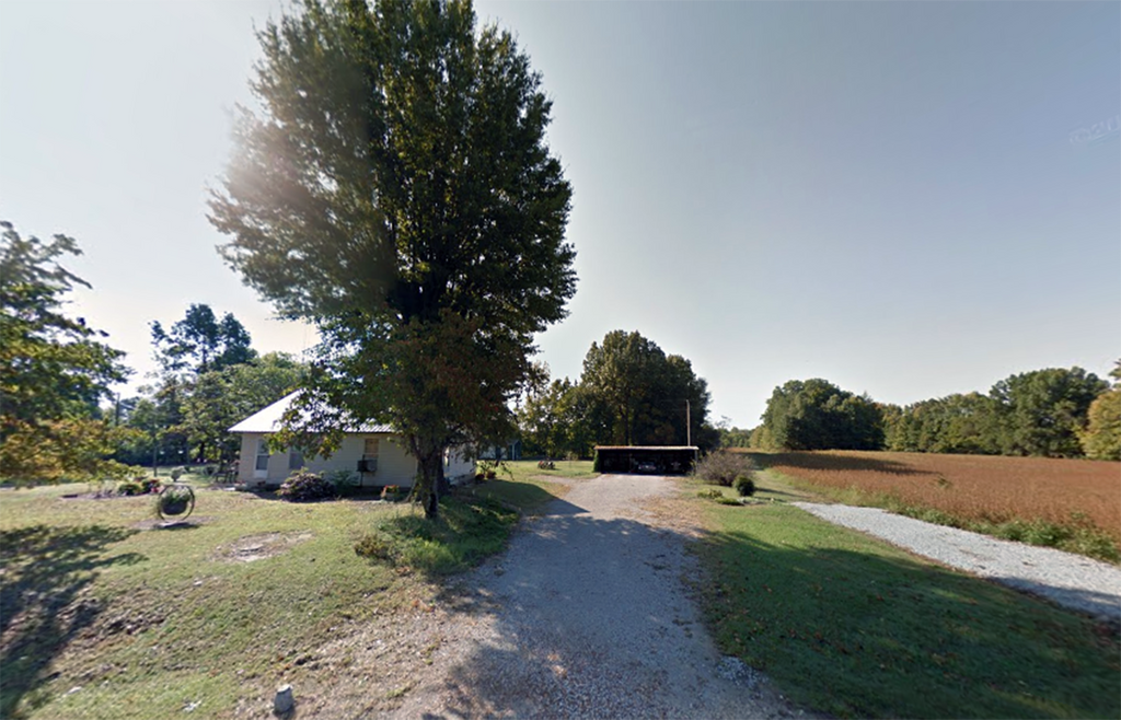
| Description | : | From the intersection of Old Dyersburg Rd. & US-45 W, NNW of Trenton, travel west on Old Dyersburg Rd. for 7.6 mi.,to a house on the south (left) side, with a new green metal roof at about 930 Old Dyersburg Rd. On the west side of this house in a large clump of trees, in a farm field is the Hogue Cemetery, about 150 yards from the highway. This location is 0.5 mi. west of the Balentine Rd. |
frequently asked questions (FAQ):
-
Where is Hogue Cemetery?
Hogue Cemetery is located at Old Dyersburg Rd Yorkville, Gibson County ,Tennessee ,USA.
-
Hogue Cemetery cemetery's updated grave count on graveviews.com?
1 memorials
-
Where are the coordinates of the Hogue Cemetery?
Latitude: 36.0495580
Longitude: -89.0985780
Nearby Cemetories:
1. Balentine Family Cemetery
Dyer, Gibson County, USA
Coordinate: 36.0544690, -89.0928070
2. Bethel Cemetery
Yorkville, Gibson County, USA
Coordinate: 36.0871370, -89.1178680
3. Bethel MB Church Cemetery
Yorkville, Gibson County, USA
Coordinate: 36.0878910, -89.1180910
4. Crenshaw-Wyatt Cemetery
Dyer, Gibson County, USA
Coordinate: 36.0778090, -89.0589010
5. Good Hope Cemetery
Dyer, Gibson County, USA
Coordinate: 36.0477982, -89.0438995
6. Duck Hill Cemetery
Trenton, Gibson County, USA
Coordinate: 36.0331001, -89.0413971
7. Hall Family Cemetery
Dyer, Gibson County, USA
Coordinate: 36.0302900, -89.0393600
8. Yorkville Cemetery
Yorkville, Gibson County, USA
Coordinate: 36.0980988, -89.1207962
9. Cowan Cemetery
Dyer, Gibson County, USA
Coordinate: 36.0978120, -89.0753020
10. Yorkville Cumberland Presbyterian Church Cemetery
Yorkville, Gibson County, USA
Coordinate: 36.1007996, -89.1231003
11. Clear Creek Cemetery
Currie, Gibson County, USA
Coordinate: 36.0400009, -89.0299988
12. Walnut Grove Cemetery
Trenton, Gibson County, USA
Coordinate: 35.9947014, -89.0764008
13. Concidine Gravesite
Gibson County, USA
Coordinate: 35.9930000, -89.0800000
14. Roberts Family Cemetery
Eaton, Gibson County, USA
Coordinate: 35.9882200, -89.0734100
15. Springhill MB Church Cemetery
Eaton, Gibson County, USA
Coordinate: 35.9871860, -89.1210420
16. Mount Olive Cemetery
Dyer, Gibson County, USA
Coordinate: 36.0807991, -89.0278015
17. Thompson Cemetery
Rutherford, Gibson County, USA
Coordinate: 36.1047220, -89.0553430
18. Spring Hill Baptist Church Cemetery
Eaton, Gibson County, USA
Coordinate: 35.9859520, -89.1221080
19. Flowers - Wright Cemetery
Dyer, Gibson County, USA
Coordinate: 36.0951100, -89.0348700
20. Bells Chapel Cemetery
Dyer, Gibson County, USA
Coordinate: 36.1164017, -89.0686035
21. Shaw Cemetery
Tatumville, Dyer County, USA
Coordinate: 36.0435982, -89.1868973
22. Reed Burial Ground
Yorkville, Gibson County, USA
Coordinate: 36.1176420, -89.1372490
23. Center Cemetery
Newbern, Dyer County, USA
Coordinate: 36.0835740, -89.1849550
24. Wilson Cemetery
Gibson County, USA
Coordinate: 35.9706001, -89.0980988