
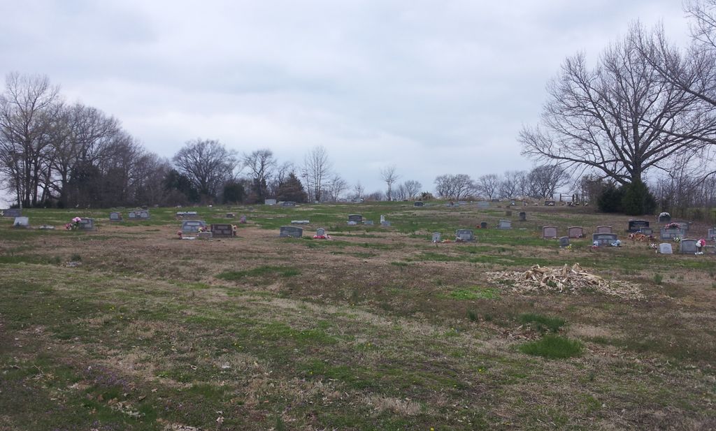
| Memorials | : | 15 |
| Location | : | Eaton, Gibson County, USA |
| Coordinate | : | 35.9871860, -89.1210420 |
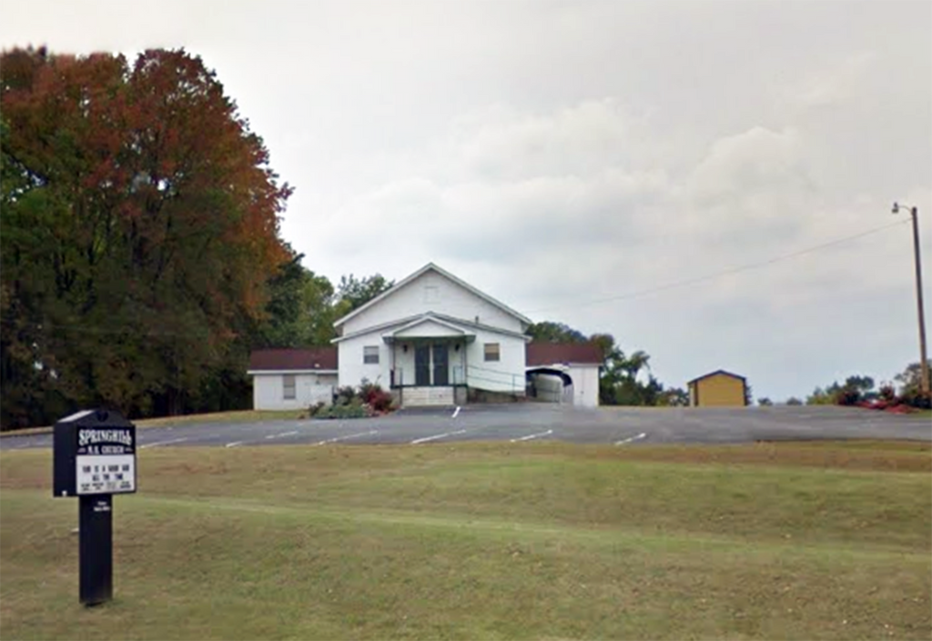
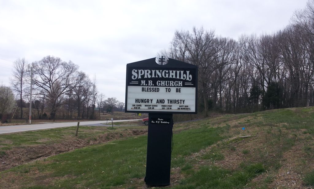
| Description | : | From the intersection of TN-188 & TN-104, travel south on TN-188 for 0.6 mi., turning west (right) into the driveway , which leads about 100 yards past the Springhill MB Church, to the well maintained cemetery, behind to the northwest. |
frequently asked questions (FAQ):
-
Where is Springhill MB Church Cemetery?
Springhill MB Church Cemetery is located at 60 TN-188 Eaton, Gibson County ,Tennessee ,USA.
-
Springhill MB Church Cemetery cemetery's updated grave count on graveviews.com?
13 memorials
-
Where are the coordinates of the Springhill MB Church Cemetery?
Latitude: 35.9871860
Longitude: -89.1210420
Nearby Cemetories:
1. Spring Hill Baptist Church Cemetery
Eaton, Gibson County, USA
Coordinate: 35.9859520, -89.1221080
2. Wilson Cemetery
Gibson County, USA
Coordinate: 35.9706001, -89.0980988
3. Concidine Gravesite
Gibson County, USA
Coordinate: 35.9930000, -89.0800000
4. Walnut Grove Cemetery
Trenton, Gibson County, USA
Coordinate: 35.9947014, -89.0764008
5. Old Mayfield Cemetery
Eaton, Gibson County, USA
Coordinate: 35.9894960, -89.1666780
6. Mayfield Cemetery
Eaton, Gibson County, USA
Coordinate: 35.9910230, -89.1678300
7. Roberts Family Cemetery
Eaton, Gibson County, USA
Coordinate: 35.9882200, -89.0734100
8. Salem Primitive Baptist Cemetery
Hickory Grove, Gibson County, USA
Coordinate: 35.9681400, -89.0709700
9. Olive Branch Methodist Church Cemetery
Eaton, Gibson County, USA
Coordinate: 35.9678001, -89.0607986
10. Elizabeth Methodist Church Cemetery
Elizabeth, Crockett County, USA
Coordinate: 35.9605010, -89.1770140
11. Bethesda Cemetery
Wilcox, Crockett County, USA
Coordinate: 35.9361230, -89.1557970
12. Young & Williams Cemetery
Elizabeth, Crockett County, USA
Coordinate: 35.9707990, -89.1937240
13. Hogue Cemetery
Yorkville, Gibson County, USA
Coordinate: 36.0495580, -89.0985780
14. Balentine Family Cemetery
Dyer, Gibson County, USA
Coordinate: 36.0544690, -89.0928070
15. Shaw Cemetery
Tatumville, Dyer County, USA
Coordinate: 36.0435982, -89.1868973
16. Hall Family Cemetery
Dyer, Gibson County, USA
Coordinate: 36.0302900, -89.0393600
17. Duck Hill Cemetery
Trenton, Gibson County, USA
Coordinate: 36.0331001, -89.0413971
18. Hartsfield Cemetery
Gibson County, USA
Coordinate: 35.9155500, -89.0721100
19. Mays Chapel Cemetery
Friendship, Crockett County, USA
Coordinate: 35.9363540, -89.2006050
20. Warren Cemetery
Crockett Mills, Crockett County, USA
Coordinate: 35.9074790, -89.1521770
21. Williams Chapel Baptist Church Cemetery
Friendship, Crockett County, USA
Coordinate: 35.9258940, -89.1916320
22. Sanders Cemetery
Crockett Mills, Crockett County, USA
Coordinate: 35.9096750, -89.1609030
23. Ward's Grove C.M.E. Church Cemetery
Trenton, Gibson County, USA
Coordinate: 35.9097929, -89.0770110
24. Zion Cemetery
Brazil, Gibson County, USA
Coordinate: 35.9167220, -89.0616380