
| Memorials | : | 1 |
| Location | : | Upper Black Eddy, Bucks County, USA |
| Coordinate | : | 40.5010986, -75.1181030 |
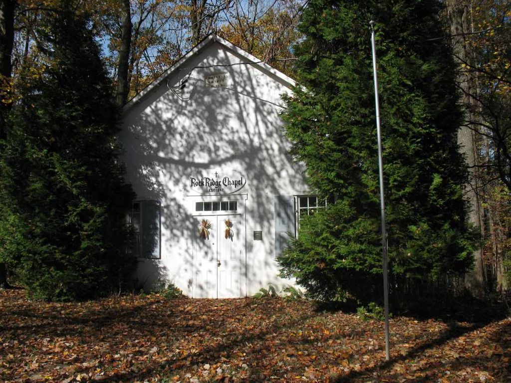
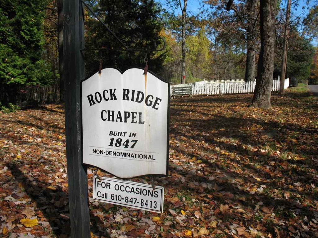
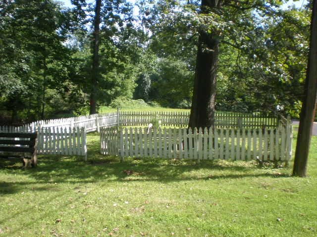
| Description | : | Rock Ridge Chapel, originally called Rope Walk Chapel. It was founded in 1843 as the Nondenominational Canal Men's Chapel on Geigel Hill Road in Tinicum Township, Upper Bucks County. The small cemetery is to the right of the Church building, surrounded by a white wooden fence. There are only 3 headstones that are somewhat readable, there are other stones that are broken and/or worn smooth. |
frequently asked questions (FAQ):
-
Where is Rock Ridge Chapel Cemetery?
Rock Ridge Chapel Cemetery is located at Geigel Hill Rd Upper Black Eddy, Bucks County ,Pennsylvania , 18972USA.
-
Rock Ridge Chapel Cemetery cemetery's updated grave count on graveviews.com?
1 memorials
-
Where are the coordinates of the Rock Ridge Chapel Cemetery?
Latitude: 40.5010986
Longitude: -75.1181030
Nearby Cemetories:
1. Stewart Cemetery
Tinicum, Bucks County, USA
Coordinate: 40.5148430, -75.1368700
2. Marshall-Cooper-Ridge Cemetery
Tinicum, Bucks County, USA
Coordinate: 40.4890160, -75.0906330
3. Upper Tinicum Cemetery
Upper Black Eddy, Bucks County, USA
Coordinate: 40.5292650, -75.0822933
4. Red Hill Saint Lukes UCC Cemetery
Ottsville, Bucks County, USA
Coordinate: 40.4693000, -75.1577000
5. Hillpot Cemetery
Tinicum, Bucks County, USA
Coordinate: 40.4561005, -75.1082993
6. Erwin Family Cemetery
Erwinna, Bucks County, USA
Coordinate: 40.5279105, -75.0674030
7. Lower Tinicum Union Cemetery
Tinicum, Bucks County, USA
Coordinate: 40.4531000, -75.1050000
8. Frenchtown Cemetery
Frenchtown, Hunterdon County, USA
Coordinate: 40.5237503, -75.0605545
9. Nockamixon Union Cemetery
Ferndale, Bucks County, USA
Coordinate: 40.5314903, -75.1812820
10. Saint Luke's Evangelical Lutheran Church Cemetery
Ferndale, Bucks County, USA
Coordinate: 40.5290000, -75.1835000
11. Pursell Burying Ground
Upper Black Eddy, Bucks County, USA
Coordinate: 40.5584410, -75.0933950
12. Saint John the Baptist Roman Catholic Cemetery
Haycock Township, Bucks County, USA
Coordinate: 40.4996986, -75.2055969
13. Milford Union Cemetery
Milford, Hunterdon County, USA
Coordinate: 40.5667000, -75.0922012
14. Milford Christian Churchyard
Milford, Hunterdon County, USA
Coordinate: 40.5685425, -75.0972214
15. Point Pleasant Baptist Church Cemetery
Point Pleasant, Bucks County, USA
Coordinate: 40.4282100, -75.0701500
16. Gallows Hill Graveyard
Gallows Hill, Bucks County, USA
Coordinate: 40.5362000, -75.2239000
17. Baptistown Cemetery
Baptistown, Hunterdon County, USA
Coordinate: 40.5240100, -75.0061190
18. Holland Presbyterian Church Cemetery
Holland, Hunterdon County, USA
Coordinate: 40.5748700, -75.1861600
19. Kellers Church Union Cemetery
Perkasie, Bucks County, USA
Coordinate: 40.4538040, -75.2236252
20. Everittstown Methodist Cemetery
Everittstown, Hunterdon County, USA
Coordinate: 40.5655823, -75.0279922
21. Oak Summit Cemetery
Kingwood, Hunterdon County, USA
Coordinate: 40.5419000, -75.0051000
22. Mount Pleasant Cemetery
Mount Pleasant, Hunterdon County, USA
Coordinate: 40.5835267, -75.0536867
23. Methodist Episcopal Church Cemetery
Kingwood, Hunterdon County, USA
Coordinate: 40.4508800, -75.0097800
24. Groveland Mennonite Cemetery
Hinkletown, Bucks County, USA
Coordinate: 40.3996650, -75.1151170