
| Memorials | : | 0 |
| Location | : | Tinicum, Bucks County, USA |
| Coordinate | : | 40.5148430, -75.1368700 |
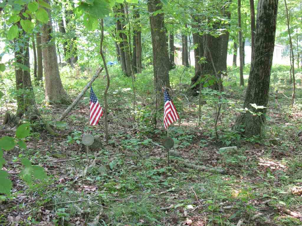
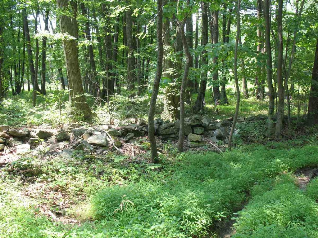
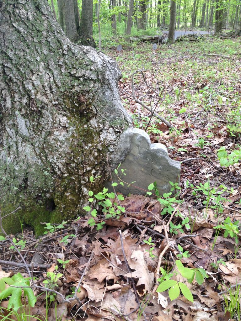
| Description | : | The memorials I put on for Stewart Cemetery were found on a paper written by B.F. Fackenthal, Jr in 1910. I found this information at the Spruance Library in Doylestown, PA. Also I found a paper by Richard A. Plank, dated April 3, 1991, identifying 4 Revolutionary War Veterans buried here. This is Mr. Fackenthal's note; The Stewart burying-ground to which Mr. Ely refers, known locally as Bunker Hill Cemetery and near which he believes to have been the site of the first Tinicum Presbyterian Church, (of which the church at Red Hill is the successor,) is located in... Read More |
frequently asked questions (FAQ):
-
Where is Stewart Cemetery?
Stewart Cemetery is located at Clay Ridge Road Tinicum, Bucks County ,Pennsylvania ,USA.
-
Stewart Cemetery cemetery's updated grave count on graveviews.com?
0 memorials
-
Where are the coordinates of the Stewart Cemetery?
Latitude: 40.5148430
Longitude: -75.1368700
Nearby Cemetories:
1. Rock Ridge Chapel Cemetery
Upper Black Eddy, Bucks County, USA
Coordinate: 40.5010986, -75.1181030
2. Nockamixon Union Cemetery
Ferndale, Bucks County, USA
Coordinate: 40.5314903, -75.1812820
3. Saint Luke's Evangelical Lutheran Church Cemetery
Ferndale, Bucks County, USA
Coordinate: 40.5290000, -75.1835000
4. Marshall-Cooper-Ridge Cemetery
Tinicum, Bucks County, USA
Coordinate: 40.4890160, -75.0906330
5. Upper Tinicum Cemetery
Upper Black Eddy, Bucks County, USA
Coordinate: 40.5292650, -75.0822933
6. Red Hill Saint Lukes UCC Cemetery
Ottsville, Bucks County, USA
Coordinate: 40.4693000, -75.1577000
7. Erwin Family Cemetery
Erwinna, Bucks County, USA
Coordinate: 40.5279105, -75.0674030
8. Saint John the Baptist Roman Catholic Cemetery
Haycock Township, Bucks County, USA
Coordinate: 40.4996986, -75.2055969
9. Pursell Burying Ground
Upper Black Eddy, Bucks County, USA
Coordinate: 40.5584410, -75.0933950
10. Frenchtown Cemetery
Frenchtown, Hunterdon County, USA
Coordinate: 40.5237503, -75.0605545
11. Milford Christian Churchyard
Milford, Hunterdon County, USA
Coordinate: 40.5685425, -75.0972214
12. Milford Union Cemetery
Milford, Hunterdon County, USA
Coordinate: 40.5667000, -75.0922012
13. Hillpot Cemetery
Tinicum, Bucks County, USA
Coordinate: 40.4561005, -75.1082993
14. Lower Tinicum Union Cemetery
Tinicum, Bucks County, USA
Coordinate: 40.4531000, -75.1050000
15. Gallows Hill Graveyard
Gallows Hill, Bucks County, USA
Coordinate: 40.5362000, -75.2239000
16. Holland Presbyterian Church Cemetery
Holland, Hunterdon County, USA
Coordinate: 40.5748700, -75.1861600
17. Kellers Church Union Cemetery
Perkasie, Bucks County, USA
Coordinate: 40.4538040, -75.2236252
18. Finesville Union Cemetery
Finesville, Warren County, USA
Coordinate: 40.6010300, -75.1773900
19. Riegelsville Union Cemetery
Riegelsville, Bucks County, USA
Coordinate: 40.5957920, -75.1965020
20. Mount Pleasant Cemetery
Mount Pleasant, Hunterdon County, USA
Coordinate: 40.5835267, -75.0536867
21. Oak Hill Golf Course Burial Ground
Holland, Hunterdon County, USA
Coordinate: 40.6061170, -75.1085940
22. Durham Cemetery
Durham, Bucks County, USA
Coordinate: 40.5837517, -75.2259521
23. Everittstown Methodist Cemetery
Everittstown, Hunterdon County, USA
Coordinate: 40.5655823, -75.0279922
24. Haycock Mennonite Cemetery
Quakertown, Bucks County, USA
Coordinate: 40.4716148, -75.2524948