
| Memorials | : | 85 |
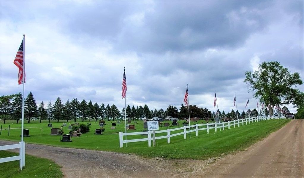
| Location | : | Hollandale, Freeborn County, USA |
| Coordinate | : | 43.7537689, -93.2004471 |
frequently asked questions (FAQ):
-
Where is Hollandale Cemetery?
Hollandale Cemetery is located at Hollandale, Freeborn County ,Minnesota ,USA.
-
Hollandale Cemetery cemetery's updated grave count on graveviews.com?
85 memorials
-
Where are the coordinates of the Hollandale Cemetery?
Latitude: 43.7537689
Longitude: -93.2004471
Nearby Cemetories:
1. Saint Pauls Lutheran Cemetery
Hollandale, Freeborn County, USA
Coordinate: 43.7392006, -93.2482986
2. Riceland Cemetery
Hollandale, Freeborn County, USA
Coordinate: 43.7376175, -93.2476654
3. Saint Marys Cemetery
Newry, Freeborn County, USA
Coordinate: 43.7947006, -93.1532974
4. Moscow Lutheran Church Cemetery
Moscow, Freeborn County, USA
Coordinate: 43.7309799, -93.1295166
5. Sumner-Hildreth Cemetery
Moscow, Freeborn County, USA
Coordinate: 43.6841698, -93.1522217
6. Clarks Grove Baptist Cemetery
Clarks Grove, Freeborn County, USA
Coordinate: 43.7677994, -93.3097000
7. Fairview Cemetery
Oakland, Freeborn County, USA
Coordinate: 43.6889000, -93.1292038
8. Oakland Lutheran and Trondhjem Cemetery
Oakland, Freeborn County, USA
Coordinate: 43.6733284, -93.1683273
9. East Freeborn Lutheran Church Cemetery
Lerdal, Freeborn County, USA
Coordinate: 43.7008286, -93.2991714
10. Geneva Cemetery
Geneva, Freeborn County, USA
Coordinate: 43.8292618, -93.2687225
11. Hillcrest Cemetery
Oakland, Freeborn County, USA
Coordinate: 43.6669388, -93.1569366
12. Red Oak Cemetery
Moscow, Freeborn County, USA
Coordinate: 43.7050018, -93.0888901
13. Danish Lutheran Cemetery
Summit, Steele County, USA
Coordinate: 43.8482520, -93.2123500
14. Clark Family Cemetery
Steele County, USA
Coordinate: 43.8527794, -93.2138901
15. Taylor-DeGood Cemetery
Moscow, Freeborn County, USA
Coordinate: 43.7313919, -93.0497208
16. Hayward Cemetery
Hayward, Freeborn County, USA
Coordinate: 43.6445618, -93.2436066
17. Red Oak Grove Cemetery
Austin, Mower County, USA
Coordinate: 43.7921982, -93.0488968
18. Saint Ansgar Cemetery
Steele County, USA
Coordinate: 43.8699989, -93.2210999
19. North Freeborn Lutheran Cemetery
Clarks Grove, Freeborn County, USA
Coordinate: 43.7917100, -93.3649700
20. Poor Farm Cemetery
Bancroft, Freeborn County, USA
Coordinate: 43.7013466, -93.3613213
21. First Lutheran Cemetery
Ellendale, Steele County, USA
Coordinate: 43.8619385, -93.3055573
22. Czech National Cemetery
Steele County, USA
Coordinate: 43.8852997, -93.1660995
23. Seventh Day Adventist Cemetery
Bath, Freeborn County, USA
Coordinate: 43.8107600, -93.3730400
24. Central Freeborn Lutheran Cemetery
Albert Lea, Freeborn County, USA
Coordinate: 43.7088890, -93.3819427