
| Memorials | : | 177 |
| Location | : | Clarks Grove, Freeborn County, USA |
| Coordinate | : | 43.7917100, -93.3649700 |
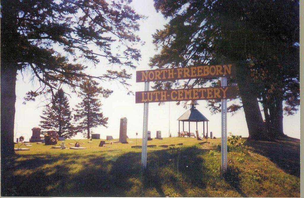
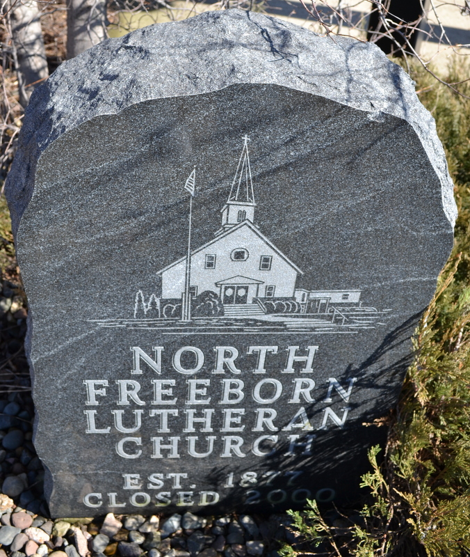
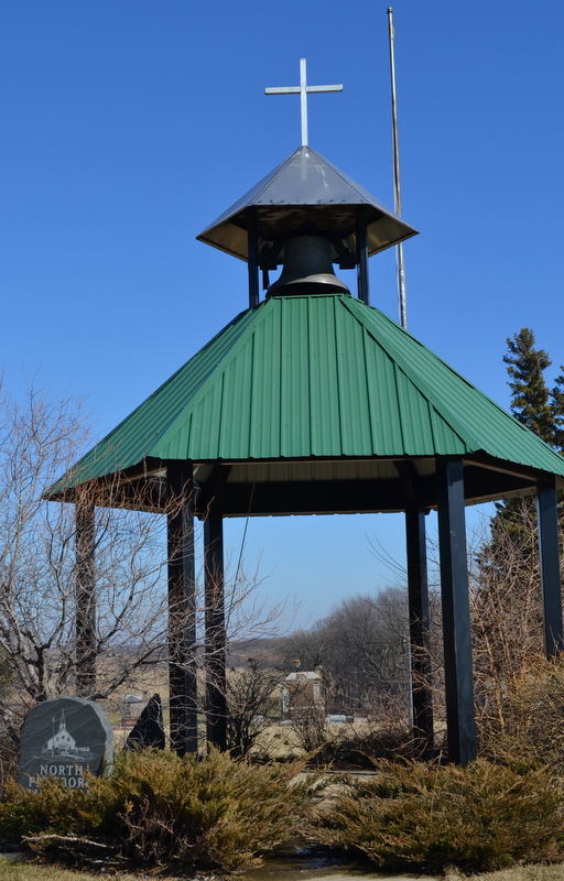
| Description | : | This cemetery is in Bath Township, Section 21, west of Clarks Grove 2 miles on County Road 31, turn right (north), go 2 miles, turn right (east), go 1/4 mile. North Freeborn Lutheran was one of a group of Norwegian Lutheran churches founded in 1861, four of which were named for the county. The "Freeborn" churches were incorporated separately in 1888. First burials in this cemetery were about 1882. There was a church on the site, but it was moved or removed between 2001 and 2005. |
frequently asked questions (FAQ):
-
Where is North Freeborn Lutheran Cemetery?
North Freeborn Lutheran Cemetery is located at Clarks Grove, Freeborn County ,Minnesota ,USA.
-
North Freeborn Lutheran Cemetery cemetery's updated grave count on graveviews.com?
177 memorials
-
Where are the coordinates of the North Freeborn Lutheran Cemetery?
Latitude: 43.7917100
Longitude: -93.3649700
Nearby Cemetories:
1. Seventh Day Adventist Cemetery
Bath, Freeborn County, USA
Coordinate: 43.8107600, -93.3730400
2. Saint Aidan Catholic Cemetery
Bath, Freeborn County, USA
Coordinate: 43.8241997, -93.3867035
3. Clarks Grove Baptist Cemetery
Clarks Grove, Freeborn County, USA
Coordinate: 43.7677994, -93.3097000
4. Geneva Cemetery
Geneva, Freeborn County, USA
Coordinate: 43.8292618, -93.2687225
5. First Lutheran Cemetery
Ellendale, Steele County, USA
Coordinate: 43.8619385, -93.3055573
6. South Hartland Cemetery
Hartland, Freeborn County, USA
Coordinate: 43.7888985, -93.4792023
7. Central Freeborn Lutheran Cemetery
Albert Lea, Freeborn County, USA
Coordinate: 43.7088890, -93.3819427
8. Hartland Cemetery
Hartland, Freeborn County, USA
Coordinate: 43.8008308, -93.4888916
9. Poor Farm Cemetery
Bancroft, Freeborn County, USA
Coordinate: 43.7013466, -93.3613213
10. West Freeborn Cemetery
Manchester, Freeborn County, USA
Coordinate: 43.7494011, -93.4783020
11. Saint Pauls Lutheran Cemetery
Hollandale, Freeborn County, USA
Coordinate: 43.7392006, -93.2482986
12. Riceland Cemetery
Hollandale, Freeborn County, USA
Coordinate: 43.7376175, -93.2476654
13. East Freeborn Lutheran Church Cemetery
Lerdal, Freeborn County, USA
Coordinate: 43.7008286, -93.2991714
14. Berlin Cemetery
Ellendale, Steele County, USA
Coordinate: 43.9002991, -93.3013992
15. Itasca Cemetery
Albert Lea, Freeborn County, USA
Coordinate: 43.6758499, -93.4035721
16. Danish Lutheran Cemetery
Summit, Steele County, USA
Coordinate: 43.8482520, -93.2123500
17. Hollandale Cemetery
Hollandale, Freeborn County, USA
Coordinate: 43.7537689, -93.2004471
18. Clark Family Cemetery
Steele County, USA
Coordinate: 43.8527794, -93.2138901
19. Saint Ansgar Cemetery
Steele County, USA
Coordinate: 43.8699989, -93.2210999
20. Saint Theodores Cemetery
Albert Lea, Freeborn County, USA
Coordinate: 43.6611099, -93.3705597
21. Lakewood Cemetery
Albert Lea, Freeborn County, USA
Coordinate: 43.6591682, -93.3694382
22. Saint Olaf Cemetery
New Richland, Waseca County, USA
Coordinate: 43.8983002, -93.4788971
23. LeSueur River Lutheran Cemetery
New Richland, Waseca County, USA
Coordinate: 43.9202385, -93.4338226
24. Graceland Cemetery
Albert Lea, Freeborn County, USA
Coordinate: 43.6491699, -93.3930588