
| Memorials | : | 0 |
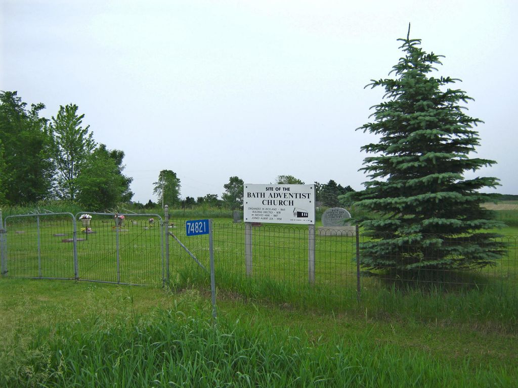
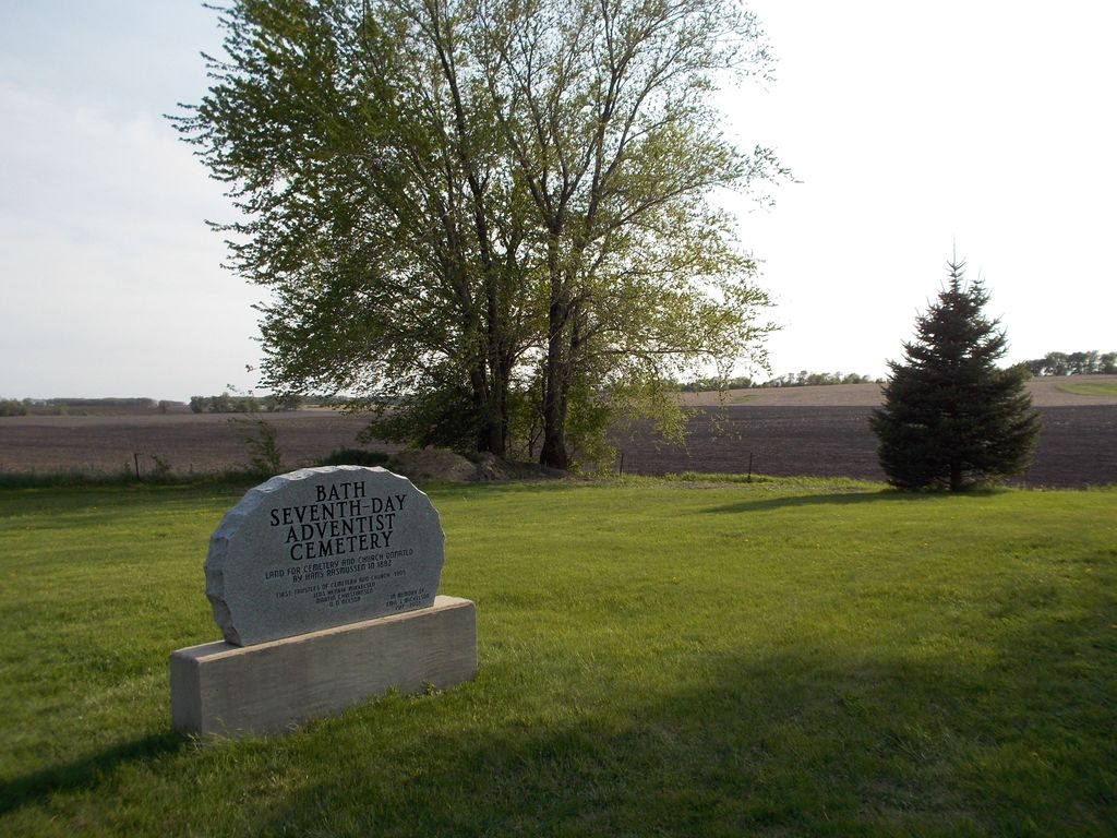
| Location | : | Bath, Freeborn County, USA |
| Coordinate | : | 43.8107600, -93.3730400 |
| Description | : | Bath Township, Section 17, take Richway Drive west which turns into County Road 20, follow north 9 1/2 miles, turn right, go 3/4 mile. |
frequently asked questions (FAQ):
-
Where is Seventh Day Adventist Cemetery?
Seventh Day Adventist Cemetery is located at Bath, Freeborn County ,Minnesota ,USA.
-
Seventh Day Adventist Cemetery cemetery's updated grave count on graveviews.com?
0 memorials
-
Where are the coordinates of the Seventh Day Adventist Cemetery?
Latitude: 43.8107600
Longitude: -93.3730400
Nearby Cemetories:
1. Saint Aidan Catholic Cemetery
Bath, Freeborn County, USA
Coordinate: 43.8241997, -93.3867035
2. North Freeborn Lutheran Cemetery
Clarks Grove, Freeborn County, USA
Coordinate: 43.7917100, -93.3649700
3. Clarks Grove Baptist Cemetery
Clarks Grove, Freeborn County, USA
Coordinate: 43.7677994, -93.3097000
4. First Lutheran Cemetery
Ellendale, Steele County, USA
Coordinate: 43.8619385, -93.3055573
5. Geneva Cemetery
Geneva, Freeborn County, USA
Coordinate: 43.8292618, -93.2687225
6. South Hartland Cemetery
Hartland, Freeborn County, USA
Coordinate: 43.7888985, -93.4792023
7. Hartland Cemetery
Hartland, Freeborn County, USA
Coordinate: 43.8008308, -93.4888916
8. West Freeborn Cemetery
Manchester, Freeborn County, USA
Coordinate: 43.7494011, -93.4783020
9. Central Freeborn Lutheran Cemetery
Albert Lea, Freeborn County, USA
Coordinate: 43.7088890, -93.3819427
10. Berlin Cemetery
Ellendale, Steele County, USA
Coordinate: 43.9002991, -93.3013992
11. Poor Farm Cemetery
Bancroft, Freeborn County, USA
Coordinate: 43.7013466, -93.3613213
12. Saint Pauls Lutheran Cemetery
Hollandale, Freeborn County, USA
Coordinate: 43.7392006, -93.2482986
13. Saint Olaf Cemetery
New Richland, Waseca County, USA
Coordinate: 43.8983002, -93.4788971
14. Riceland Cemetery
Hollandale, Freeborn County, USA
Coordinate: 43.7376175, -93.2476654
15. LeSueur River Lutheran Cemetery
New Richland, Waseca County, USA
Coordinate: 43.9202385, -93.4338226
16. Danish Lutheran Cemetery
Summit, Steele County, USA
Coordinate: 43.8482520, -93.2123500
17. East Freeborn Lutheran Church Cemetery
Lerdal, Freeborn County, USA
Coordinate: 43.7008286, -93.2991714
18. Clark Family Cemetery
Steele County, USA
Coordinate: 43.8527794, -93.2138901
19. Saint Ansgar Cemetery
Steele County, USA
Coordinate: 43.8699989, -93.2210999
20. Calvary Cemetery
New Richland, Waseca County, USA
Coordinate: 43.9039001, -93.4946976
21. Itasca Cemetery
Albert Lea, Freeborn County, USA
Coordinate: 43.6758499, -93.4035721
22. Hollandale Cemetery
Hollandale, Freeborn County, USA
Coordinate: 43.7537689, -93.2004471
23. Zion Lutheran Cemetery
Lemond, Steele County, USA
Coordinate: 43.9500008, -93.3455582
24. Seven Day Baptist Cemetery
Freeborn, Freeborn County, USA
Coordinate: 43.8328018, -93.5658035