
| Memorials | : | 4 |
| Location | : | Fort Pierre, Stanley County, USA |
| Coordinate | : | 44.2694292, -100.0356989 |
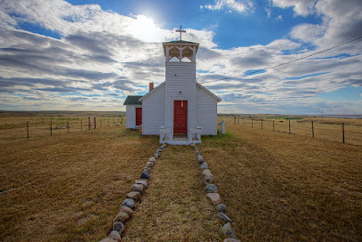
| Description | : | The cemetery is about 1400 feet southwest of South Dakota State Highway 1806. The U.S. Geological Survey (USGS) Geographic Names Information System (GNIS) feature ID for the cemetery is 2779352 (Holy Name Chapel Cemetery). |
frequently asked questions (FAQ):
-
Where is Holy Name Chapel Cemetery?
Holy Name Chapel Cemetery is located at South Dakota State Highway 1806 Fort Pierre, Stanley County ,South Dakota , 57532USA.
-
Holy Name Chapel Cemetery cemetery's updated grave count on graveviews.com?
4 memorials
-
Where are the coordinates of the Holy Name Chapel Cemetery?
Latitude: 44.2694292
Longitude: -100.0356989
Nearby Cemetories:
1. Holy Name Episcopal Cemetery
Fort Pierre, Stanley County, USA
Coordinate: 44.2694960, -100.0357300
2. Chapelle Cemetery
Hughes County, USA
Coordinate: 44.3025017, -99.8653030
3. Canning Cemetery
Hughes County, USA
Coordinate: 44.3986890, -100.0278460
4. Holy Faith Cemetery
Lyman County, USA
Coordinate: 44.1356010, -99.9878006
5. Saint Catherines Cemetery
Harrold, Hughes County, USA
Coordinate: 44.2091100, -99.7868200
6. Ascension Cemetery
Canning, Hughes County, USA
Coordinate: 44.1523700, -99.7927100
7. Riverside Cemetery
Pierre, Hughes County, USA
Coordinate: 44.3608017, -100.3071976
8. South Dakota State Capitol Grounds
Pierre, Hughes County, USA
Coordinate: 44.3660100, -100.3448000
9. Pleasant Hill Cemetery
Blunt, Hughes County, USA
Coordinate: 44.5135994, -100.0156021
10. Byron Township Cemetery
Blunt, Hughes County, USA
Coordinate: 44.4979200, -100.1904700
11. Cedar Hill Cemetery
Fort Pierre, Stanley County, USA
Coordinate: 44.3356018, -100.3964005
12. Messiah Episcopal Cemetery
Lower Brule, Lyman County, USA
Coordinate: 44.1011800, -99.7380800
13. Mount Calvary Cemetery
Pierre, Hughes County, USA
Coordinate: 44.4197006, -100.3557968
14. Fort Pierre Chouteau Cemetery
Fort Pierre, Stanley County, USA
Coordinate: 44.3908700, -100.3878300
15. Scotty Philip Cemetery
Fort Pierre, Stanley County, USA
Coordinate: 44.4019012, -100.4036026
16. Medicine Hill Cemetery
Harrold, Hughes County, USA
Coordinate: 44.5116997, -99.7453003
17. Saint John Catholic Cemetery
Harrold, Hughes County, USA
Coordinate: 44.5127983, -99.7335968
18. Presho Cemetery
Presho, Lyman County, USA
Coordinate: 43.9108658, -100.0631256
19. Earling Cemetery
Lyman County, USA
Coordinate: 43.9206009, -99.9143982
20. Medicine Creek Cemetery
Presho, Lyman County, USA
Coordinate: 43.9053001, -100.0952988
21. Holy Comforter Episcopal Cemetery
Lower Brule, Lyman County, USA
Coordinate: 44.0781700, -99.5815200
22. Holy Angels Cemetery
Presho, Lyman County, USA
Coordinate: 43.8911018, -100.0643997
23. Triple L Cemetery
Lower Brule, Lyman County, USA
Coordinate: 44.0743408, -99.5823467
24. Saint Marys Cemetery
Lower Brule, Lyman County, USA
Coordinate: 44.0722500, -99.5810100