
| Memorials | : | 31 |
| Location | : | Fort Pierre, Stanley County, USA |
| Coordinate | : | 44.2694960, -100.0357300 |
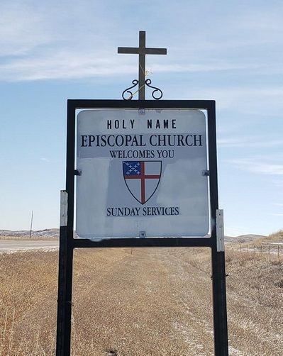
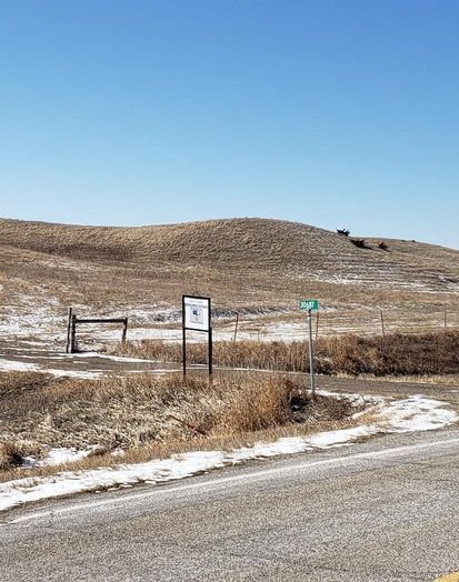
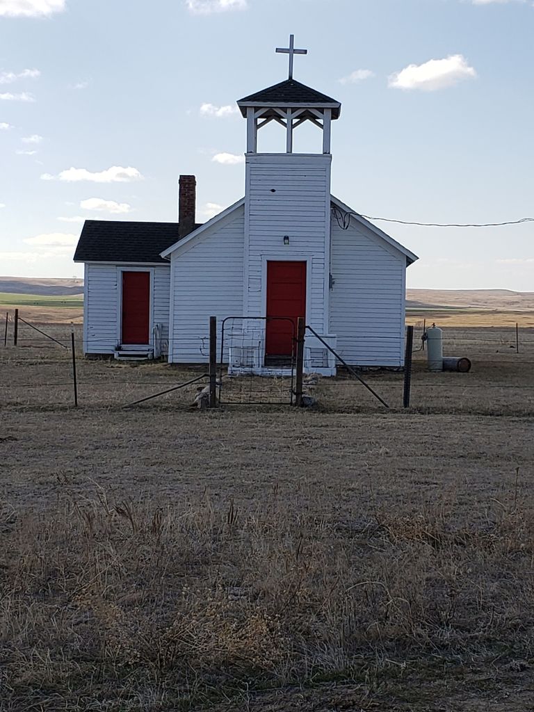
| Description | : | Holy Name Episcopal Cemetery is located near Ft. George by the Holy Name Chapel on Hwy 1806. |
frequently asked questions (FAQ):
-
Where is Holy Name Episcopal Cemetery?
Holy Name Episcopal Cemetery is located at South Dakota 1806 Fort Pierre, Stanley County ,South Dakota , 57532USA.
-
Holy Name Episcopal Cemetery cemetery's updated grave count on graveviews.com?
31 memorials
-
Where are the coordinates of the Holy Name Episcopal Cemetery?
Latitude: 44.2694960
Longitude: -100.0357300
Nearby Cemetories:
1. Holy Name Chapel Cemetery
Fort Pierre, Stanley County, USA
Coordinate: 44.2694292, -100.0356989
2. Chapelle Cemetery
Hughes County, USA
Coordinate: 44.3025017, -99.8653030
3. Canning Cemetery
Hughes County, USA
Coordinate: 44.3986890, -100.0278460
4. Holy Faith Cemetery
Lyman County, USA
Coordinate: 44.1356010, -99.9878006
5. Saint Catherines Cemetery
Harrold, Hughes County, USA
Coordinate: 44.2091100, -99.7868200
6. Ascension Cemetery
Canning, Hughes County, USA
Coordinate: 44.1523700, -99.7927100
7. Riverside Cemetery
Pierre, Hughes County, USA
Coordinate: 44.3608017, -100.3071976
8. South Dakota State Capitol Grounds
Pierre, Hughes County, USA
Coordinate: 44.3660100, -100.3448000
9. Pleasant Hill Cemetery
Blunt, Hughes County, USA
Coordinate: 44.5135994, -100.0156021
10. Byron Township Cemetery
Blunt, Hughes County, USA
Coordinate: 44.4979200, -100.1904700
11. Cedar Hill Cemetery
Fort Pierre, Stanley County, USA
Coordinate: 44.3356018, -100.3964005
12. Messiah Episcopal Cemetery
Lower Brule, Lyman County, USA
Coordinate: 44.1011800, -99.7380800
13. Mount Calvary Cemetery
Pierre, Hughes County, USA
Coordinate: 44.4197006, -100.3557968
14. Fort Pierre Chouteau Cemetery
Fort Pierre, Stanley County, USA
Coordinate: 44.3908700, -100.3878300
15. Scotty Philip Cemetery
Fort Pierre, Stanley County, USA
Coordinate: 44.4019012, -100.4036026
16. Medicine Hill Cemetery
Harrold, Hughes County, USA
Coordinate: 44.5116997, -99.7453003
17. Saint John Catholic Cemetery
Harrold, Hughes County, USA
Coordinate: 44.5127983, -99.7335968
18. Presho Cemetery
Presho, Lyman County, USA
Coordinate: 43.9108658, -100.0631256
19. Earling Cemetery
Lyman County, USA
Coordinate: 43.9206009, -99.9143982
20. Medicine Creek Cemetery
Presho, Lyman County, USA
Coordinate: 43.9053001, -100.0952988
21. Holy Comforter Episcopal Cemetery
Lower Brule, Lyman County, USA
Coordinate: 44.0781700, -99.5815200
22. Holy Angels Cemetery
Presho, Lyman County, USA
Coordinate: 43.8911018, -100.0643997
23. Triple L Cemetery
Lower Brule, Lyman County, USA
Coordinate: 44.0743408, -99.5823467
24. Saint Marys Cemetery
Lower Brule, Lyman County, USA
Coordinate: 44.0722500, -99.5810100