
| Memorials | : | 0 |
| Location | : | Honeybourne, Wychavon District, England |
| Website | : | honeybourne-pc.gov.uk/ |
| Coordinate | : | 52.0957393, -1.8266225 |
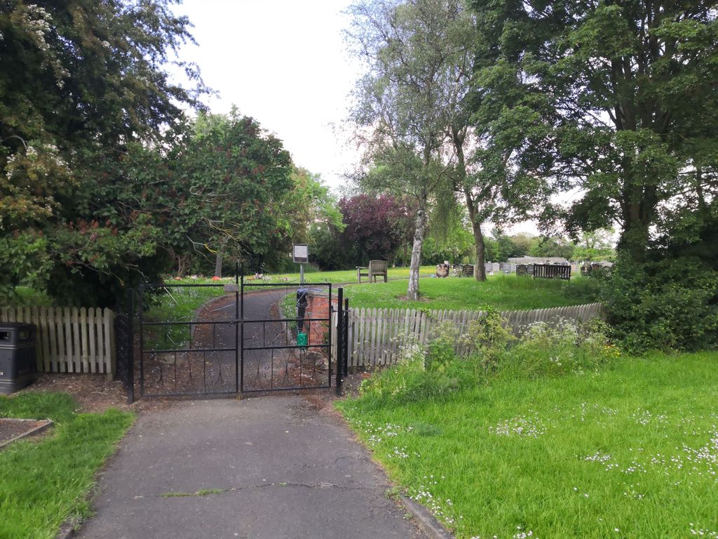
| Description | : | Honeybourne Cemetery occupies a long narrow plot lying behind the houses on the south side of Stratford Road. It is reached from Stratford Road by the same lane which leads to the old Church of St Ecgwin. It is not known when it was opened, but it can be seen for the first time on detailed Maps of 1971. On an earlier Map of 1923, the plot is shown to have been either an orchard, or small wooded area. |
frequently asked questions (FAQ):
-
Where is Honeybourne Cemetery?
Honeybourne Cemetery is located at Stratford Road Honeybourne, Wychavon District ,Worcestershire , WR11 7PPEngland.
-
Honeybourne Cemetery cemetery's updated grave count on graveviews.com?
0 memorials
-
Where are the coordinates of the Honeybourne Cemetery?
Latitude: 52.0957393
Longitude: -1.8266225
Nearby Cemetories:
1. St. Ecgwin Churchyard
Honeybourne, Wychavon District, England
Coordinate: 52.0946646, -1.8262611
2. Bretforton Cemetery
Bretforton, Wychavon District, England
Coordinate: 52.0935996, -1.8625984
3. St. Leonard's Churchyard
Bretforton, Wychavon District, England
Coordinate: 52.0926100, -1.8657200
4. St. Peter's Churchyard
Pebworth, Wychavon District, England
Coordinate: 52.1200720, -1.8137810
5. St Andrew's Church
Aston Subedge, Cotswold District, England
Coordinate: 52.0729286, -1.7994658
6. St. Lawrence's Churchyard
Mickleton, Cotswold District, England
Coordinate: 52.0895200, -1.7653900
7. St. Nicholas Churchyard
Middle Littleton, Wychavon District, England
Coordinate: 52.1212200, -1.8837500
8. St. Michael the Archangel Churchyard
South Littleton, Wychavon District, England
Coordinate: 52.1144100, -1.8909300
9. St. James' Churchyard
Badsey, Wychavon District, England
Coordinate: 52.0863700, -1.8978500
10. St James the Great Churchyard
Long Marston, Stratford-on-Avon District, England
Coordinate: 52.1311800, -1.7783000
11. Wickhamford Parish Cemetery
Wickhamford, Wychavon District, England
Coordinate: 52.0778657, -1.8986902
12. St. John the Baptist Churchyard
Wickhamford, Wychavon District, England
Coordinate: 52.0786800, -1.9021300
13. St Peter's churchyard
Dorsington, Stratford-on-Avon District, England
Coordinate: 52.1458000, -1.8081300
14. St James Churchyard
Chipping Campden, Cotswold District, England
Coordinate: 52.0532670, -1.7758760
15. St Lawrence Churchyard
Bourton-on-the-Hill, Cotswold District, England
Coordinate: 52.0531830, -1.7758910
16. St Catherine's Cemetery
Chipping Campden, Cotswold District, England
Coordinate: 52.0495800, -1.7850600
17. St Andrew Churchyard
Cleeve Prior, Wychavon District, England
Coordinate: 52.1421200, -1.8735300
18. St Saviour's Roman Catholic Churchyard
Broadway, Wychavon District, England
Coordinate: 52.0385690, -1.8569250
19. St. Mary & St. Milburgh Churchyard
Offenham, Wychavon District, England
Coordinate: 52.1123470, -1.9219860
20. St. Swithin's Churchyard
Quinton, Stratford-on-Avon District, England
Coordinate: 52.1213370, -1.7334890
21. St. Swithin Churchyard Extension
Quinton, Stratford-on-Avon District, England
Coordinate: 52.1209500, -1.7326740
22. St. Michael and All Angels Churchyard
Broadway, Wychavon District, England
Coordinate: 52.0343270, -1.8632960
23. St Eadburgha Churchyard
Broadway, Wychavon District, England
Coordinate: 52.0343100, -1.8632560
24. St Mary's Churchyard
Childswickham, Wychavon District, England
Coordinate: 52.0440000, -1.8919000