
| Memorials | : | 221 |
| Location | : | Chipping Campden, Cotswold District, England |
| Coordinate | : | 52.0495800, -1.7850600 |
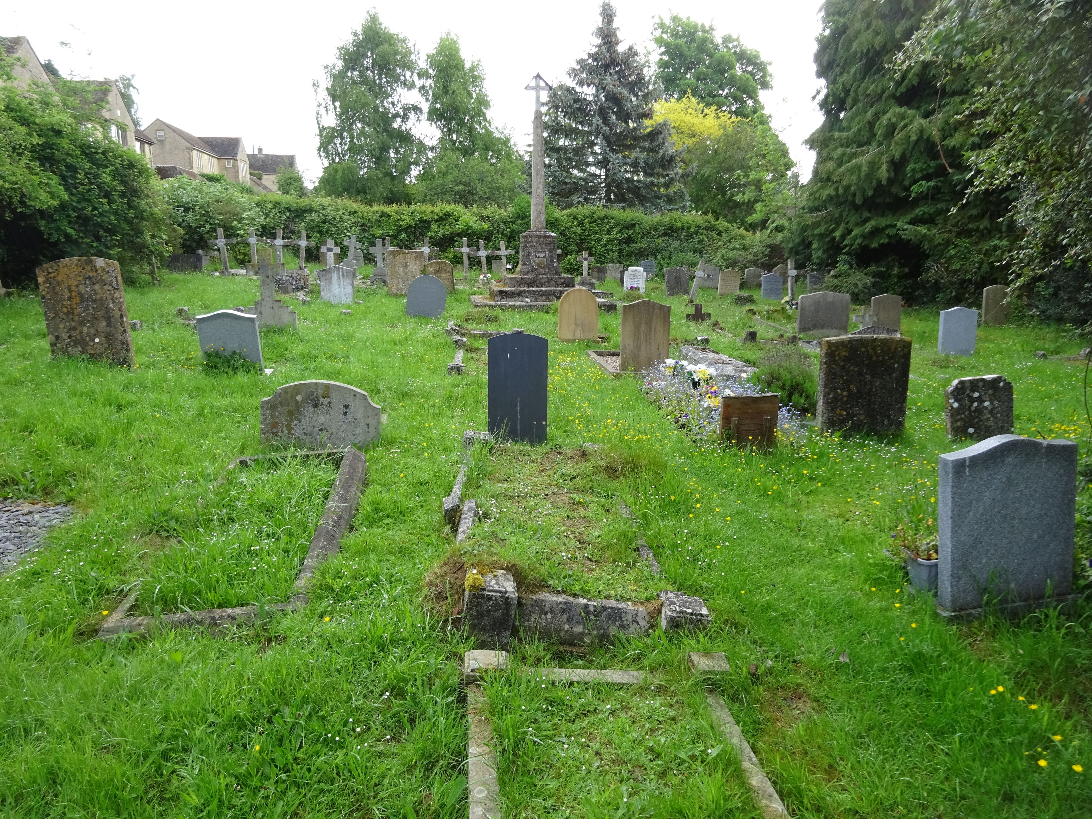
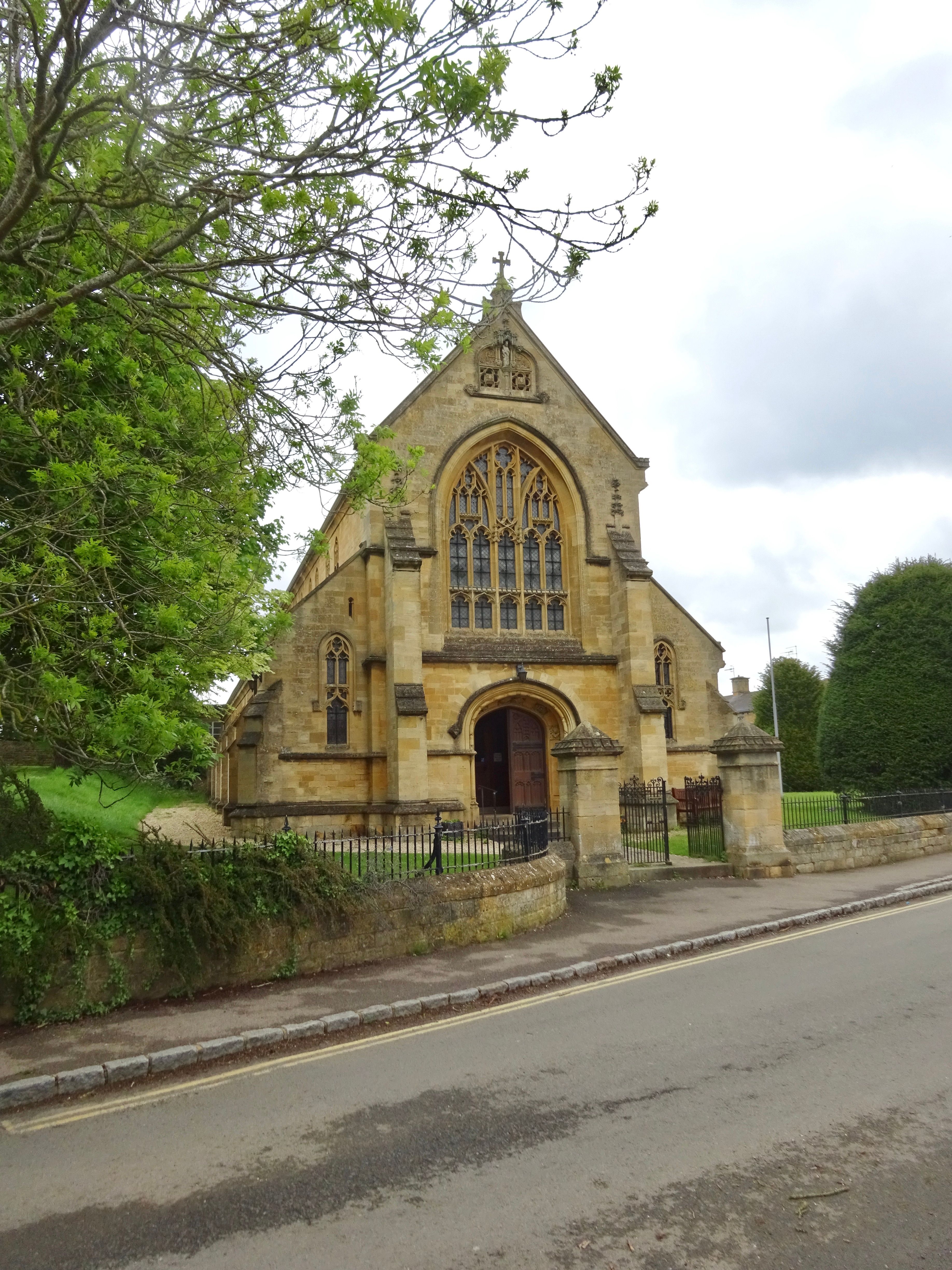
| Description | : | This is an attractive small cemetery hidden by hedgerows beside St. Catherine's Catholic church. It also contains a number of burials of WW II Polish immigrants from a nearby Polish Resettlement camp. It is located at the junction of Lower High Street and Hoo Lane in Chipping Camden. |
frequently asked questions (FAQ):
-
Where is St Catherine's Cemetery?
St Catherine's Cemetery is located at Chipping Campden, Cotswold District ,Gloucestershire ,England.
-
St Catherine's Cemetery cemetery's updated grave count on graveviews.com?
221 memorials
-
Where are the coordinates of the St Catherine's Cemetery?
Latitude: 52.0495800
Longitude: -1.7850600

Nearby Cemetories:
1. St Lawrence Churchyard
Bourton-on-the-Hill, Cotswold District, England
Coordinate: 52.0531830, -1.7758910
2. St James Churchyard
Chipping Campden, Cotswold District, England
Coordinate: 52.0532670, -1.7758760
3. St Andrew's Church
Aston Subedge, Cotswold District, England
Coordinate: 52.0729286, -1.7994658
4. St. Peter and St. Paul's Churchyard
Blockley, Cotswold District, England
Coordinate: 52.0124600, -1.7617000
5. St. Lawrence's Churchyard
Mickleton, Cotswold District, England
Coordinate: 52.0895200, -1.7653900
6. St Saviour's Roman Catholic Churchyard
Broadway, Wychavon District, England
Coordinate: 52.0385690, -1.8569250
7. St Eadburgha Churchyard
Broadway, Wychavon District, England
Coordinate: 52.0343100, -1.8632560
8. St. Michael and All Angels Churchyard
Broadway, Wychavon District, England
Coordinate: 52.0343270, -1.8632960
9. St. Ecgwin Churchyard
Honeybourne, Wychavon District, England
Coordinate: 52.0946646, -1.8262611
10. Honeybourne Cemetery
Honeybourne, Wychavon District, England
Coordinate: 52.0957393, -1.8266225
11. St. Eadburgha New Churchyard
Broadway, Wychavon District, England
Coordinate: 52.0223000, -1.8591500
12. St Marys Churchyard
Batsford, Cotswold District, England
Coordinate: 52.0030800, -1.7291600
13. Bretforton Cemetery
Bretforton, Wychavon District, England
Coordinate: 52.0935996, -1.8625984
14. St. Michael Churchyard Extension
Buckland, Tewkesbury Borough, England
Coordinate: 52.0223380, -1.8816020
15. St. Leonard's Churchyard
Bretforton, Wychavon District, England
Coordinate: 52.0926100, -1.8657200
16. St Mary's Churchyard
Childswickham, Wychavon District, England
Coordinate: 52.0440000, -1.8919000
17. St Barnabas Churchyard
Snowshill, Tewkesbury Borough, England
Coordinate: 52.0017600, -1.8608100
18. St. Peter's Churchyard
Stretton-on-Fosse, Stratford-on-Avon District, England
Coordinate: 52.0430778, -1.6754209
19. St. Mary the Virgin Churchyard
Ilmington, Stratford-on-Avon District, England
Coordinate: 52.0892430, -1.6955030
20. Stretton Cemetery
Stretton-on-Fosse, Stratford-on-Avon District, England
Coordinate: 52.0413935, -1.6733470
21. St. Peter's Churchyard
Pebworth, Wychavon District, England
Coordinate: 52.1200720, -1.8137810
22. St Leonard's
Moreton-in-Marsh, Cotswold District, England
Coordinate: 52.0087019, -1.6822226
23. Wickhamford Parish Cemetery
Wickhamford, Wychavon District, England
Coordinate: 52.0778657, -1.8986902
24. St. John the Baptist Churchyard
Wickhamford, Wychavon District, England
Coordinate: 52.0786800, -1.9021300