
| Memorials | : | 0 |
| Location | : | Chadwick, Carroll County, USA |
| Coordinate | : | 42.0116855, -89.9176153 |
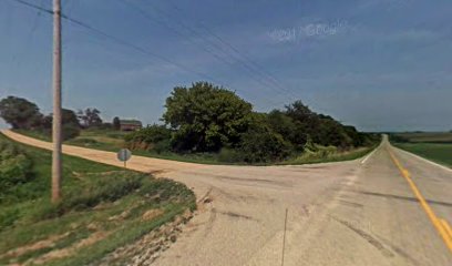
| Description | : | The cemetery is located in Fairhaven Township on the northeast corner of the intersection of Argo Fay Route and Oakville Road. The U.S. Geological Survey (USGS) Geographic Names Information System (GNIS) feature ID for the cemetery is 410506 (Hope Brethern Cemetery / Hope Brethren Cemetery / Hope Cemetery). |
frequently asked questions (FAQ):
-
Where is Hope Brethren Cemetery?
Hope Brethren Cemetery is located at Argo Fay Route and Oakville Road Chadwick, Carroll County ,Illinois , 61014USA.
-
Hope Brethren Cemetery cemetery's updated grave count on graveviews.com?
0 memorials
-
Where are the coordinates of the Hope Brethren Cemetery?
Latitude: 42.0116855
Longitude: -89.9176153
Nearby Cemetories:
1. Black Oak Cemetery
Chadwick, Carroll County, USA
Coordinate: 42.0122185, -89.9372177
2. Chadwick Cemetery
Chadwick, Carroll County, USA
Coordinate: 42.0097198, -89.8680573
3. Oakville Cemetery
Mount Carroll, Carroll County, USA
Coordinate: 42.0501862, -89.9262314
4. Daggert Cemetery
Mount Carroll, Carroll County, USA
Coordinate: 42.0377808, -89.9583282
5. Trinity Lutheran Church Cemetery
Mount Carroll, Carroll County, USA
Coordinate: 42.0505600, -89.9588928
6. Stein Family Cemetery
Carroll County, USA
Coordinate: 41.9740200, -89.8737700
7. Fairhaven Cemetery
Fair Haven, Carroll County, USA
Coordinate: 41.9466705, -89.9288864
8. Argo Cemetery
Argo Fay, Carroll County, USA
Coordinate: 42.0042480, -90.0170160
9. Carroll County Farm Cemetery
Mount Carroll, Carroll County, USA
Coordinate: 42.0722050, -89.9848680
10. Dutchtown Church of the Brethren Cemetery
Milledgeville, Carroll County, USA
Coordinate: 41.9741130, -89.8174290
11. Sipe Cemetery
Mount Carroll, Carroll County, USA
Coordinate: 42.0450900, -90.0226600
12. Zook Cemetery
Whiteside County, USA
Coordinate: 41.9175565, -89.9001371
13. North Clyde Methodist Cemetery
Whiteside County, USA
Coordinate: 41.9162760, -89.9675410
14. Oak Hill Cemetery
Mount Carroll, Carroll County, USA
Coordinate: 42.1033287, -89.9861069
15. Hickory Grove Cemetery
Mount Carroll, Carroll County, USA
Coordinate: 42.0578651, -90.0461960
16. Lanark City Cemetery
Lanark, Carroll County, USA
Coordinate: 42.0966682, -89.8261108
17. Lower York Cemetery
Thomson, Carroll County, USA
Coordinate: 41.9588890, -90.0555573
18. Center Hill Cemetery
Center Hill, Carroll County, USA
Coordinate: 42.0813904, -90.0425034
19. Arnolds Grove Cemetery
Carroll County, USA
Coordinate: 42.1283302, -89.9436111
20. Hazel Green Cemetery
Genesee Township, Whiteside County, USA
Coordinate: 41.9241700, -89.8104540
21. Bethel Cemetery
Milledgeville, Carroll County, USA
Coordinate: 41.9440700, -89.7829260
22. Union Cemetery
Milledgeville, Carroll County, USA
Coordinate: 42.0019417, -89.7533264
23. Genesee Grove Central Cemetery
Coleta, Whiteside County, USA
Coordinate: 41.9026290, -89.8413490
24. Arnolds Grove Dunkard Cemetery
Mount Carroll, Carroll County, USA
Coordinate: 42.1338610, -89.9436900