
| Memorials | : | 14 |
| Location | : | Jefferson County, USA |
| Coordinate | : | 41.0029000, -91.7566000 |
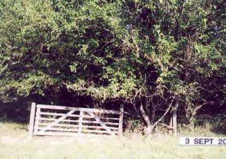
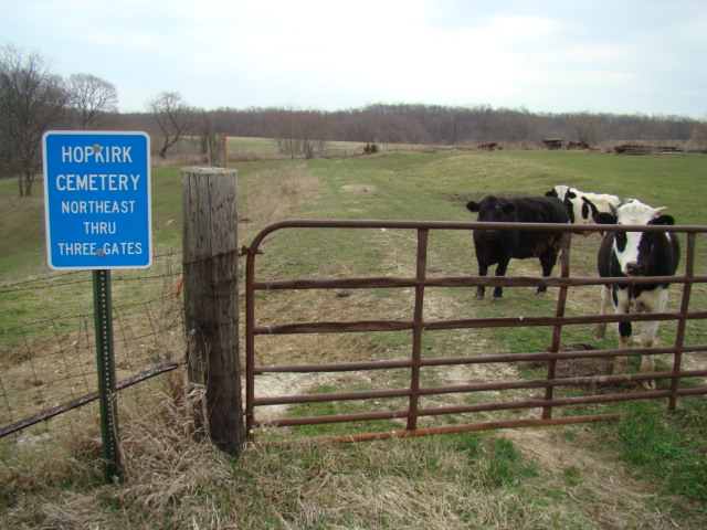
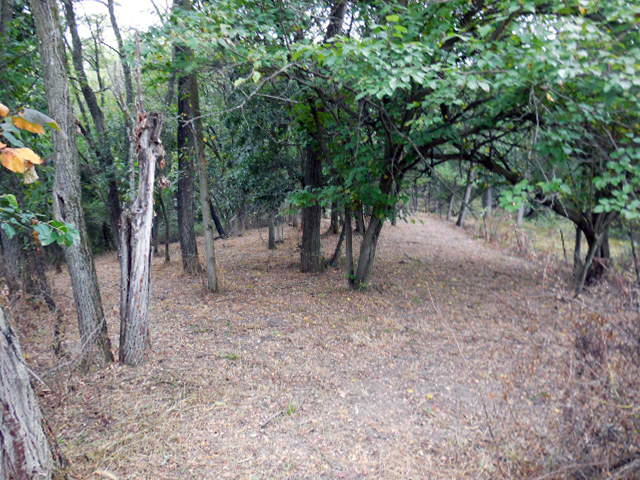
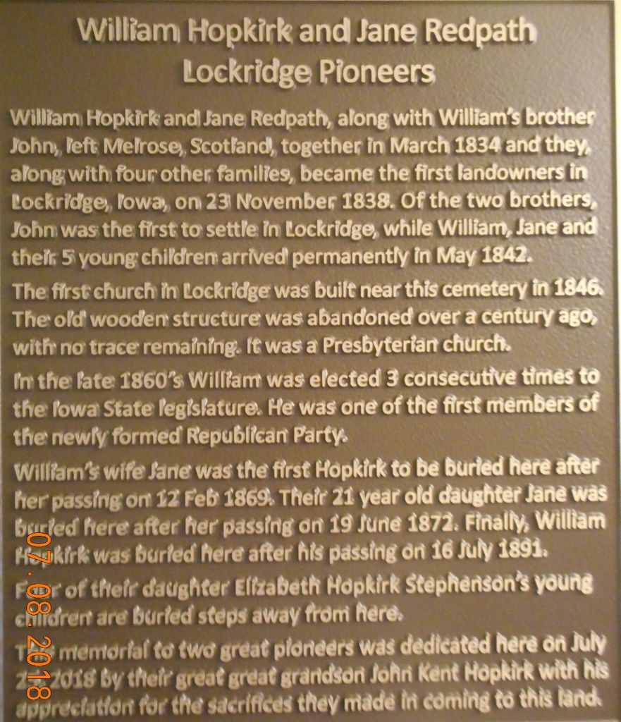
| Description | : | Thanks to JEN for the cemetery picture. It is appreciated. Located at Coalport. In bad condition. I had a great aunt Bridget Lanigan who died in May of 1860 at Coalport. Don't know if she was buried here or not. My great grandfather John Lanigan and family lived in a train car at Coalport and worked on the railroad.Helped build the first railroad into Fairfield, Iowa. Since first posting this descrition of this cemetery; it has been cleaned up and inscriptions and stone pictures have been taken of stones that are not buried. Also thanks RIHARD for adding these great photos~~~~~ |
frequently asked questions (FAQ):
-
Where is Hopkirk Cemetery?
Hopkirk Cemetery is located at Jefferson County ,Iowa ,USA.
-
Hopkirk Cemetery cemetery's updated grave count on graveviews.com?
3 memorials
-
Where are the coordinates of the Hopkirk Cemetery?
Latitude: 41.0029000
Longitude: -91.7566000
Nearby Cemetories:
1. Lockridge Cemetery
Lockridge, Jefferson County, USA
Coordinate: 40.9952000, -91.7558500
2. New Swedish Methodist Church Cemetery
Jefferson County, USA
Coordinate: 41.0037384, -91.7763519
3. Hopkirk Family Cemetery
Lockridge, Jefferson County, USA
Coordinate: 40.9928820, -91.7396530
4. Four Corners German Lutheran Cemetery
Lockridge, Jefferson County, USA
Coordinate: 41.0247002, -91.7605972
5. New Sweden United Methodist Church Cemetery
Lockridge, Jefferson County, USA
Coordinate: 41.0247002, -91.7752991
6. New Sweden Lutheran Cemetery
Lockridge, Jefferson County, USA
Coordinate: 41.0238991, -91.7797012
7. New Sweden Baptist Cemetery
Jefferson County, USA
Coordinate: 41.0242004, -91.7857971
8. Upland Cemetery
Lockridge, Jefferson County, USA
Coordinate: 40.9700012, -91.7461014
9. Bonnifield Cemetery
Lockridge, Jefferson County, USA
Coordinate: 40.9874992, -91.7966995
10. Vorhies Cemetery
Rome, Henry County, USA
Coordinate: 41.0213230, -91.7134810
11. Grant Cemetery
Rome, Henry County, USA
Coordinate: 40.9880981, -91.6992035
12. Smith Family Burial Site
Mount Pleasant, Henry County, USA
Coordinate: 40.9755300, -91.6987500
13. Alfred Warner Family Burial Ground
Trenton, Henry County, USA
Coordinate: 41.0180520, -91.6909500
14. Peterson Cemetery
Lockridge, Jefferson County, USA
Coordinate: 41.0393982, -91.8075027
15. Gilmer Cemetery
Jefferson County, USA
Coordinate: 40.9486008, -91.7564011
16. Union Cemetery
Lockridge Township, Jefferson County, USA
Coordinate: 40.9878000, -91.8266000
17. Mount Zion Cemetery
Jefferson County, USA
Coordinate: 40.9617004, -91.8082962
18. White Oak Cemetery
Trenton, Henry County, USA
Coordinate: 41.0293999, -91.6793976
19. Messer Cemetery
Henry County, USA
Coordinate: 41.0419006, -91.6885986
20. Glasgow Cemetery
Glasgow, Jefferson County, USA
Coordinate: 40.9375000, -91.7838974
21. Salina Cemetery
Salina, Jefferson County, USA
Coordinate: 41.0419006, -91.8330994
22. Scheffel Family Cemetery
Trenton, Henry County, USA
Coordinate: 41.0539030, -91.6921730
23. Chillcott Family Cemetery
Jefferson County, USA
Coordinate: 41.0558000, -91.8286300
24. Roth Cemetery
Trenton, Henry County, USA
Coordinate: 41.0515000, -91.6772000