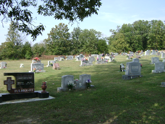
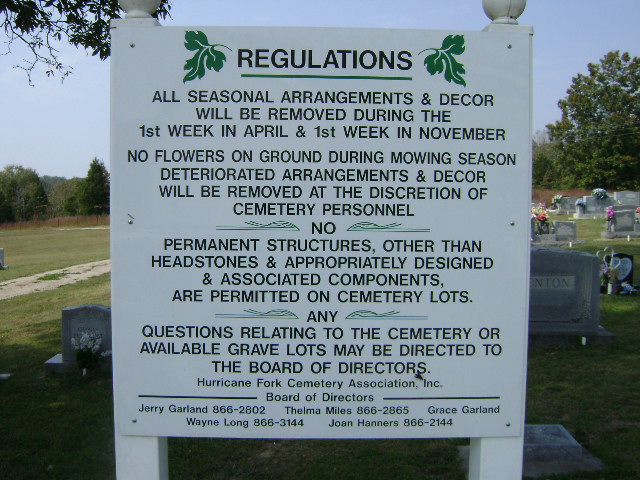
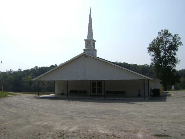
| Memorials | : | 1 |
| Location | : | Hurricane, Bollinger County, USA |
| Coordinate | : | 37.4186668, -90.0178833 |
| Description | : | Located at Hurricane Fork General Baptist Church. Sometimes referred to as "Pinhook", but it is uncertain how that name originated. Located 12 miles north of Marble Hill, MO, one and one-half miles down County Road 330; off Hwy 51. |
frequently asked questions (FAQ):
-
Where is Hurricane Fork Cemetery?
Hurricane Fork Cemetery is located at Hurricane, Bollinger County ,Missouri ,USA.
-
Hurricane Fork Cemetery cemetery's updated grave count on graveviews.com?
1 memorials
-
Where are the coordinates of the Hurricane Fork Cemetery?
Latitude: 37.4186668
Longitude: -90.0178833
Nearby Cemetories:
1. Lincoln Cemetery
Hurricane, Bollinger County, USA
Coordinate: 37.3955994, -90.0010986
2. Plainview Cemetery
Hurricane, Bollinger County, USA
Coordinate: 37.3914452, -90.0123291
3. New Bethel Congregational Methodist Church Cemeter
Bollinger County, USA
Coordinate: 37.4151450, -90.0555070
4. Mountain View Cemetery
Bollinger County, USA
Coordinate: 37.4157982, -89.9738998
5. Wallis Cemetery
Hurricane, Bollinger County, USA
Coordinate: 37.3800011, -90.0081024
6. Moores Cemetery
Bollinger County, USA
Coordinate: 37.3883018, -90.0522003
7. Bess Cemetery
Hurricane, Bollinger County, USA
Coordinate: 37.3807983, -89.9927979
8. Shrum Cemetery
Hurricane, Bollinger County, USA
Coordinate: 37.3751500, -90.0144800
9. Mount Carmel Missionary Baptist Church Cemetery
Tallent, Bollinger County, USA
Coordinate: 37.4564438, -90.0537186
10. Slinkard Cemetery
Patton, Bollinger County, USA
Coordinate: 37.4406013, -90.0777969
11. McMahan Cemetery
Bessville, Bollinger County, USA
Coordinate: 37.3767014, -90.0597000
12. Burton Cemetery
Marble Hill, Bollinger County, USA
Coordinate: 37.3722000, -89.9697037
13. Coles Cemetery
Bollinger County, USA
Coordinate: 37.4021988, -89.9447021
14. Pleasant Valley Cemetery
Gipsy, Bollinger County, USA
Coordinate: 37.4580800, -90.0801100
15. Old Pulliam-Judge Long Cemetery
Bollinger County, USA
Coordinate: 37.4207993, -89.9372025
16. Liberty Congregational Methodist Church Cemetery
Bessville, Bollinger County, USA
Coordinate: 37.4537100, -90.0919700
17. Mount Zion Cemetery
Scopus, Bollinger County, USA
Coordinate: 37.3815575, -89.9451447
18. Hawn Cemetery
Bollinger County, USA
Coordinate: 37.4239006, -90.1063995
19. James Cemetery
Scopus, Bollinger County, USA
Coordinate: 37.4291992, -89.9297028
20. Old Union Methodist Church Cemetery
Bessville, Bollinger County, USA
Coordinate: 37.3844719, -90.0987778
21. Dalton Cemetery
Bollinger County, USA
Coordinate: 37.4897003, -89.9969025
22. Buehler Cemetery
Glenallen, Bollinger County, USA
Coordinate: 37.3466988, -89.9989014
23. Berry Cemetery
Bollinger County, USA
Coordinate: 37.4000015, -90.1128006
24. Seabaugh Cemetery
Mayfield, Bollinger County, USA
Coordinate: 37.4710999, -89.9452972


