
| Memorials | : | 0 |
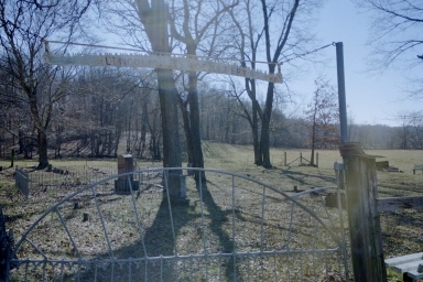
| Location | : | Hurricane, Bollinger County, USA |
| Coordinate | : | 37.3955994, -90.0010986 |
frequently asked questions (FAQ):
-
Where is Lincoln Cemetery?
Lincoln Cemetery is located at Hurricane, Bollinger County ,Missouri ,USA.
-
Lincoln Cemetery cemetery's updated grave count on graveviews.com?
0 memorials
-
Where are the coordinates of the Lincoln Cemetery?
Latitude: 37.3955994
Longitude: -90.0010986
Nearby Cemetories:
1. Plainview Cemetery
Hurricane, Bollinger County, USA
Coordinate: 37.3914452, -90.0123291
2. Bess Cemetery
Hurricane, Bollinger County, USA
Coordinate: 37.3807983, -89.9927979
3. Wallis Cemetery
Hurricane, Bollinger County, USA
Coordinate: 37.3800011, -90.0081024
4. Shrum Cemetery
Hurricane, Bollinger County, USA
Coordinate: 37.3751500, -90.0144800
5. Hurricane Fork Cemetery
Hurricane, Bollinger County, USA
Coordinate: 37.4186668, -90.0178833
6. Mountain View Cemetery
Bollinger County, USA
Coordinate: 37.4157982, -89.9738998
7. Burton Cemetery
Marble Hill, Bollinger County, USA
Coordinate: 37.3722000, -89.9697037
8. Moores Cemetery
Bollinger County, USA
Coordinate: 37.3883018, -90.0522003
9. Coles Cemetery
Bollinger County, USA
Coordinate: 37.4021988, -89.9447021
10. Mount Zion Cemetery
Scopus, Bollinger County, USA
Coordinate: 37.3815575, -89.9451447
11. New Bethel Congregational Methodist Church Cemeter
Bollinger County, USA
Coordinate: 37.4151450, -90.0555070
12. Buehler Cemetery
Glenallen, Bollinger County, USA
Coordinate: 37.3466988, -89.9989014
13. McMahan Cemetery
Bessville, Bollinger County, USA
Coordinate: 37.3767014, -90.0597000
14. Old Pulliam-Judge Long Cemetery
Bollinger County, USA
Coordinate: 37.4207993, -89.9372025
15. Chostner Cemetery
Scopus, Bollinger County, USA
Coordinate: 37.3857994, -89.9263992
16. Barks Cemetery
Marble Hill, Bollinger County, USA
Coordinate: 37.3506012, -89.9494019
17. James Cemetery
Scopus, Bollinger County, USA
Coordinate: 37.4291992, -89.9297028
18. Cook Cemetery
Scopus, Bollinger County, USA
Coordinate: 37.4033012, -89.9156036
19. Mount Carmel Missionary Baptist Church Cemetery
Tallent, Bollinger County, USA
Coordinate: 37.4564438, -90.0537186
20. Slinkard Cemetery
Patton, Bollinger County, USA
Coordinate: 37.4406013, -90.0777969
21. Pulliam Cemetery
Mayfield, Bollinger County, USA
Coordinate: 37.4397011, -89.9225006
22. Old Union Methodist Church Cemetery
Bessville, Bollinger County, USA
Coordinate: 37.3844719, -90.0987778
23. Myers Cemetery
Glenallen, Bollinger County, USA
Coordinate: 37.3171997, -90.0096970
24. Glen Allen Cemetery
Glenallen, Bollinger County, USA
Coordinate: 37.3201100, -90.0320100