
| Memorials | : | 18 |
| Location | : | Chestertown, Kent County, USA |
| Coordinate | : | 39.1891030, -76.1570530 |
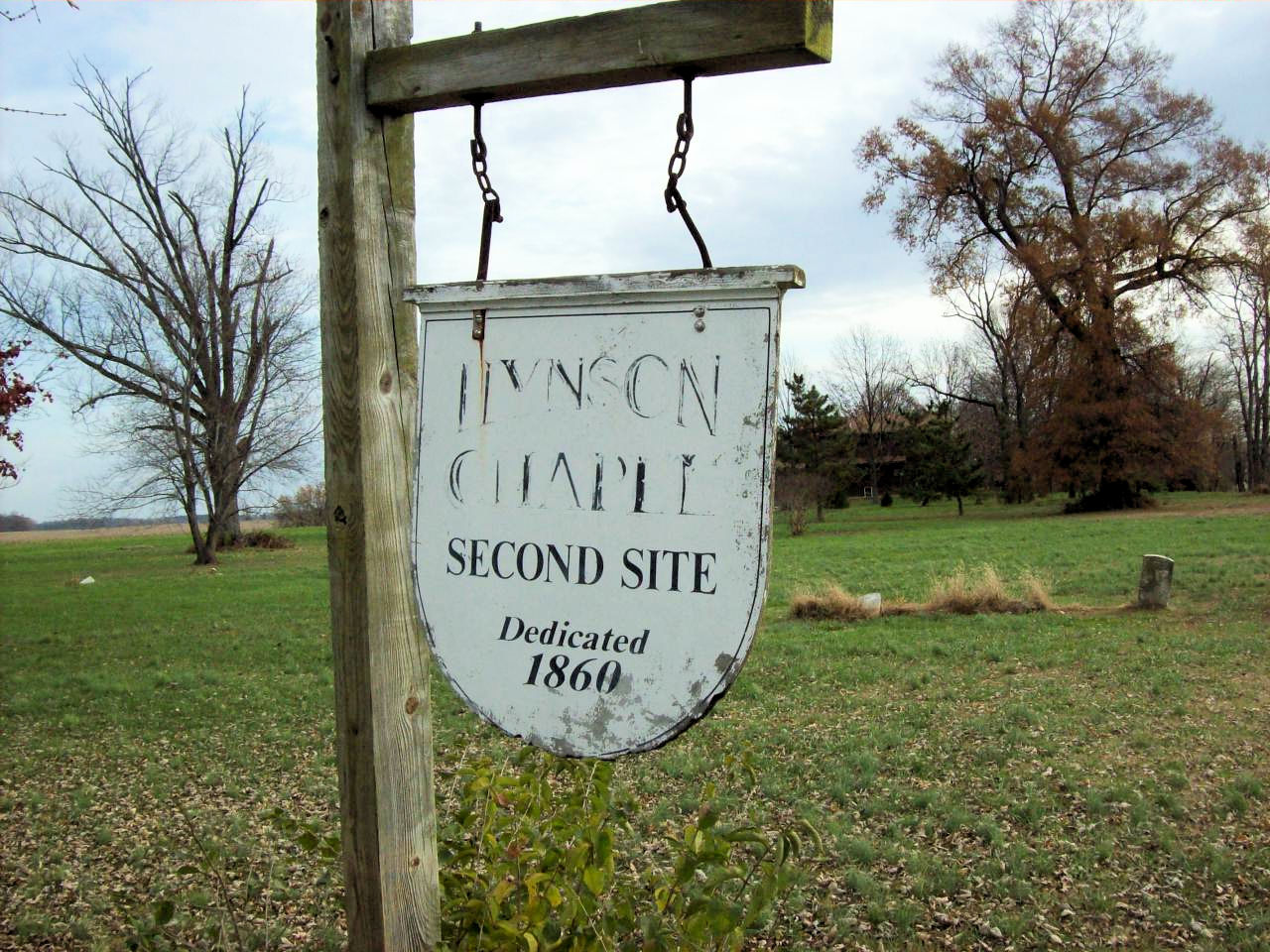
| Description | : | Hynson chapel, dedicated in 1860, has disappeared, but 11 marked graves remain from the cemetery. This is the second of the two sites occupied by the Hynson Chapel. It is located at the intersection of Bakers Lane and Ricaud's Branch Road near Fairlee Maryland. |
frequently asked questions (FAQ):
-
Where is Hynson Chapel Cemetery?
Hynson Chapel Cemetery is located at Ricauds Branch Road at Bakers Lane Chestertown, Kent County ,Maryland ,USA.
-
Hynson Chapel Cemetery cemetery's updated grave count on graveviews.com?
18 memorials
-
Where are the coordinates of the Hynson Chapel Cemetery?
Latitude: 39.1891030
Longitude: -76.1570530
Nearby Cemetories:
1. Saint Paul's Kent Churchyard
Chestertown, Kent County, USA
Coordinate: 39.1871740, -76.1794370
2. Hadaway Chapel Cemetery
Kent County, USA
Coordinate: 39.1591988, -76.1607971
3. Kelsey Methodist Protestant Chapel Cemetery
Fairlee, Kent County, USA
Coordinate: 39.1494510, -76.1640940
4. Mount Pleasant Cemetery
Fairlee, Kent County, USA
Coordinate: 39.2313995, -76.1669006
5. Asbury Cemetery
Chestertown, Kent County, USA
Coordinate: 39.2188988, -76.1986008
6. Bond Chapel Cemetery
Kent County, USA
Coordinate: 39.1585999, -76.1136017
7. Emmanuel United Methodist Church Cemetery
Pomona, Kent County, USA
Coordinate: 39.1623700, -76.1029500
8. Holy Trinity AME Church Cemetery
Rock Hall, Kent County, USA
Coordinate: 39.1519700, -76.2067600
9. Trew Family Cemetery
Chestertown, Kent County, USA
Coordinate: 39.1327553, -76.1409607
10. Jane's Cemetery
Chestertown, Kent County, USA
Coordinate: 39.1869020, -76.0743800
11. Wesley Chapel Cemetery
Rock Hall, Kent County, USA
Coordinate: 39.1450005, -76.2181015
12. Mowbray Chapel
Cliffs City, Kent County, USA
Coordinate: 39.1201105, -76.1430046
13. Chester Cemetery
Chestertown, Kent County, USA
Coordinate: 39.2168999, -76.0736008
14. Comegys Bight Cemetery
Chestertown, Kent County, USA
Coordinate: 39.1204033, -76.1325912
15. Aaron's Chapel Church Cemetery
Kent County, USA
Coordinate: 39.1350600, -76.2235650
16. Piney Neck Cemetery
Rock Hall, Kent County, USA
Coordinate: 39.1206660, -76.1966180
17. Saint Johns Cemetery
Rock Hall, Kent County, USA
Coordinate: 39.1330986, -76.2319031
18. Ashley Cemetery
Rock Hall, Kent County, USA
Coordinate: 39.1107030, -76.1942110
19. Ashley Burial Ground
Rock Hall, Kent County, USA
Coordinate: 39.1107020, -76.1942100
20. Saint James Cemetery
Worton, Kent County, USA
Coordinate: 39.2792015, -76.1382980
21. Meadow and Vale Cemetery
Queen Anne's County, USA
Coordinate: 39.1735620, -76.0350920
22. Conquest Farm Cemetery
Queen Anne's County, USA
Coordinate: 39.0953200, -76.1246300
23. Mount Olive Cemetery
Kent County, USA
Coordinate: 39.2827988, -76.1093979
24. Worton Union ME Church Cemetery
Worton, Kent County, USA
Coordinate: 39.2866173, -76.0948257