
| Memorials | : | 8 |
| Location | : | Cedar Grove, Henderson County, USA |
| Coordinate | : | 35.8034590, -88.5310720 |
| Description | : | From the intersection of TN-104 & I-40, at Exit 101, travel northwest on TN-102 for 2.4 mi., turning northeast (right) onto Baudy James Rd., going 1.8 mi., turning east (left) to stay on Baudy James Rd., going 0.7 mi., to the sparely used cemetery on the south (left) side of the road. |
frequently asked questions (FAQ):
-
Where is James Cemetery?
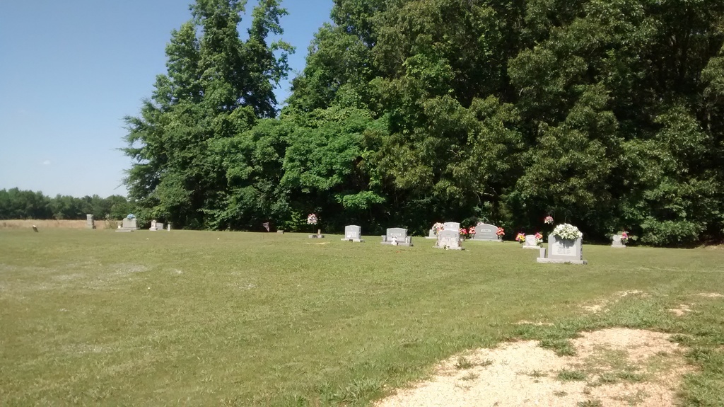
James Cemetery is located at Baudy James Rd Cedar Grove, Henderson County ,Tennessee , 38321USA.
-
James Cemetery cemetery's updated grave count on graveviews.com?
8 memorials
-
Where are the coordinates of the James Cemetery?
Latitude: 35.8034590
Longitude: -88.5310720
Nearby Cemetories:
1. Rue Hammer Cemetery
Parkers Crossroads, Henderson County, USA
Coordinate: 35.8093400, -88.4994800
2. Bible Hill Cemetery
Henderson County, USA
Coordinate: 35.8097000, -88.4985200
3. Mount Pleasant Church Cemetery
Wildersville, Henderson County, USA
Coordinate: 35.8095680, -88.4974310
4. New Bethel Cemetery
Cedar Grove, Carroll County, USA
Coordinate: 35.8319016, -88.5286636
5. Spain Cemetery
Henderson County, USA
Coordinate: 35.8069000, -88.5663986
6. Seats Chapel Holiness Church Cemetery
Cedar Grove, Henderson County, USA
Coordinate: 35.8118860, -88.4964260
7. Morning Sun Cemetery
Cedar Grove, Carroll County, USA
Coordinate: 35.8335550, -88.5556430
8. Stewart Cemetery
Henderson County, USA
Coordinate: 35.7694170, -88.5537500
9. Pleasant Hill Cemetery
Mount Gilead, Henderson County, USA
Coordinate: 35.7599983, -88.5408020
10. Lucas Cemetery
Henderson County, USA
Coordinate: 35.7983589, -88.4765930
11. Mount Aratt Primitive Baptist Church Cemetery
Rock Springs, Henderson County, USA
Coordinate: 35.8206000, -88.4798800
12. Barham Cemetery
Carroll County, USA
Coordinate: 35.8264600, -88.5800200
13. Smith-Hart Cemetery
Henderson County, USA
Coordinate: 35.8191986, -88.4753036
14. Hickory Flat Church Cemetery
Cedar Grove, Carroll County, USA
Coordinate: 35.8223490, -88.5904320
15. Kirk Family Cemetery
Cedar Grove, Henderson County, USA
Coordinate: 35.8158990, -88.5958870
16. Old Woodard Cemetery
Cedar Grove, Carroll County, USA
Coordinate: 35.8570180, -88.5457830
17. Douglass Cemetery
Bargerton, Henderson County, USA
Coordinate: 35.7734720, -88.4710370
18. Woodard Cemetery
Cedar Grove, Carroll County, USA
Coordinate: 35.8574250, -88.5639770
19. Coffman Cemetery
Parkers Crossroads, Henderson County, USA
Coordinate: 35.8149620, -88.4533040
20. Rock Springs Cemetery
Wildersville, Henderson County, USA
Coordinate: 35.7956600, -88.4497500
21. Douglass Cemetery
Union Cross, Henderson County, USA
Coordinate: 35.7579550, -88.4705780
22. Rock Springs Christian Fellowship Cemetery
Wildersville, Henderson County, USA
Coordinate: 35.7969270, -88.4473080
23. Palestine Cemetery
Howley, Carroll County, USA
Coordinate: 35.8574982, -88.4783020
24. Poplar Corner Church Cemetery
Wildersville, Henderson County, USA
Coordinate: 35.7749690, -88.4483170