
| Memorials | : | 0 |
| Location | : | Parkers Crossroads, Henderson County, USA |
| Coordinate | : | 35.8093400, -88.4994800 |
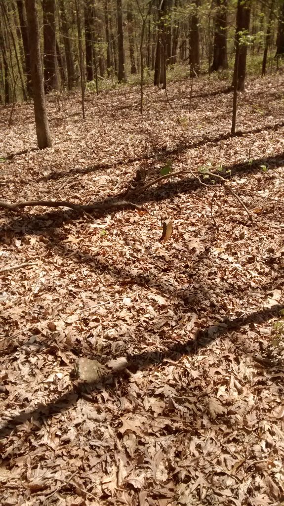
| Description | : | Located across the road from Bible Hill Baptist Church in the woods. This burial ground is the site of Old Rue Hammer Church and cemetery. The cemetery has very many unmarked graves and was abandoned when the congregation moved to Smith School House site around 1900. No grave conventional grave stones located, only field stone markers. Approx. 30 to maybe 50 burials. |
frequently asked questions (FAQ):
-
Where is Rue Hammer Cemetery?
Rue Hammer Cemetery is located at Parkers Crossroads, Henderson County ,Tennessee ,USA.
-
Rue Hammer Cemetery cemetery's updated grave count on graveviews.com?
0 memorials
-
Where are the coordinates of the Rue Hammer Cemetery?
Latitude: 35.8093400
Longitude: -88.4994800
Nearby Cemetories:
1. Bible Hill Cemetery
Henderson County, USA
Coordinate: 35.8097000, -88.4985200
2. Mount Pleasant Church Cemetery
Wildersville, Henderson County, USA
Coordinate: 35.8095680, -88.4974310
3. Seats Chapel Holiness Church Cemetery
Cedar Grove, Henderson County, USA
Coordinate: 35.8118860, -88.4964260
4. Mount Aratt Primitive Baptist Church Cemetery
Rock Springs, Henderson County, USA
Coordinate: 35.8206000, -88.4798800
5. Lucas Cemetery
Henderson County, USA
Coordinate: 35.7983589, -88.4765930
6. Smith-Hart Cemetery
Henderson County, USA
Coordinate: 35.8191986, -88.4753036
7. James Cemetery
Cedar Grove, Henderson County, USA
Coordinate: 35.8034590, -88.5310720
8. New Bethel Cemetery
Cedar Grove, Carroll County, USA
Coordinate: 35.8319016, -88.5286636
9. Coffman Cemetery
Parkers Crossroads, Henderson County, USA
Coordinate: 35.8149620, -88.4533040
10. Rock Springs Cemetery
Wildersville, Henderson County, USA
Coordinate: 35.7956600, -88.4497500
11. Douglass Cemetery
Bargerton, Henderson County, USA
Coordinate: 35.7734720, -88.4710370
12. Rock Springs Christian Fellowship Cemetery
Wildersville, Henderson County, USA
Coordinate: 35.7969270, -88.4473080
13. White Cemetery
Henderson County, USA
Coordinate: 35.8078003, -88.4392014
14. Palestine Cemetery
Howley, Carroll County, USA
Coordinate: 35.8574982, -88.4783020
15. Morning Sun Cemetery
Cedar Grove, Carroll County, USA
Coordinate: 35.8335550, -88.5556430
16. Poplar Corner Church Cemetery
Wildersville, Henderson County, USA
Coordinate: 35.7749690, -88.4483170
17. Spain Cemetery
Henderson County, USA
Coordinate: 35.8069000, -88.5663986
18. Douglass Cemetery
Union Cross, Henderson County, USA
Coordinate: 35.7579550, -88.4705780
19. Rosser Cemetery
Clarksburg, Carroll County, USA
Coordinate: 35.8403015, -88.4389038
20. Stewart Cemetery
Henderson County, USA
Coordinate: 35.7694170, -88.5537500
21. Pleasant Hill Cemetery
Mount Gilead, Henderson County, USA
Coordinate: 35.7599983, -88.5408020
22. Old Woodard Cemetery
Cedar Grove, Carroll County, USA
Coordinate: 35.8570180, -88.5457830
23. Kee-Cox Family Cemetery
Clarksburg, Carroll County, USA
Coordinate: 35.8508230, -88.4438010
24. New Haven Church Cemetery
Union Cross, Henderson County, USA
Coordinate: 35.7610080, -88.4522310