
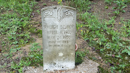
| Memorials | : | 1 |
| Location | : | Owsley County, USA |
| Coordinate | : | 37.3542790, -83.6417330 |
| Description | : | From Booneville take RT.28 E. to RT.2024 S. travel 4.7 miles on 2024 to dead end. Turn right onto Buffalo Branch Rd. go to the fork in the road and take the right fork. Travel one mile, cemetery is on the right side of the road. The cemetery sits on a hill. |
frequently asked questions (FAQ):
-
Where is John Baker Cemetery?
John Baker Cemetery is located at Right Fork Buffalo Road Owsley County ,Kentucky , 41721USA.
-
John Baker Cemetery cemetery's updated grave count on graveviews.com?
1 memorials
-
Where are the coordinates of the John Baker Cemetery?
Latitude: 37.3542790
Longitude: -83.6417330
Nearby Cemetories:
1. Reed Cemetery
Ricetown, Owsley County, USA
Coordinate: 37.3714000, -83.6467830
2. Anderson Cemetery
Ricetown, Owsley County, USA
Coordinate: 37.3816830, -83.6416830
3. Laurel Point Cemetery
Clay County, USA
Coordinate: 37.3348167, -83.6705833
4. Wilson Cemetery
Cow Creek, Owsley County, USA
Coordinate: 37.3725014, -83.6725006
5. Hensley Cemetery
Taft, Owsley County, USA
Coordinate: 37.3637600, -83.6823360
6. Job Allen Cemetery
Oneida, Clay County, USA
Coordinate: 37.3150500, -83.6557000
7. King Cemetery
Owsley County, USA
Coordinate: 37.3622017, -83.6947021
8. Amis-Baker Cemetery
Ricetown, Owsley County, USA
Coordinate: 37.3873330, -83.6060330
9. Vires Cemetery
Lucky Fork, Owsley County, USA
Coordinate: 37.3798500, -83.5951000
10. Highland Cemetery
Owsley County, USA
Coordinate: 37.3221500, -83.5974500
11. Horn Hill Cemetery
Ricetown, Owsley County, USA
Coordinate: 37.3718987, -83.5839005
12. Edwards-Sandlin Family Cemetery
Ricetown, Owsley County, USA
Coordinate: 37.3488846, -83.7043152
13. Marshall Family Cemetery
Booneville, Owsley County, USA
Coordinate: 37.4072500, -83.6661800
14. Esau-Gabbard Cemetery
Ricetown, Owsley County, USA
Coordinate: 37.4128700, -83.6337160
15. Cope Cemetery
Southfork, Owsley County, USA
Coordinate: 37.4073830, -83.6745500
16. Sizemore Cemetery
Manchester, Clay County, USA
Coordinate: 37.3367000, -83.7141100
17. Russell-Moore Cemetery
Felty, Clay County, USA
Coordinate: 37.3366500, -83.7141300
18. Griffith Cemetery
Southfork, Owsley County, USA
Coordinate: 37.4136009, -83.6650009
19. Deaton Family Cemetery
Southfork, Owsley County, USA
Coordinate: 37.4144600, -83.6656200
20. George Washington Edwards Cemetery
Island City, Owsley County, USA
Coordinate: 37.3544300, -83.7238300
21. Middleton Cemetery
Clay County, USA
Coordinate: 37.3314018, -83.7197037
22. Saddler Cemetery North
Felty, Clay County, USA
Coordinate: 37.3125500, -83.7076400
23. Saddler Cemetery South
Felty, Clay County, USA
Coordinate: 37.3122100, -83.7074500
24. Gay Cemetery
Booneville, Owsley County, USA
Coordinate: 37.4143670, -83.6813670