
| Memorials | : | 12 |
| Location | : | Oneida, Clay County, USA |
| Coordinate | : | 37.3150500, -83.6557000 |
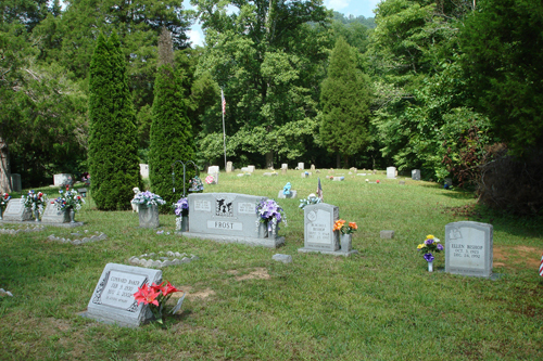
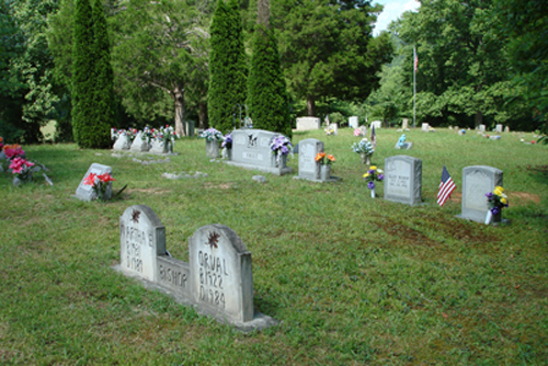
| Description | : | From Oneida, go north on HWY 11 approximately 4.2 miles. Turn right on Benny Malt Baker Road, Approximately 1.4 miles, the cemetery road will turn up the hill on the left side of the road. The community name is Aldridge Rock. GPS Location N37.18.891 W83.39.358 29 Unmarked graves. All the photos & almost all the info added by Audrey Russell to this cemetery is courtesy of James Davidson. I want to thank James Davidson for all the hard work he did in surveying, taking photos & gathering info on the people buried in this cemetery. He did an amazing job. |
frequently asked questions (FAQ):
-
Where is Job Allen Cemetery?
Job Allen Cemetery is located at Oneida, Clay County ,Kentucky ,USA.
-
Job Allen Cemetery cemetery's updated grave count on graveviews.com?
12 memorials
-
Where are the coordinates of the Job Allen Cemetery?
Latitude: 37.3150500
Longitude: -83.6557000
Nearby Cemetories:
1. Laurel Point Cemetery
Clay County, USA
Coordinate: 37.3348167, -83.6705833
2. Rhonda L. Barger Cemetery
Oneida, Clay County, USA
Coordinate: 37.2871000, -83.6687100
3. Maxaline Baker Cemetery
Oneida, Clay County, USA
Coordinate: 37.2828400, -83.6668300
4. John Baker Cemetery
Owsley County, USA
Coordinate: 37.3542790, -83.6417330
5. Saddler Cemetery South
Felty, Clay County, USA
Coordinate: 37.3122100, -83.7074500
6. Saddler Cemetery North
Felty, Clay County, USA
Coordinate: 37.3125500, -83.7076400
7. George Felty Cemetery
Clay County, USA
Coordinate: 37.3142700, -83.7133600
8. Lower Saddler Cemetery
Felty, Clay County, USA
Coordinate: 37.3142800, -83.7134700
9. Highland Cemetery
Owsley County, USA
Coordinate: 37.3221500, -83.5974500
10. Oneida Cemetery
Oneida, Clay County, USA
Coordinate: 37.2669200, -83.6516600
11. Burns Cemetery
Oneida, Clay County, USA
Coordinate: 37.2721200, -83.6241500
12. Russell-Moore Cemetery
Felty, Clay County, USA
Coordinate: 37.3366500, -83.7141300
13. Sizemore Cemetery
Manchester, Clay County, USA
Coordinate: 37.3367000, -83.7141100
14. Edwards-Sandlin Family Cemetery
Ricetown, Owsley County, USA
Coordinate: 37.3488846, -83.7043152
15. Sierra Brooke Hensley Cemetery
Oneida, Clay County, USA
Coordinate: 37.2646960, -83.6373880
16. Hensley Cemetery
Taft, Owsley County, USA
Coordinate: 37.3637600, -83.6823360
17. Middleton Cemetery
Clay County, USA
Coordinate: 37.3314018, -83.7197037
18. Brown-Wilson Cemetery
Oneida, Clay County, USA
Coordinate: 37.2606730, -83.6402730
19. King Cemetery
Owsley County, USA
Coordinate: 37.3622017, -83.6947021
20. Reed Cemetery
Ricetown, Owsley County, USA
Coordinate: 37.3714000, -83.6467830
21. Hensley Cemetery
Ammie, Clay County, USA
Coordinate: 37.2656540, -83.6924540
22. Corinth Church Cemetery
Alger, Clay County, USA
Coordinate: 37.3214190, -83.7283070
23. Wilson Cemetery
Cow Creek, Owsley County, USA
Coordinate: 37.3725014, -83.6725006
24. Squire Hensley Cemetery
Oneida, Clay County, USA
Coordinate: 37.2547300, -83.6671500