
| Memorials | : | 0 |
| Location | : | Marblehead, Ottawa County, USA |
| Coordinate | : | 41.5003014, -82.7300034 |
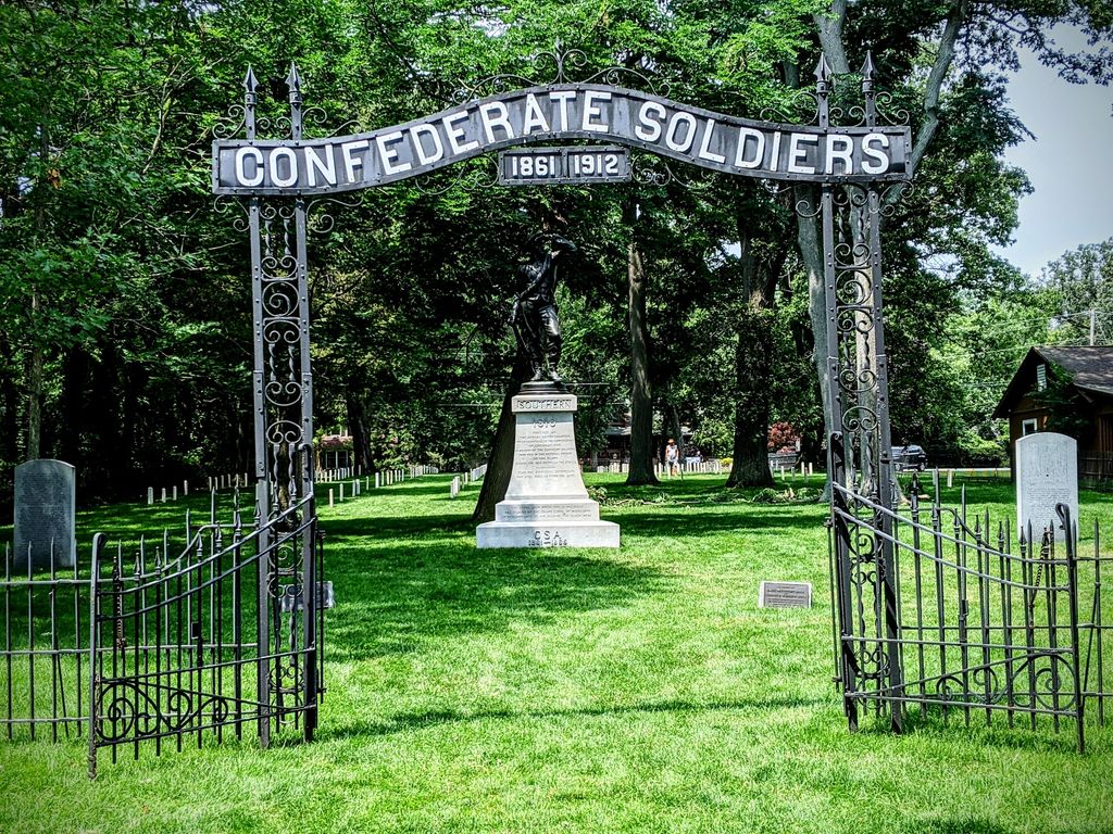
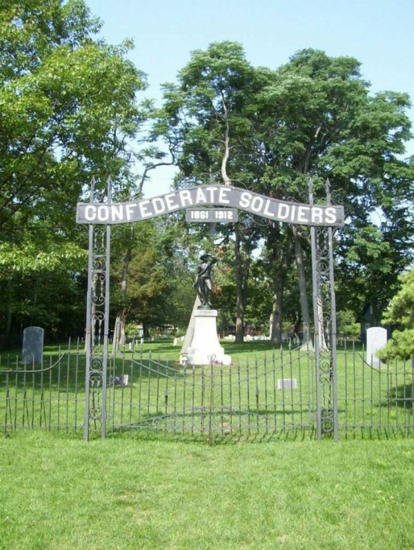
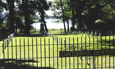
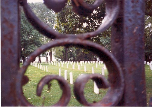
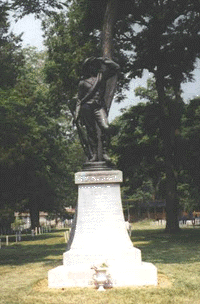
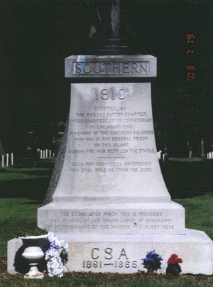
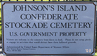
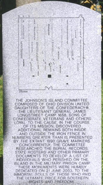
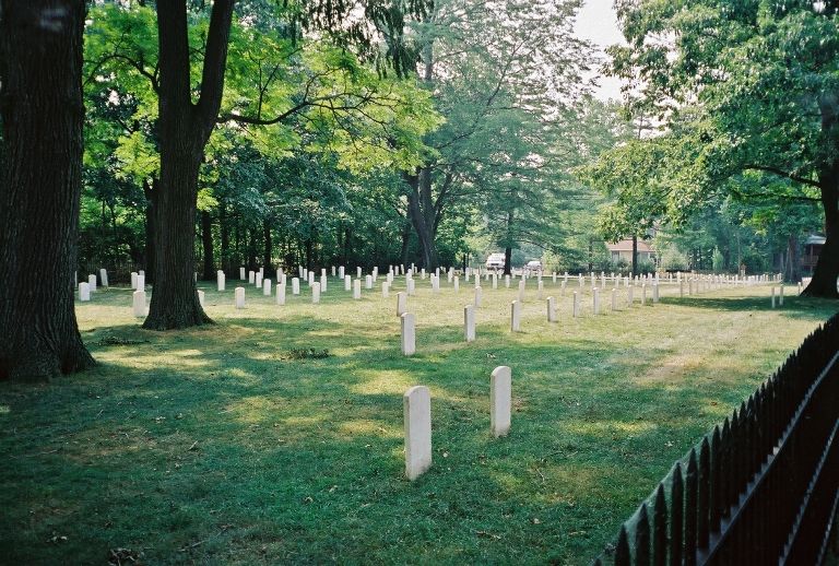
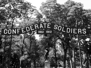
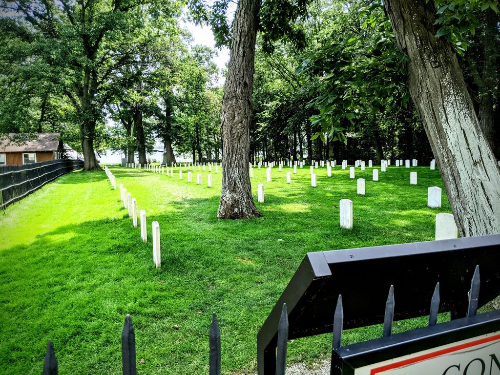
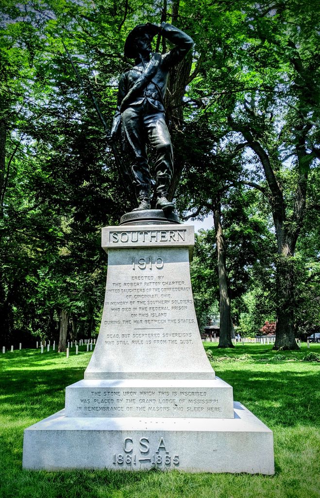
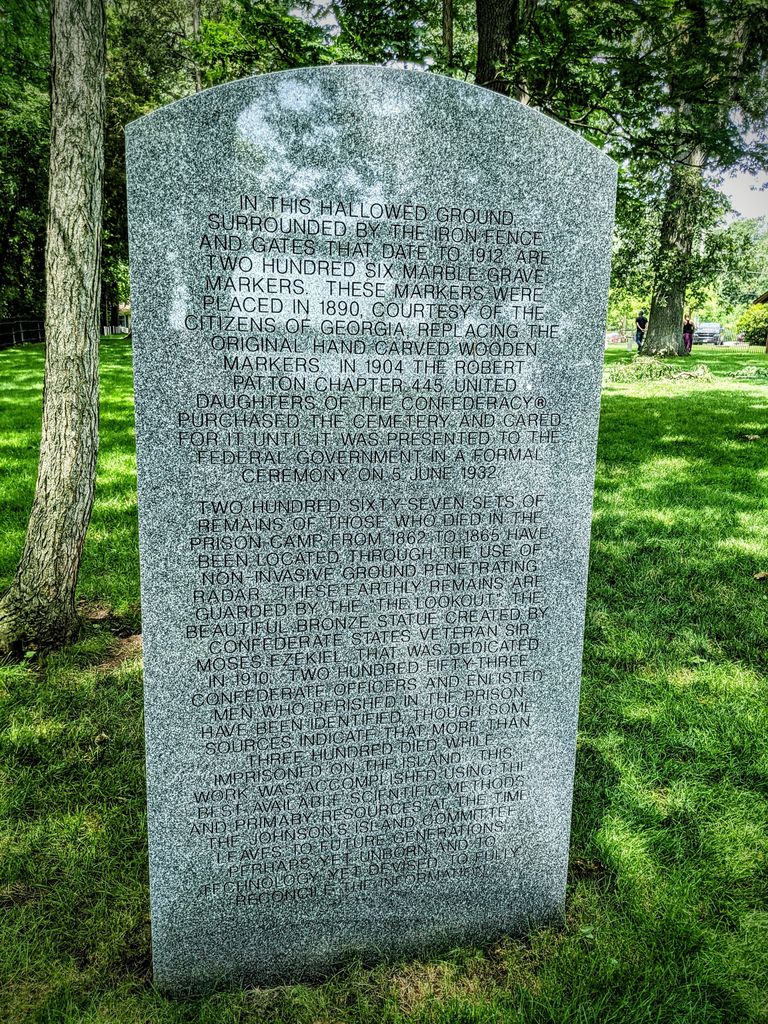
| Description | : | Situated in Ottawa County on little Johnson's Island, Sandusky Bay, Marblehead, Ohio, this cemetery occupies land donated to the United States in 1931 by the United Daughters of the Confederacy. In 1862 through 1865, the 1.2 acre tract was used as a prison burial ground for Confederate commissioned officers. The prison was primarily for the confinement of Confederate officers although a few enlisted men were also interred in the cemetery. There are 153 known and 52 unknown graves, but the cemetery register shows 246 names, of which 20 were citizens and 22 were later removed, Other records state that there... Read More |
frequently asked questions (FAQ):
-
Where is Johnson's Island Confederate Cemetery?
Johnson's Island Confederate Cemetery is located at Johnson Island Causeway Marblehead, Ottawa County ,Ohio , 43440USA.
-
Johnson's Island Confederate Cemetery cemetery's updated grave count on graveviews.com?
0 memorials
-
Where are the coordinates of the Johnson's Island Confederate Cemetery?
Latitude: 41.5003014
Longitude: -82.7300034
Nearby Cemetories:
1. War of 1812 Battle Site
Mineyahta-on-the Bay, Ottawa County, USA
Coordinate: 41.5140350, -82.7438530
2. Wolcott Cemetery
Marblehead, Ottawa County, USA
Coordinate: 41.5177994, -82.7403030
3. Hartshorn Cemetery
Danbury, Ottawa County, USA
Coordinate: 41.5144440, -82.7499530
4. Russian Cemetery
Marblehead, Ottawa County, USA
Coordinate: 41.5335999, -82.7371979
5. Saint Joseph's Catholic Cemetery
Marblehead, Ottawa County, USA
Coordinate: 41.5344009, -82.7382965
6. Holy Assumption Orthodox Cemetery
Marblehead, Ottawa County, USA
Coordinate: 41.5361530, -82.7389380
7. Kelly Cemetery
Danbury, Ottawa County, USA
Coordinate: 41.5245720, -82.7705950
8. Saint Mary's Byzantine Catholic Cemetery
Marblehead, Ottawa County, USA
Coordinate: 41.5409012, -82.7223969
9. Clemons Cemetery
Marblehead, Ottawa County, USA
Coordinate: 41.5409012, -82.7213974
10. Chautauqua Park Memorial Garden
Lakeside, Ottawa County, USA
Coordinate: 41.5412410, -82.7418240
11. First Cemetery (Defunct)
Sandusky, Erie County, USA
Coordinate: 41.4543770, -82.7216040
12. Grace Episcopal Church Columbarium
Sandusky, Erie County, USA
Coordinate: 41.4547630, -82.7093940
13. Cholera Cemetery
Sandusky, Erie County, USA
Coordinate: 41.4496660, -82.7252970
14. Sackett Cemetery
Danbury, Ottawa County, USA
Coordinate: 41.5303001, -82.7872009
15. Saint Marys Cemetery
Sandusky, Erie County, USA
Coordinate: 41.4425011, -82.7285995
16. Saint Joseph's Cemetery
Sandusky, Erie County, USA
Coordinate: 41.4420800, -82.7259500
17. Saint Pauls Lutheran Church Cemetery
Lakeside, Ottawa County, USA
Coordinate: 41.5242200, -82.8049100
18. Calvary Cemetery
Sandusky, Erie County, USA
Coordinate: 41.4383011, -82.7339020
19. Jamison Cemetery
Danbury, Ottawa County, USA
Coordinate: 41.5050060, -82.8180740
20. Venice Cemetery
Margaretta Township, Erie County, USA
Coordinate: 41.4413690, -82.7829920
21. Saint Stephen United Church of Christ Columbarium
Sandusky, Erie County, USA
Coordinate: 41.4331790, -82.6861310
22. Lockwood Cemetery
Lakeside, Ottawa County, USA
Coordinate: 41.5435140, -82.8161560
23. Oakland Cemetery
Sandusky, Erie County, USA
Coordinate: 41.4267807, -82.6873398
24. Oheb Shalom Cemetery
Perkins Township, Erie County, USA
Coordinate: 41.4199800, -82.6902400