
| Memorials | : | 1 |
| Location | : | Washington County, USA |
| Coordinate | : | 36.1731550, -94.0149680 |
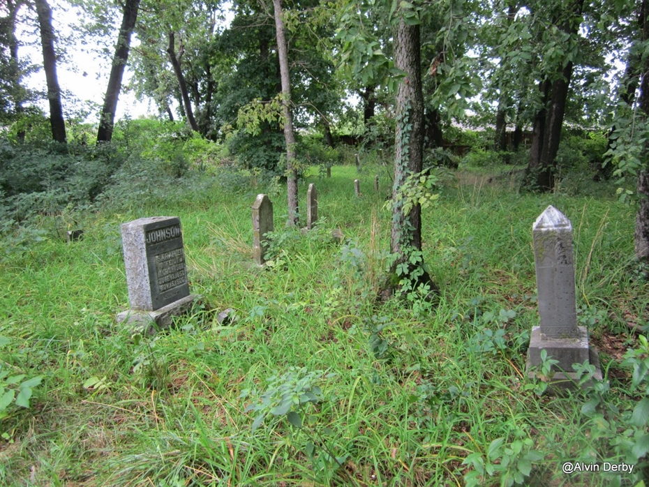
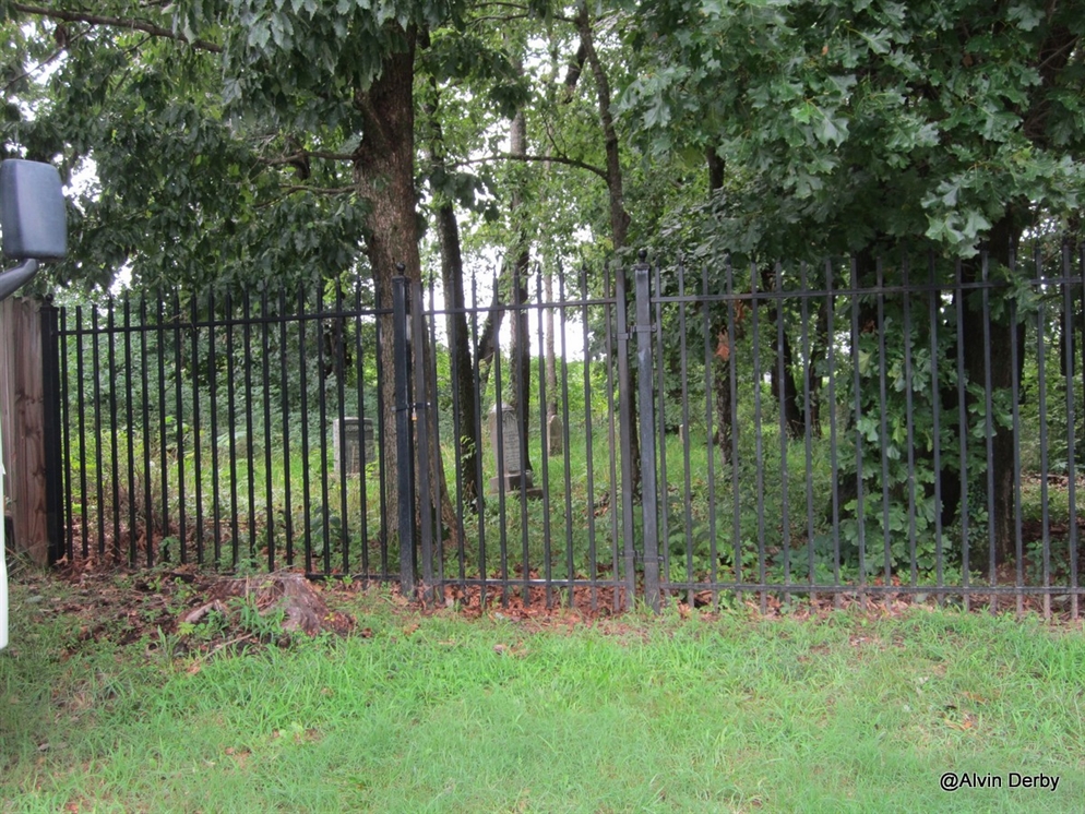
| Description | : | Johnson Cemetery is located in a subdivision named “Blue Springs Village”, which is located just north of Highway 412 near the 412 Bridge that crosses Beaver Lake. The Johnson Cemetery is fenced and has a locked gate. It is surrounded by dozens of newer houses. To reach the Johnson Cemetery, from Springdale go east on Highway 412 about 8 miles which will bring you to the 412 Bridge that crosses Beaver Lake. Continue East for ¼ mile and turn left onto South Street; stay on South Street, then turn right on Hillcrest Drive for about... Read More |
frequently asked questions (FAQ):
-
Where is Johnson Cemetery?
Johnson Cemetery is located at Washington County ,Arkansas ,USA.
-
Johnson Cemetery cemetery's updated grave count on graveviews.com?
1 memorials
-
Where are the coordinates of the Johnson Cemetery?
Latitude: 36.1731550
Longitude: -94.0149680

Nearby Cemetories:
1. Carrel Cemetery
Washington County, USA
Coordinate: 36.1638350, -94.0232190
2. Head Family Cemetery
Washington County, USA
Coordinate: 36.1604800, -94.0120720
3. Cloer-Harp Cemetery
Washington County, USA
Coordinate: 36.1537980, -94.0177970
4. Davis Cemetery
Washington County, USA
Coordinate: 36.1526690, -94.0085080
5. Farrell Family Cemetery
Washington County, USA
Coordinate: 36.1525170, -94.0224950
6. Sonora Cemetery
Sonora, Washington County, USA
Coordinate: 36.1652390, -94.0409630
7. Joyce Cemetery
Spring Valley, Washington County, USA
Coordinate: 36.1638985, -93.9785995
8. Butler Ford Cemetery
Hickory Creek, Benton County, USA
Coordinate: 36.2090200, -94.0220300
9. Cloer Cemetery
Mayfield, Washington County, USA
Coordinate: 36.1368280, -93.9864300
10. Stone Family Cemetery
Fayetteville, Washington County, USA
Coordinate: 36.1381700, -94.0487200
11. Friendship Cemetery
Springdale, Washington County, USA
Coordinate: 36.1681280, -94.0854990
12. Hickory Creek Cemetery
Creech, Benton County, USA
Coordinate: 36.2289009, -94.0338974
13. Mayfield Cemetery
Washington County, USA
Coordinate: 36.1330986, -93.9567032
14. Dibler Cemetery
Pleasure Heights, Benton County, USA
Coordinate: 36.2374992, -94.0072021
15. Spring Valley Cemetery
Spring Valley, Washington County, USA
Coordinate: 36.1741440, -93.9334660
16. Clark Cemetery
Mayfield, Washington County, USA
Coordinate: 36.1365890, -93.9444430
17. Wilson Cemetery
Lowell, Benton County, USA
Coordinate: 36.2108002, -94.0847015
18. Oxford Bend Cemetery
Fayetteville, Washington County, USA
Coordinate: 36.1018982, -94.0294037
19. Habberton Cemetery
Habberton, Washington County, USA
Coordinate: 36.1070830, -94.0512080
20. Goshen Cemetery
Goshen, Washington County, USA
Coordinate: 36.1022970, -93.9904810
21. Zion Cemetery
Springdale, Washington County, USA
Coordinate: 36.1327100, -94.0962230
22. Clark Family Cemetery
Washington County, USA
Coordinate: 36.0902090, -94.0015550
23. Morriss Cemetery
Hindsville, Madison County, USA
Coordinate: 36.1827800, -93.9103900
24. Oakland Cemetery
Fayetteville, Washington County, USA
Coordinate: 36.1232990, -94.1026670