
| Memorials | : | 8 |
| Location | : | Bronx, Bronx County, USA |
| Coordinate | : | 40.8103447, -73.8825531 |
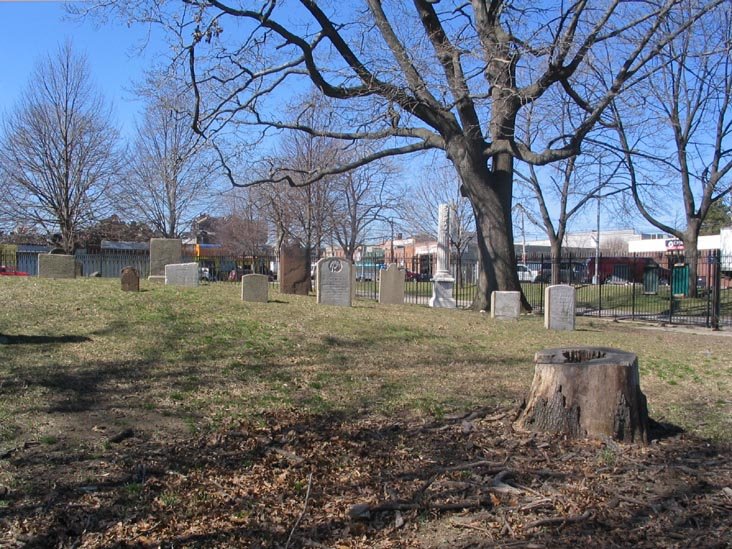
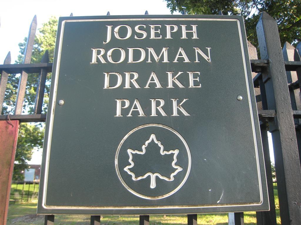
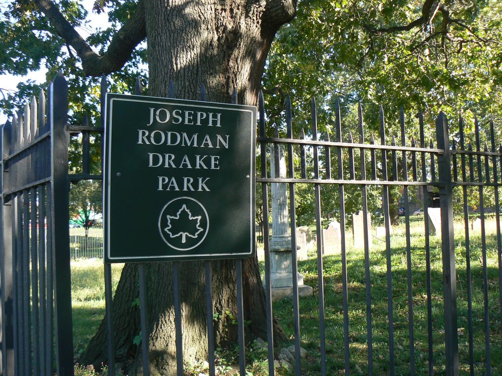
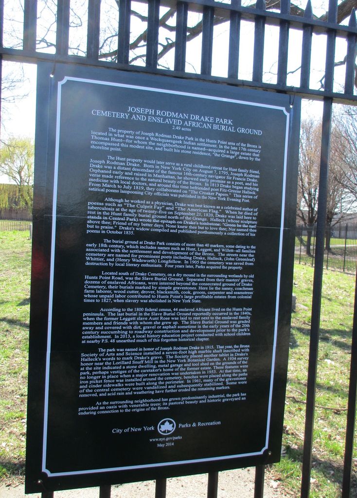
| Description | : | Small cemetery started by the interment of poet Joseph Rodman Drake, who requested that he be buried near the Bronx River. The burial ground of the Hunt mansion consists of about fifty markers including names such as Hunt, Leggett, and Willett—all families associated with the settlement and development of the Bronx. The streets near the cemetery are named for prominent poets including Drake, Halleck, (John Greenleaf) Whittier, and (Henry Wadsworth) Longfellow. In 1905 the cemetery was saved from destruction by local literary enthusiasts. Four years later, Parks acquired the property. The park was named in honor of Joseph Rodman Drake... Read More |
frequently asked questions (FAQ):
-
Where is Joseph Rodman Drake Park?
Joseph Rodman Drake Park is located at Hunts Point and Oak Avenues Bronx, Bronx County ,New York ,USA.
-
Joseph Rodman Drake Park cemetery's updated grave count on graveviews.com?
8 memorials
-
Where are the coordinates of the Joseph Rodman Drake Park?
Latitude: 40.8103447
Longitude: -73.8825531
Nearby Cemetories:
1. Hunts Point Slave Burial Ground
Bronx, Bronx County, USA
Coordinate: 40.8103500, -73.8826760
2. Corpus Christi Monastery
Bronx, Bronx County, USA
Coordinate: 40.8159170, -73.8902750
3. Bensonia Cemetery
Morrisania, Bronx County, USA
Coordinate: 40.8174070, -73.9124690
4. Saint Ann's Episcopal Church Graveyard
Bronx, Bronx County, USA
Coordinate: 40.8081100, -73.9167700
5. New York City Catholic Protectory Cemetery
Parkchester, Bronx County, USA
Coordinate: 40.8383510, -73.8599670
6. West Farms Soldier Cemetery
West Farms, Bronx County, USA
Coordinate: 40.8435826, -73.8793190
7. Old Presbyterian Church Cemetery
West Farms, Bronx County, USA
Coordinate: 40.8439960, -73.8797820
8. Berrien Island Cemetery
Astoria, Queens County, USA
Coordinate: 40.7842070, -73.9120700
9. Randalls Island Burial Ground
Randalls Island, New York County (Manhattan), USA
Coordinate: 40.7912970, -73.9226250
10. Rapelje Cemetery
Queens County, USA
Coordinate: 40.7827820, -73.9146340
11. Bowery Bay Cemetery (Defunct)
Queens, Queens County, USA
Coordinate: 40.7733730, -73.8849560
12. Lawrence Cemetery
Astoria, Queens County, USA
Coordinate: 40.7773800, -73.9056200
13. Riker-Lent Burial Ground
Astoria, Queens County, USA
Coordinate: 40.7734100, -73.8922120
14. Dutch Reformed Church Cemetery of Harlem (Defunct)
Harlem, New York County (Manhattan), USA
Coordinate: 40.8014950, -73.9317320
15. William Lawrence Family Burial Ground
College Point, Queens County, USA
Coordinate: 40.7909680, -73.8388130
16. New York House of Refuge Grounds Cemetery
Manhattan, New York County (Manhattan), USA
Coordinate: 40.7931683, -73.9279023
17. Saint Raymonds Roman Catholic Churchyard
Bronx, Bronx County, USA
Coordinate: 40.8421100, -73.8538400
18. Saint Fidelis Church Cemetery
College Point, Queens County, USA
Coordinate: 40.7848660, -73.8442450
19. Quaker Cemetery
Bronx, Bronx County, USA
Coordinate: 40.8378070, -73.8443860
20. Saint Raymond's Cemetery New
Bronx, Bronx County, USA
Coordinate: 40.8253300, -73.8333930
21. Saint Peters Episcopal Churchyard
Bronx, Bronx County, USA
Coordinate: 40.8388600, -73.8439500
22. Saint Andrews Episcopal Churchyard
Harlem, New York County (Manhattan), USA
Coordinate: 40.8066430, -73.9374220
23. Ferris Family Burying Ground
Bronx, Bronx County, USA
Coordinate: 40.8388300, -73.8422200
24. Methodist Church Cemetery (Defunct)
Westchester Square, Bronx County, USA
Coordinate: 40.8435020, -73.8486860