
| Memorials | : | 0 |
| Location | : | Buitenpost, Achtkarspelen Municipality, Netherlands |
| Phone | : | +31 511 541 436 |
| Coordinate | : | 53.2517066, 6.1449971 |
frequently asked questions (FAQ):
-
Where is Kerkhof Mariakerk?
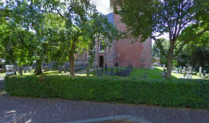
Kerkhof Mariakerk is located at Oude Havenstraat 1 Buitenpost, Achtkarspelen Municipality ,Friesland , 9285 TCNetherlands.
-
Kerkhof Mariakerk cemetery's updated grave count on graveviews.com?
0 memorials
-
Where are the coordinates of the Kerkhof Mariakerk?
Latitude: 53.2517066
Longitude: 6.1449971
Nearby Cemetories:
1. Begraafplaats Jeltingalaan
Buitenpost, Achtkarspelen Municipality, Netherlands
Coordinate: 53.2600555, 6.1359754
2. Begraafplaats Nijenhof
Oudwoude, Kollumerland en Nieuwkruisland Municipality, Netherlands
Coordinate: 53.2760214, 6.1267219
3. Nederlands Hervormde begraafplaats Twizel
Twijzel, Achtkarspelen Municipality, Netherlands
Coordinate: 53.2388004, 6.0948838
4. Begraafplaats Alde Dyk
Kootstertille, Achtkarspelen Municipality, Netherlands
Coordinate: 53.2191071, 6.1040850
5. Kerkhof Nederlands Hervormde Begraafplaats
Kollumerzwaag, Kollumerland en Nieuwkruisland Municipality, Netherlands
Coordinate: 53.2619801, 6.0736539
6. Begraafplaats Tillebuorren
Kootstertille, Achtkarspelen Municipality, Netherlands
Coordinate: 53.2116548, 6.0919066
7. Westergeest Protestant Churchyard
Westergeest, Kollumerland en Nieuwkruisland Municipality, Netherlands
Coordinate: 53.2902000, 6.0856800
8. Begraafplaats Twijzelerheide
Twijzelerheide, Achtkarspelen Municipality, Netherlands
Coordinate: 53.2413444, 6.0525175
9. Begraafplaats Zwaagwesteinde
Zwaagwesteinde, Dantumadeel Municipality, Netherlands
Coordinate: 53.2580833, 6.0351062
10. Kerkhof Nederlands Hervormde kerk De Westereen
Zwaagwesteinde, Dantumadeel Municipality, Netherlands
Coordinate: 53.2583297, 6.0348107
11. Kerkhof Dorpskerk
Engwierum, Dongeradeel Municipality, Netherlands
Coordinate: 53.3203340, 6.1362935
12. Begraafplaats De Westereen
Zwaagwesteinde, Dantumadeel Municipality, Netherlands
Coordinate: 53.2497819, 6.0273741
13. Driesum Protestant Churchyard
Driezum, Dantumadeel Municipality, Netherlands
Coordinate: 53.2977400, 6.0460900
14. Rêsthôf Driezum
Driezum, Dantumadeel Municipality, Netherlands
Coordinate: 53.2948039, 6.0418101
15. It Heechsân Cemetery
Eastermar, Tytsjerksteradiel Municipality, Netherlands
Coordinate: 53.1851321, 6.0703815
16. Doezum Kerkhof
Doezum, Grootegast Municipality, Netherlands
Coordinate: 53.2000600, 6.2485600
17. Opende Protestant Churchyard
Opende, Grootegast Municipality, Netherlands
Coordinate: 53.1736100, 6.2212900
18. Begraafplaats te Veenwouden Cemetery
Feanwâlden, Dantumadeel Municipality, Netherlands
Coordinate: 53.2390761, 5.9921180
19. Damwoude General Cemetery
Damwâld, Dantumadeel Municipality, Netherlands
Coordinate: 53.2857700, 5.9996900
20. Rêsthôf Broeksterwâld
Broeksterwoude, Dantumadeel Municipality, Netherlands
Coordinate: 53.2758766, 5.9907295
21. Feanwâlden Bûtefjild Cemetery
Feanwâlden, Dantumadeel Municipality, Netherlands
Coordinate: 53.2378864, 5.9815750
22. Grijpskerk Cemetery
Grijpskerk, Zuidhorn Municipality, Netherlands
Coordinate: 53.2627500, 6.3115500
23. Bergum Protestant Churchyard
Bergum, Tytsjerksteradiel Municipality, Netherlands
Coordinate: 53.1958500, 6.0016300
24. Sebaldeburen Churchyard
Sebaldeburen, Grootegast Municipality, Netherlands
Coordinate: 53.2204900, 6.3091900