
| Memorials | : | 0 |
| Location | : | Ritter, Grant County, USA |
| Coordinate | : | 44.8434200, -118.9918300 |
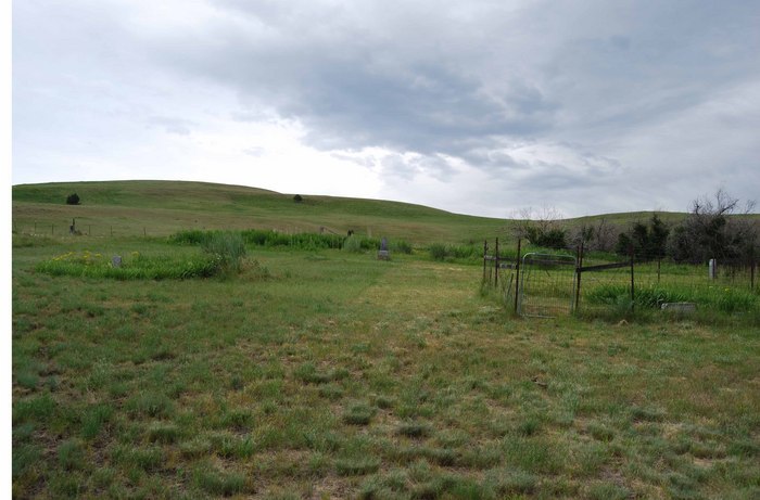
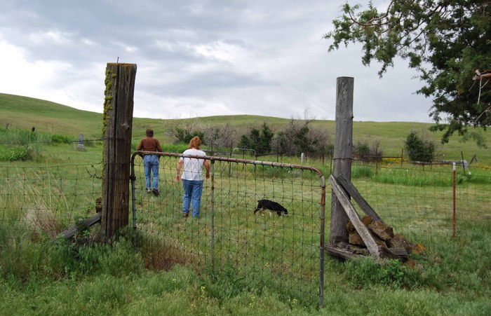
| Description | : | AKA Johnson Cemetery, Granite Creek Cemetery, and Willow Creek Cemetery. Located R31E, Township 8S, Section 28 - east of the Ritter Junction on the Middle Fork of the John Day River to Lick Creek Road turn left about 2-1/2 miles up in the hills on Fred & Jaclyn Burnette's private ranch. No entry without permission. |
frequently asked questions (FAQ):
-
Where is Kilbride Cemetery?
Kilbride Cemetery is located at Pendleton-John Day Highway (County Road 28) Ritter, Grant County ,Oregon , 97865USA.
-
Kilbride Cemetery cemetery's updated grave count on graveviews.com?
0 memorials
-
Where are the coordinates of the Kilbride Cemetery?
Latitude: 44.8434200
Longitude: -118.9918300
Nearby Cemetories:
1. Walton Ranch Cemetery
Grant County, USA
Coordinate: 44.8675499, -119.0265656
2. Dickerson Ranch Cemetery
Ritter, Grant County, USA
Coordinate: 44.8875008, -119.1402969
3. Ritter Cemetery
Ritter, Grant County, USA
Coordinate: 44.9117012, -119.1481018
4. Long Creek Cemetery
Long Creek, Grant County, USA
Coordinate: 44.7172012, -119.0777969
5. Johnson Children Burials
Long Creek, Grant County, USA
Coordinate: 44.7131690, -119.1066030
6. Galena Cemetery
Grant County, USA
Coordinate: 44.7083015, -118.8056030
7. Fox Valley Cemetery
Grant County, USA
Coordinate: 44.6375008, -119.1513977
8. Hamilton Cemetery
Hamilton, Grant County, USA
Coordinate: 44.7435989, -119.3167038
9. Ukiah Cemetery
Ukiah, Umatilla County, USA
Coordinate: 45.1418991, -118.9306030
10. Cottonwood Cemetery
Monument, Grant County, USA
Coordinate: 44.8127747, -119.4158936
11. Monument Cemetery
Monument, Grant County, USA
Coordinate: 44.8208008, -119.4235992
12. Sturdivant Cemetery
Ukiah, Umatilla County, USA
Coordinate: 45.1685000, -118.9669500
13. Cupper Canyon Cemetery
Monument, Grant County, USA
Coordinate: 44.8374300, -119.5015100
14. Albee Cemetery
Albee, Umatilla County, USA
Coordinate: 45.2102000, -118.9346000
15. Greenhorn Cemetery
Baker County, USA
Coordinate: 44.7071991, -118.4935989
16. Granite Cemetery
Granite, Grant County, USA
Coordinate: 44.8108530, -118.4188440
17. Rest Lawn Cemetery
John Day, Grant County, USA
Coordinate: 44.4249992, -118.9617004
18. McHaley Cemetery
Prairie City, Grant County, USA
Coordinate: 44.4618988, -118.7169037
19. Alexander Patterson Gravesite
Umatilla County, USA
Coordinate: 45.2694016, -119.1027985
20. Gurdane Cemetery
Umatilla County, USA
Coordinate: 45.2689018, -119.1136017
21. Hester A Lemons Grave
Mount Vernon, Grant County, USA
Coordinate: 44.4228060, -119.1501540
22. Prairie City Cemetery
Prairie City, Grant County, USA
Coordinate: 44.4566994, -118.7027969
23. Ingle Cemetery
Mount Vernon, Grant County, USA
Coordinate: 44.4091988, -119.0947037
24. Cabell Cemetery
Cabell City, Grant County, USA
Coordinate: 44.8965720, -118.3695880