
| Memorials | : | 0 |
| Location | : | Warren, Marion County, USA |
| Coordinate | : | 39.7498110, -91.7764030 |
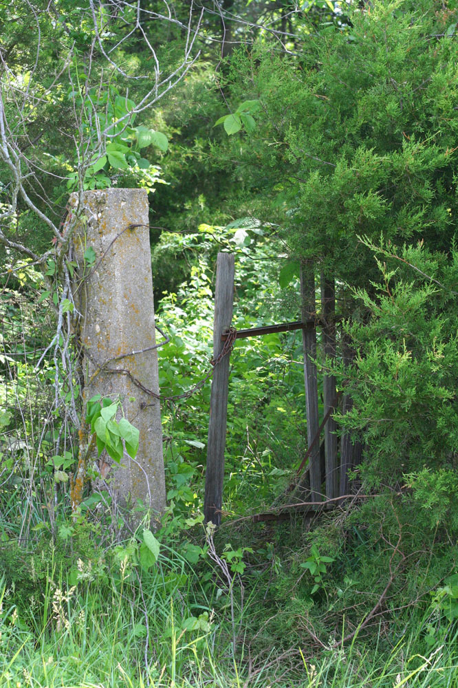
| Description | : | Kincaid Cemetery is on private land on the ridge east of Pee Dee Creek, and permission of the landowner is needed before visiting. Specific direction on the current best route across his land should be requested at the same time. The cemetery is somewhat overgrown (including Toxicodendron and Smilax species) but is surrounded by a substantial fence and appears to have been well tended at times in the past. Most of the markers are remarkably unweathered for their age, likely due in part to the protection of the thick tree canopy. |
frequently asked questions (FAQ):
-
Where is Kincaid Cemetery?
Kincaid Cemetery is located at Warren, Marion County ,Missouri ,USA.
-
Kincaid Cemetery cemetery's updated grave count on graveviews.com?
0 memorials
-
Where are the coordinates of the Kincaid Cemetery?
Latitude: 39.7498110
Longitude: -91.7764030
Nearby Cemetories:
1. Andrew Chapel Cemetery
Warren, Marion County, USA
Coordinate: 39.7747002, -91.7913971
2. Cissna Farm Cemetery
Marion County, USA
Coordinate: 39.7745400, -91.7926600
3. Warren Cemetery
Warren, Marion County, USA
Coordinate: 39.7712200, -91.7517200
4. Calvert Cemetery
Marion County, USA
Coordinate: 39.7806015, -91.7902985
5. Howe Cemetery
Marion County, USA
Coordinate: 39.7155991, -91.7630997
6. Cobb Cemetery
Marion County, USA
Coordinate: 39.7393990, -91.7292023
7. Young Burial Ground
Sharpsburg, Marion County, USA
Coordinate: 39.6997200, -91.7611100
8. Shaw Family Gravesite
Sharpsburg, Marion County, USA
Coordinate: 39.6874900, -91.7736050
9. Sharpsburg Cemetery
Marion County, USA
Coordinate: 39.6822160, -91.7678850
10. Union Chapel Cemetery
Hunnewell, Shelby County, USA
Coordinate: 39.7162323, -91.8602524
11. Ballinger Cemetery
Philadelphia, Marion County, USA
Coordinate: 39.8168010, -91.7228860
12. Pea Ridge Cemetery
Marion County, USA
Coordinate: 39.7953211, -91.6929383
13. Mount Vernon United Methodist Church Cemetery
Sees Branch Settlement, Marion County, USA
Coordinate: 39.7297800, -91.6767200
14. Emden Memorial Gardens
Emden, Shelby County, USA
Coordinate: 39.7983600, -91.8632300
15. Terrill Cemetery
Philadelphia, Marion County, USA
Coordinate: 39.8161011, -91.7099991
16. Prairie View Baptist Cemetery
Hunnewell, Shelby County, USA
Coordinate: 39.7353400, -91.8836300
17. Coleman Cemetery
Marion County, USA
Coordinate: 39.8306007, -91.7367020
18. Ebenezer Cemetery
Marion County, USA
Coordinate: 39.8311005, -91.8150024
19. Philadelphia Cemetery
Philadelphia, Marion County, USA
Coordinate: 39.8407900, -91.7428000
20. Browne Cemetery
Hunnewell, Shelby County, USA
Coordinate: 39.6737500, -91.8509600
21. IOOF Cemetery
Hunnewell, Shelby County, USA
Coordinate: 39.6736800, -91.8523800
22. Saint Jude Cemetery
Monroe City, Monroe County, USA
Coordinate: 39.6528015, -91.7450027
23. Holy Rosary Cemetery
Monroe City, Monroe County, USA
Coordinate: 39.6528000, -91.7450000
24. Crane Cemetery
Palmyra, Marion County, USA
Coordinate: 39.7694016, -91.6406021