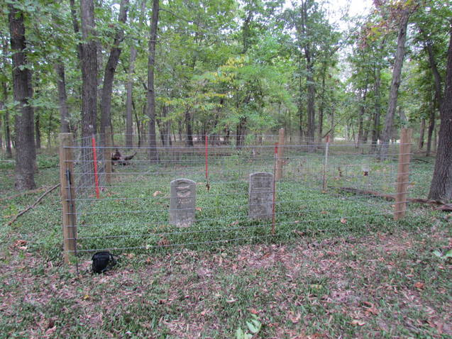
| Memorials | : | 0 |
| Location | : | Sharpsburg, Marion County, USA |
| Coordinate | : | 39.6874900, -91.7736050 |
| Description | : | In Monroe City, MO. at the junction of 36 and 24, go north on road 225, about 1 1/2 miles, turn West (left) on 225 and go about 2 1/2 miles, turn right into the lane to the farm house. These 2 graves are about a half mile to the NE of the house. The original old farm house has been gone for many years but the graves are there. Henry P and Mary Shaw bought 240 acres in 1871 for $1100. The land was divided up between his kids at his death, his grandson in law T.E."Tel" Lear sold 80... Read More |
frequently asked questions (FAQ):
-
Where is Shaw Family Gravesite?
Shaw Family Gravesite is located at Sharpsburg, Marion County ,Missouri ,USA.
-
Shaw Family Gravesite cemetery's updated grave count on graveviews.com?
0 memorials
-
Where are the coordinates of the Shaw Family Gravesite?
Latitude: 39.6874900
Longitude: -91.7736050
Nearby Cemetories:
1. Sharpsburg Cemetery
Marion County, USA
Coordinate: 39.6822160, -91.7678850
2. Young Burial Ground
Sharpsburg, Marion County, USA
Coordinate: 39.6997200, -91.7611100
3. Howe Cemetery
Marion County, USA
Coordinate: 39.7155991, -91.7630997
4. Saint Jude Cemetery
Monroe City, Monroe County, USA
Coordinate: 39.6528015, -91.7450027
5. Holy Rosary Cemetery
Monroe City, Monroe County, USA
Coordinate: 39.6528000, -91.7450000
6. Browne Cemetery
Hunnewell, Shelby County, USA
Coordinate: 39.6737500, -91.8509600
7. Cobb Cemetery
Marion County, USA
Coordinate: 39.7393990, -91.7292023
8. IOOF Cemetery
Hunnewell, Shelby County, USA
Coordinate: 39.6736800, -91.8523800
9. Kincaid Cemetery
Warren, Marion County, USA
Coordinate: 39.7498110, -91.7764030
10. Union Chapel Cemetery
Hunnewell, Shelby County, USA
Coordinate: 39.7162323, -91.8602524
11. Godfrey Cemetery
Hunnewell, Shelby County, USA
Coordinate: 39.6699982, -91.8788986
12. Saint Johns Cemetery
Hunnewell, Shelby County, USA
Coordinate: 39.6617012, -91.8778000
13. Warren Cemetery
Warren, Marion County, USA
Coordinate: 39.7712200, -91.7517200
14. Mount Vernon United Methodist Church Cemetery
Sees Branch Settlement, Marion County, USA
Coordinate: 39.7297800, -91.6767200
15. Cissna Farm Cemetery
Marion County, USA
Coordinate: 39.7745400, -91.7926600
16. Andrew Chapel Cemetery
Warren, Marion County, USA
Coordinate: 39.7747002, -91.7913971
17. Calvert Cemetery
Marion County, USA
Coordinate: 39.7806015, -91.7902985
18. Jeter Cemetery
Monroe County, USA
Coordinate: 39.6175003, -91.8563995
19. Saint Stephens Catholic Cemetery
Indian Creek, Monroe County, USA
Coordinate: 39.5925800, -91.7762400
20. Prairie View Baptist Cemetery
Hunnewell, Shelby County, USA
Coordinate: 39.7353400, -91.8836300
21. DeMoss Chapel Cemetery
Hassard, Ralls County, USA
Coordinate: 39.6044846, -91.6873856
22. Bethlehem Cemetery
Ralls County, USA
Coordinate: 39.6069400, -91.6733300
23. Kendall Mount Olive Cemetery
Shelby County, USA
Coordinate: 39.7167900, -91.9150900
24. Shannon Cemetery
Woodland, Marion County, USA
Coordinate: 39.7375500, -91.6301000

