
| Memorials | : | 51 |
| Location | : | Monroe City, Monroe County, USA |
| Coordinate | : | 39.6528000, -91.7450000 |
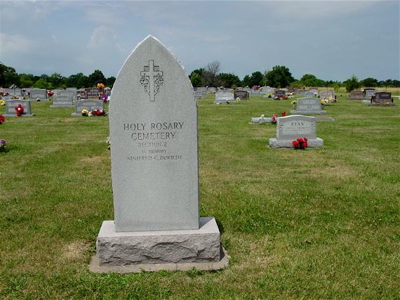
| Description | : | Holy Rosary is a Catholic Cemetery located in Monroe City adjacent to on two sides, but independent from, the Saint Jude Cemetery which is maintained by the city. Holy Rosary is entirely on the West side of West Border Street, Saint Jude is on the east side except for two sections of new addition that are adjacent to Holy Rosary on the south side, making the two cemeteries easily confused. |
frequently asked questions (FAQ):
-
Where is Holy Rosary Cemetery?
Holy Rosary Cemetery is located at Monroe City, Monroe County ,Missouri ,USA.
-
Holy Rosary Cemetery cemetery's updated grave count on graveviews.com?
49 memorials
-
Where are the coordinates of the Holy Rosary Cemetery?
Latitude: 39.6528000
Longitude: -91.7450000
Nearby Cemetories:
1. Saint Jude Cemetery
Monroe City, Monroe County, USA
Coordinate: 39.6528015, -91.7450027
2. Sharpsburg Cemetery
Marion County, USA
Coordinate: 39.6822160, -91.7678850
3. Shaw Family Gravesite
Sharpsburg, Marion County, USA
Coordinate: 39.6874900, -91.7736050
4. Young Burial Ground
Sharpsburg, Marion County, USA
Coordinate: 39.6997200, -91.7611100
5. Howe Cemetery
Marion County, USA
Coordinate: 39.7155991, -91.7630997
6. Saint Stephens Catholic Cemetery
Indian Creek, Monroe County, USA
Coordinate: 39.5925800, -91.7762400
7. DeMoss Chapel Cemetery
Hassard, Ralls County, USA
Coordinate: 39.6044846, -91.6873856
8. Bethlehem Cemetery
Ralls County, USA
Coordinate: 39.6069400, -91.6733300
9. Browne Cemetery
Hunnewell, Shelby County, USA
Coordinate: 39.6737500, -91.8509600
10. IOOF Cemetery
Hunnewell, Shelby County, USA
Coordinate: 39.6736800, -91.8523800
11. Cobb Cemetery
Marion County, USA
Coordinate: 39.7393990, -91.7292023
12. Jeter Cemetery
Monroe County, USA
Coordinate: 39.6175003, -91.8563995
13. Mount Vernon United Methodist Church Cemetery
Sees Branch Settlement, Marion County, USA
Coordinate: 39.7297800, -91.6767200
14. Kincaid Cemetery
Warren, Marion County, USA
Coordinate: 39.7498110, -91.7764030
15. Saint Johns Cemetery
Hunnewell, Shelby County, USA
Coordinate: 39.6617012, -91.8778000
16. Godfrey Cemetery
Hunnewell, Shelby County, USA
Coordinate: 39.6699982, -91.8788986
17. New Oakland Cemetery
The Landing, Ralls County, USA
Coordinate: 39.5660200, -91.6651200
18. Yager Cemetery
The Landing, Ralls County, USA
Coordinate: 39.5600640, -91.6719080
19. Union Chapel Cemetery
Hunnewell, Shelby County, USA
Coordinate: 39.7162323, -91.8602524
20. Brush Creek Cemetery
Ralls County, USA
Coordinate: 39.6197650, -91.6040461
21. Warren Cemetery
Warren, Marion County, USA
Coordinate: 39.7712200, -91.7517200
22. Greathouse Cemetery
Ralls County, USA
Coordinate: 39.6142006, -91.5991974
23. Shannon Cemetery
Woodland, Marion County, USA
Coordinate: 39.7375500, -91.6301000
24. Deer Creek Cemetery
Monroe County, USA
Coordinate: 39.6136017, -91.8985977