
| Memorials | : | 16 |
| Location | : | Longmarsh Acres, Clarke County, USA |
| Coordinate | : | 39.1729300, -78.0180500 |
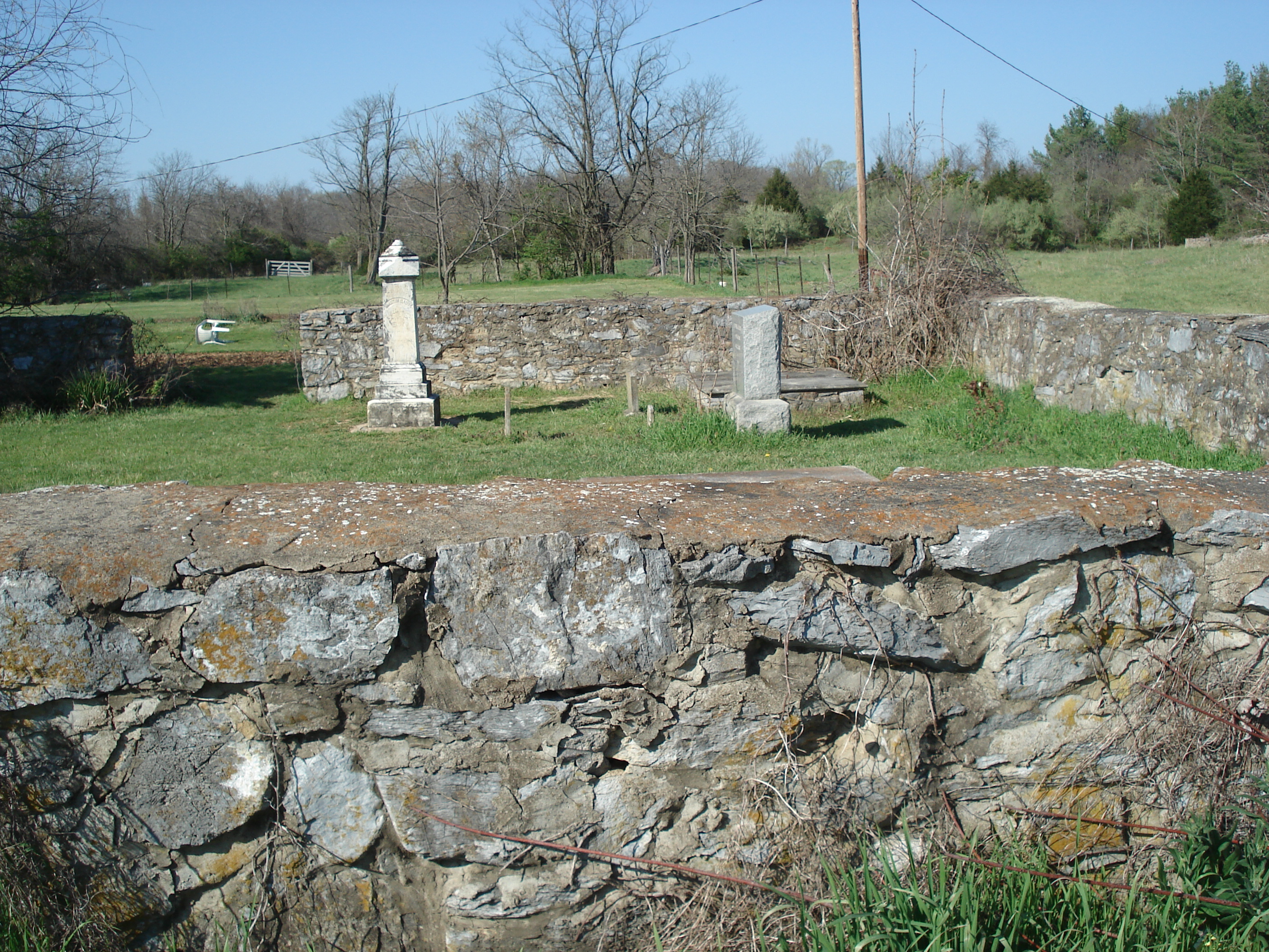
| Description | : | The Kitchen-Gaunt Family Cemetery is located on Route 7 about 200 yards from the intersection with Crums Church Road. It is surrounded by a stone wall about 4 feet high. It looks well taken care of. |
frequently asked questions (FAQ):
-
Where is Kitchen-Gaunt Family Cemetery?
Kitchen-Gaunt Family Cemetery is located at Harry Byrd Highway (Rt. 7) Longmarsh Acres, Clarke County ,Virginia , 22611USA.
-
Kitchen-Gaunt Family Cemetery cemetery's updated grave count on graveviews.com?
16 memorials
-
Where are the coordinates of the Kitchen-Gaunt Family Cemetery?
Latitude: 39.1729300
Longitude: -78.0180500
Nearby Cemetories:
1. Russell Family Cemetery Rock Hall
Berryville, Clarke County, USA
Coordinate: 39.1748210, -78.0211690
2. Thomas Blakemore Family Farm Cemetery
Berryville, Clarke County, USA
Coordinate: 39.1724620, -77.9900770
3. Berryville Baptist Church Cemetery
Berryville, Clarke County, USA
Coordinate: 39.1534060, -77.9826350
4. AME Church Cemetery
Berryville, Clarke County, USA
Coordinate: 39.1541940, -77.9803560
5. Green Hill Cemetery
Berryville, Clarke County, USA
Coordinate: 39.1581001, -77.9768982
6. Grace Episcopal Church Cemetery
Berryville, Clarke County, USA
Coordinate: 39.1524390, -77.9800680
7. Crums Cemetery
Berryville, Clarke County, USA
Coordinate: 39.2092018, -78.0018997
8. Duncan Memorial United Methodist Church Cemetery
Berryville, Clarke County, USA
Coordinate: 39.1492140, -77.9774040
9. Milton Valley Cemetery
Berryville, Clarke County, USA
Coordinate: 39.1399994, -77.9792023
10. Burnt Factory United Methodist Church Cemetery
Burnt Factory, Frederick County, USA
Coordinate: 39.1949005, -78.0755005
11. Stones Chapel Cemetery
Clarke County, USA
Coordinate: 39.2261009, -78.0105972
12. Redbud Cemetery
Burnt Factory, Frederick County, USA
Coordinate: 39.1918983, -78.0916977
13. Salem Regular Baptist Church Cemetery
Boyce, Clarke County, USA
Coordinate: 39.1300011, -78.0828018
14. Old Chapel Cemetery
Millwood, Clarke County, USA
Coordinate: 39.1067009, -78.0147018
15. Jamestown Cemetery
Summit Point, Jefferson County, USA
Coordinate: 39.2346800, -77.9842300
16. Redbud United Methodist Church Cemetery
Frederick County, USA
Coordinate: 39.1925000, -78.1019400
17. Briggs Family-Air Hill
Berryville, Clarke County, USA
Coordinate: 39.1040444, -78.0032310
18. Prosperity Baptist Church Cemetery
Summit Point, Jefferson County, USA
Coordinate: 39.2387730, -77.9843590
19. Burns Family Cemetery
Franklintown, Jefferson County, USA
Coordinate: 39.2077485, -77.9308778
20. Locust Grove Cemetery
Franklintown, Jefferson County, USA
Coordinate: 39.2080990, -77.9307680
21. Jabbers Hill Cemetery
Clear Brook, Frederick County, USA
Coordinate: 39.2472000, -78.0505981
22. Bullskin Presbyterian Churchyard
Summit Point, Jefferson County, USA
Coordinate: 39.2372940, -77.9578650
23. Greenwood United Methodist Church Cemetery
Greenwood Heights, Frederick County, USA
Coordinate: 39.1719017, -78.1222000
24. Little Chapel Cemetery
Clarke County, USA
Coordinate: 39.0922012, -78.0239029