
| Memorials | : | 0 |
| Location | : | Lutterworth, Harborough District, England |
| Coordinate | : | 52.4994752, -1.0704864 |
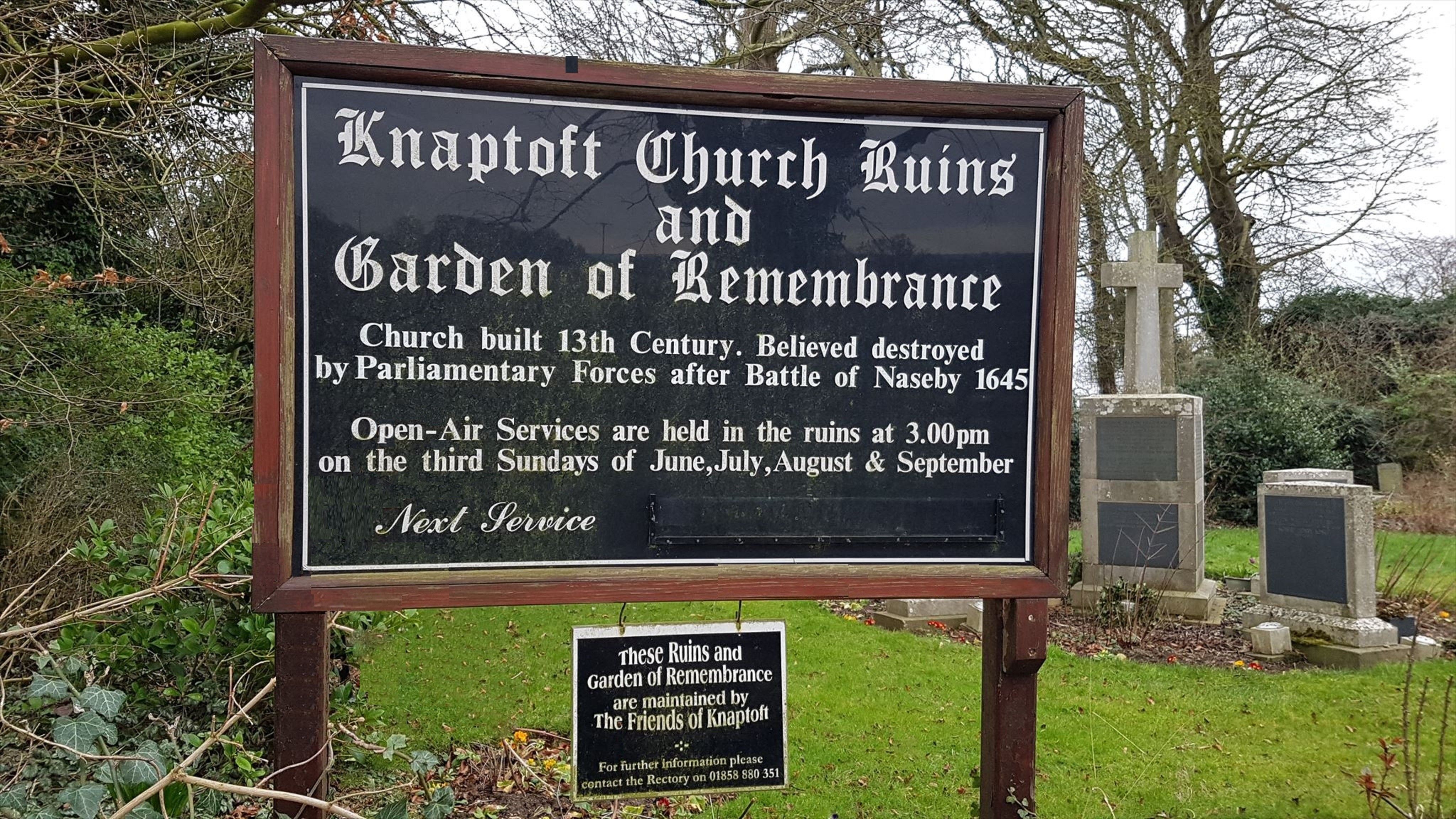
| Description | : | The Church of Saint Nicholas is now roofless but still contains headstones and the stone font. It is thought to have been sacked and destroyed by Oliver Cromwell's Roundhead forces after the Battle of Naseby in June 1645 whilst in pursuit of the fleeing defeated Royalist army. Certainly a skirmish occurred here, confirmed by archaeological finds. The church is said to be haunted. Church services are still held at the church at 3pm on the third Sunday of June, July, August and September. |
frequently asked questions (FAQ):
-
Where is Knaptoft Churchyard?
Knaptoft Churchyard is located at Knaptoft Lutterworth, Harborough District ,Leicestershire , LE17 6PAEngland.
-
Knaptoft Churchyard cemetery's updated grave count on graveviews.com?
0 memorials
-
Where are the coordinates of the Knaptoft Churchyard?
Latitude: 52.4994752
Longitude: -1.0704864

Nearby Cemetories:
1. St. Nicholas Churchyard
Knaptoft, Harborough District, England
Coordinate: 52.5007110, -1.0772070
2. Mowsley Wesleyan Baptise Chapel
Mowsley, Harborough District, England
Coordinate: 52.4932618, -1.0503955
3. St Nicholas' Churchyard
Mowsley, Harborough District, England
Coordinate: 52.4956930, -1.0484420
4. St. Mary Magdalene
Shearsby, Harborough District, England
Coordinate: 52.5131685, -1.0831940
5. St. Mary Magdalene Churchyard
Shearsby, Harborough District, England
Coordinate: 52.5131629, -1.0832646
6. St Luke
Laughton, Harborough District, England
Coordinate: 52.4963490, -1.0306710
7. St. Mary's Churchyard
Bruntingthorpe, Harborough District, England
Coordinate: 52.5029600, -1.1148100
8. St Peter Churchyard
Arnesby, Harborough District, England
Coordinate: 52.5240840, -1.0918950
9. Baptist Chapel Churchyard
Arnesby, Harborough District, England
Coordinate: 52.5264000, -1.0909600
10. St. Helens Churchyard
Saddington, Harborough District, England
Coordinate: 52.5200100, -1.0313500
11. Saddington Cemetery
Saddington, Harborough District, England
Coordinate: 52.5229700, -1.0263200
12. St Nicholas Churchyard
Fleckney, Harborough District, England
Coordinate: 52.5349410, -1.0470240
13. All Saints Churchyard
Peatling Magna, Harborough District, England
Coordinate: 52.5267900, -1.1247040
14. St Helen Churchyard
Gumley, Harborough District, England
Coordinate: 52.5053970, -0.9997570
15. All Saints Churchyard
Theddingworth, Harborough District, England
Coordinate: 52.4655020, -1.0185520
16. All Saints Churchyard
Husbands Bosworth, Harborough District, England
Coordinate: 52.4536880, -1.0529010
17. All Saints Churchyard
Kimcote, Harborough District, England
Coordinate: 52.4736330, -1.1390390
18. Christ Churchyard
Smeeton Westerby, Harborough District, England
Coordinate: 52.5279300, -1.0027100
19. Husbands Bosworth Cemetery
Husbands Bosworth, Harborough District, England
Coordinate: 52.4481064, -1.0583018
20. Methodist Chapel Cemetery
Smeeton Westerby, Harborough District, England
Coordinate: 52.5292830, -0.9982648
21. St. Bartholomew's Churchyard
Foston, Blaby District, England
Coordinate: 52.5494850, -1.1116260
22. St Bartholomew in Foston
Kilby, Blaby District, England
Coordinate: 52.5494780, -1.1117810
23. All Saints Churchyard
Gilmorton, Harborough District, England
Coordinate: 52.4855900, -1.1604900
24. St Mary Magdalene
Kilby, Blaby District, England
Coordinate: 52.5554660, -1.0884320