
| Memorials | : | 1 |
| Location | : | Otway, Scioto County, USA |
| Coordinate | : | 38.8203000, -83.2272000 |
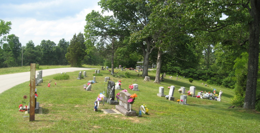
| Description | : | The cemetery is located on the east side of Tick Ridge Koenig Hill Road (County Road 42) about 1.2 miles south of its intersection with Rocky Fork Road (County Road 40). The cemetery is maintained by Brush Creek Township. The cemetery is located in Brush Creek Township, Scioto County, Ohio, and is # 10783 (Kenny Cemetery / Kinney Cemetery / Koenig Cemetery) in "Ohio Cemeteries 1803-2003", compiled by the Ohio Genealogical Society. The cemetery is registered with the Ohio Division of Real Estate and Professional Licensing (ODRE) as Koenig Cemetery with registration license number CGR.0000982554. The U.S. Geological Survey (USGS) Geographic Names Information... Read More |
frequently asked questions (FAQ):
-
Where is Koenig Cemetery?
Koenig Cemetery is located at Tick Ridge Koenig Hill Road (County Road 42) Otway, Scioto County ,Ohio , 45657USA.
-
Koenig Cemetery cemetery's updated grave count on graveviews.com?
0 memorials
-
Where are the coordinates of the Koenig Cemetery?
Latitude: 38.8203000
Longitude: -83.2272000
Nearby Cemetories:
1. Oswego Cemetery
Brush Creek Township, Scioto County, USA
Coordinate: 38.8178460, -83.2105320
2. Oppy Cemetery
Brush Creek Township, Scioto County, USA
Coordinate: 38.7989006, -83.2266998
3. Parker Cemetery
Otway, Scioto County, USA
Coordinate: 38.7949982, -83.1999969
4. Moon Cemetery
Brush Creek Township, Scioto County, USA
Coordinate: 38.7943993, -83.1992035
5. Branham Cemetery
Union Township, Scioto County, USA
Coordinate: 38.7952995, -83.1928024
6. Smith Cemetery
Otway, Scioto County, USA
Coordinate: 38.8525009, -83.2027969
7. Beech Fork Cemetery
Brush Creek Township, Scioto County, USA
Coordinate: 38.8567009, -83.2457962
8. Wamsleyville Methodist Episcopal Church Cemetery
Wamsley, Adams County, USA
Coordinate: 38.8369600, -83.2802600
9. Garvin Cemetery
Otway, Scioto County, USA
Coordinate: 38.8505770, -83.1825970
10. Jewett Cemetery
Union Township, Scioto County, USA
Coordinate: 38.8189011, -83.1572037
11. Otway Cemetery
Otway, Scioto County, USA
Coordinate: 38.8686800, -83.1912900
12. Mount Unger Cemetery
Blue Creek, Adams County, USA
Coordinate: 38.7856200, -83.2848000
13. Berea Chapel Cemetery
Brush Creek Township, Scioto County, USA
Coordinate: 38.7689000, -83.2613300
14. Setty-Ode Cemetery
Blue Creek, Adams County, USA
Coordinate: 38.7857700, -83.2871100
15. Thornton Cemetery
Union Township, Scioto County, USA
Coordinate: 38.8381004, -83.1508026
16. Garvin Cemetery
Union Township, Scioto County, USA
Coordinate: 38.8286018, -83.1442032
17. New Hoffer Hill Church Cemetery
Rarden, Scioto County, USA
Coordinate: 38.8864920, -83.2419590
18. Old Hoffer Hill Cemetery
Rarden Township, Scioto County, USA
Coordinate: 38.8903500, -83.2363700
19. Early Cemetery
Brush Creek Township, Scioto County, USA
Coordinate: 38.8899994, -83.2033005
20. Euton Cemetery
Union Township, Scioto County, USA
Coordinate: 38.8403015, -83.1378021
21. Wintersteen Cemetery
Blue Creek, Adams County, USA
Coordinate: 38.7612100, -83.2827500
22. Moores Chapel Cemetery
Jefferson, Adams County, USA
Coordinate: 38.7850000, -83.3140000
23. Holt Cemetery
Portsmouth, Scioto County, USA
Coordinate: 38.7452700, -83.2010080
24. Dry Run Cemetery
Youngs, Scioto County, USA
Coordinate: 38.8971540, -83.2042050