
| Memorials | : | 3 |
| Location | : | Brush Creek Township, Scioto County, USA |
| Coordinate | : | 38.7689000, -83.2613300 |
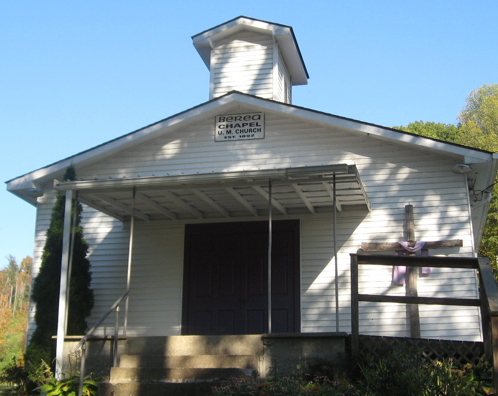
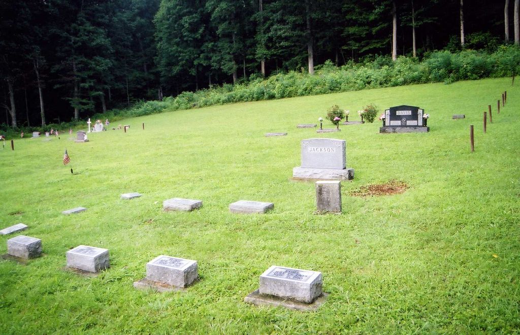
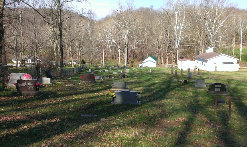
| Description | : | Lower Rocky Fork The cemetery is located on the east side of Rocky Fork Road (County Road 40) about 1.0 miles north of its intersection with Ohio State Route 125. The cemetery is located in Brush Creek Township, Scioto County, Ohio, and is # 10779 (Berea Cemetery / Berea Chapel United Methodist Cemetery) in “Ohio Cemeteries 1803-2003”, compiled by the Ohio Genealogical Society. The cemetery is registered with the Ohio Division of Real Estate and Professional Licensing (ODRE) as Berea Chapel Cemetery with registration license number CBR.0000981258. The U.S. Geological Survey (USGS) Geographic Names Information System (GNIS)... Read More |
frequently asked questions (FAQ):
-
Where is Berea Chapel Cemetery?
Berea Chapel Cemetery is located at Rocky Fork Road (County Road 40) Brush Creek Township, Scioto County ,Ohio , 45657USA.
-
Berea Chapel Cemetery cemetery's updated grave count on graveviews.com?
3 memorials
-
Where are the coordinates of the Berea Chapel Cemetery?
Latitude: 38.7689000
Longitude: -83.2613300
Nearby Cemetories:
1. Wintersteen Cemetery
Blue Creek, Adams County, USA
Coordinate: 38.7612100, -83.2827500
2. Mount Unger Cemetery
Blue Creek, Adams County, USA
Coordinate: 38.7856200, -83.2848000
3. Setty-Ode Cemetery
Blue Creek, Adams County, USA
Coordinate: 38.7857700, -83.2871100
4. Blue Creek Hill Cemetery
Blue Creek, Adams County, USA
Coordinate: 38.7623180, -83.3061050
5. Oppy Cemetery
Brush Creek Township, Scioto County, USA
Coordinate: 38.7989006, -83.2266998
6. Moores Chapel Cemetery
Jefferson, Adams County, USA
Coordinate: 38.7850000, -83.3140000
7. Rocky Fork Cemetery
Nile Township, Scioto County, USA
Coordinate: 38.7226800, -83.2576890
8. Drake Cemetery
Blue Creek, Adams County, USA
Coordinate: 38.7677994, -83.3257980
9. Holt Cemetery
Portsmouth, Scioto County, USA
Coordinate: 38.7452700, -83.2010080
10. Parker Cemetery
Otway, Scioto County, USA
Coordinate: 38.7949982, -83.1999969
11. Moon Cemetery
Brush Creek Township, Scioto County, USA
Coordinate: 38.7943993, -83.1992035
12. Brown Cemetery
Nile Township, Scioto County, USA
Coordinate: 38.7124620, -83.2575970
13. McGraw Cemetery
Nile Township, Scioto County, USA
Coordinate: 38.7122248, -83.2575254
14. Koenig Cemetery
Otway, Scioto County, USA
Coordinate: 38.8203000, -83.2272000
15. Branham Cemetery
Union Township, Scioto County, USA
Coordinate: 38.7952995, -83.1928024
16. Hazelbaker Cemetery
Blue Creek, Adams County, USA
Coordinate: 38.7734517, -83.3388611
17. Stepp Church Cemetery
Blue Creek, Adams County, USA
Coordinate: 38.7168999, -83.3031006
18. Oswego Cemetery
Brush Creek Township, Scioto County, USA
Coordinate: 38.8178460, -83.2105320
19. Evans Family Cemetery
Blue Creek, Adams County, USA
Coordinate: 38.7297800, -83.3294500
20. Sunshine Ridge Cemetery
Blue Creek, Adams County, USA
Coordinate: 38.7169100, -83.3159000
21. Hubbard Cemetery
Blue Creek, Adams County, USA
Coordinate: 38.7391730, -83.3400362
22. Wamsleyville Methodist Episcopal Church Cemetery
Wamsley, Adams County, USA
Coordinate: 38.8369600, -83.2802600
23. Paul Lewis Cemetery
Blue Creek, Adams County, USA
Coordinate: 38.7755435, -83.3513432
24. Dead Man Hollow Burial Site
Nile Township, Scioto County, USA
Coordinate: 38.6937625, -83.2427030