
| Memorials | : | 0 |
| Location | : | Kuinre, Steenwijkerland Municipality, Netherlands |
| Coordinate | : | 52.7954100, 5.8393400 |
frequently asked questions (FAQ):
-
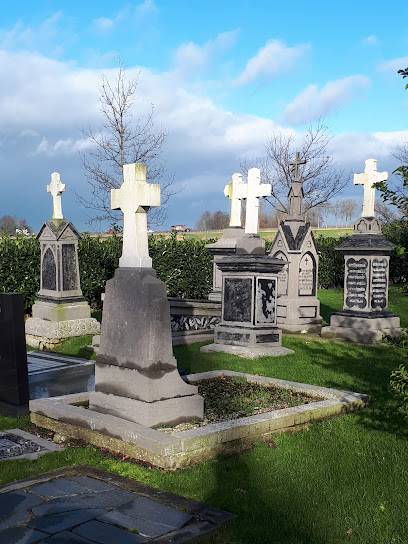
Where is Kuinre General Cemetery?
Kuinre General Cemetery is located at Kuinre, Steenwijkerland Municipality ,Overijssel ,Netherlands.
-
Kuinre General Cemetery cemetery's updated grave count on graveviews.com?
0 memorials
-
Where are the coordinates of the Kuinre General Cemetery?
Latitude: 52.7954100
Longitude: 5.8393400
Nearby Cemetories:
1. Algemene begraafplaats
Luttelgeest, Noordoostpolder Municipality, Netherlands
Coordinate: 52.7479507, 5.8546040
2. Oldetrijne Cemetery
Oldetrijne, Weststellingwerf Municipality, Netherlands
Coordinate: 52.8566500, 5.9318600
3. Lemmer General Cemetery
Lemmer, De Fryske Marren Municipality, Netherlands
Coordinate: 52.8479500, 5.7133100
4. Emmeloord General Cemetery
Emmeloord, Noordoostpolder Municipality, Netherlands
Coordinate: 52.7167200, 5.7453700
5. Blokzijl General Cemetery
Blokzijl, Steenwijkerland Municipality, Netherlands
Coordinate: 52.7253900, 5.9624600
6. Joodse Begraafplaats
Blokzijl, Steenwijkerland Municipality, Netherlands
Coordinate: 52.7253110, 5.9623440
7. Algemene Begraafplaats
Paasloo, Steenwijkerland Municipality, Netherlands
Coordinate: 52.8133500, 6.0135300
8. Algemene bregraafplaats
Creil, Noordoostpolder Municipality, Netherlands
Coordinate: 52.7629574, 5.6640223
9. Wolvega General Cemetery
Wolvega, Weststellingwerf Municipality, Netherlands
Coordinate: 52.8715200, 6.0103480
10. Stad-Vollenhove General Cemetery
Vollenhove, Steenwijkerland Municipality, Netherlands
Coordinate: 52.6808200, 5.9459100
11. Joodse Begraafplaats Tacozijl
Lemmer, De Fryske Marren Municipality, Netherlands
Coordinate: 52.8630740, 5.6452610
12. Algemene Begraafplaats
Espel, Noordoostpolder Municipality, Netherlands
Coordinate: 52.7174188, 5.6432473
13. Willemsoord General Cemetery
Willemsoord, Steenwijkerland Municipality, Netherlands
Coordinate: 52.8266800, 6.0706300
14. Begraafplaats van
Rottum, De Fryske Marren Municipality, Netherlands
Coordinate: 52.9368667, 5.8917667
15. Giethoorn Kerkhof
Giethoorn, Steenwijkerland Municipality, Netherlands
Coordinate: 52.7397600, 6.0764900
16. Kerkhof NH Vaste Burchtker
Wijckel, De Fryske Marren Municipality, Netherlands
Coordinate: 52.8889630, 5.6246630
17. Joodse Begraafplaats
Oranjewoud, Heerenveen Municipality, Netherlands
Coordinate: 52.9441810, 5.9499060
18. Begraafplaats Binnenweg
Heerenveen, Heerenveen Municipality, Netherlands
Coordinate: 52.9505875, 5.9395154
19. Westermeer Begraafplaats
Joure, De Fryske Marren Municipality, Netherlands
Coordinate: 52.9634300, 5.8033480
20. Joodse Begraafplaats
Steenwijk, Steenwijkerland Municipality, Netherlands
Coordinate: 52.7911800, 6.1213900
21. Steenwijk General Cemetery
Steenwijk, Steenwijkerland Municipality, Netherlands
Coordinate: 52.7863900, 6.1284800
22. Nijemirdum General Cemetery
Nijemirdum, De Fryske Marren Municipality, Netherlands
Coordinate: 52.8557700, 5.5669600
23. Natuurbegraafplaats Bremer Wildernis
Sondel, De Fryske Marren Municipality, Netherlands
Coordinate: 52.8714341, 5.5754786
24. Vormtweg 11
Urk, Urk Municipality, Netherlands
Coordinate: 52.6722645, 5.6091134