
| Memorials | : | 1 |
| Location | : | Lemmer, De Fryske Marren Municipality, Netherlands |
| Coordinate | : | 52.8479500, 5.7133100 |
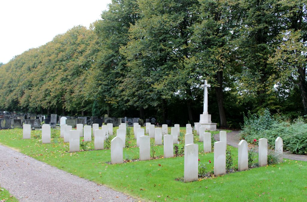
| Description | : | Lemmer, in the commune of Lemsterland, is a small port on the southern coast of Friesland. It lies 24 kilometres south of Sneek. This burial ground is on the northen outskirts of Lemmer in Straatweg, the road to Sneek. |
frequently asked questions (FAQ):
-
Where is Lemmer General Cemetery?
Lemmer General Cemetery is located at Lemmer, De Fryske Marren Municipality ,Friesland ,Netherlands.
-
Lemmer General Cemetery cemetery's updated grave count on graveviews.com?
1 memorials
-
Where are the coordinates of the Lemmer General Cemetery?
Latitude: 52.8479500
Longitude: 5.7133100
Nearby Cemetories:
1. Joodse Begraafplaats Tacozijl
Lemmer, De Fryske Marren Municipality, Netherlands
Coordinate: 52.8630740, 5.6452610
2. Kerkhof NH Vaste Burchtker
Wijckel, De Fryske Marren Municipality, Netherlands
Coordinate: 52.8889630, 5.6246630
3. Natuurbegraafplaats Bremer Wildernis
Sondel, De Fryske Marren Municipality, Netherlands
Coordinate: 52.8714341, 5.5754786
4. Nijemirdum General Cemetery
Nijemirdum, De Fryske Marren Municipality, Netherlands
Coordinate: 52.8557700, 5.5669600
5. Algemene bregraafplaats
Creil, Noordoostpolder Municipality, Netherlands
Coordinate: 52.7629574, 5.6640223
6. Kuinre General Cemetery
Kuinre, Steenwijkerland Municipality, Netherlands
Coordinate: 52.7954100, 5.8393400
7. Ijpecolsga General Cemetery
IJpecolsga, Sudwest Fryslan Municipality, Netherlands
Coordinate: 52.9344500, 5.6072800
8. Kerkhof Oudemirdum
Oudemirdum, De Fryske Marren Municipality, Netherlands
Coordinate: 52.8498364, 5.5332713
9. Westermeer Begraafplaats
Joure, De Fryske Marren Municipality, Netherlands
Coordinate: 52.9634300, 5.8033480
10. Algemene begraafplaats
Luttelgeest, Noordoostpolder Municipality, Netherlands
Coordinate: 52.7479507, 5.8546040
11. Oldetrijne Cemetery
Oldetrijne, Weststellingwerf Municipality, Netherlands
Coordinate: 52.8566500, 5.9318600
12. Emmeloord General Cemetery
Emmeloord, Noordoostpolder Municipality, Netherlands
Coordinate: 52.7167200, 5.7453700
13. Algemene Begraafplaats
Espel, Noordoostpolder Municipality, Netherlands
Coordinate: 52.7174188, 5.6432473
14. Begraafplaats van
Rottum, De Fryske Marren Municipality, Netherlands
Coordinate: 52.9368667, 5.8917667
15. Bakhuizen Roman Catholic Cemetery
Bakhuizen, De Fryske Marren Municipality, Netherlands
Coordinate: 52.8692200, 5.4557500
16. Idzega Klokkenstoel
Idzega, Sudwest Fryslan Municipality, Netherlands
Coordinate: 52.9775587, 5.5581642
17. Begraafplaats Binnenweg
Heerenveen, Heerenveen Municipality, Netherlands
Coordinate: 52.9505875, 5.9395154
18. Joodse Begraafplaats
Oranjewoud, Heerenveen Municipality, Netherlands
Coordinate: 52.9441810, 5.9499060
19. Koudum General Cemetery
Koudum, Sudwest Fryslan Municipality, Netherlands
Coordinate: 52.9114400, 5.4456200
20. Wolvega General Cemetery
Wolvega, Weststellingwerf Municipality, Netherlands
Coordinate: 52.8715200, 6.0103480
21. Begraafplaats Kerkje De Kapelle Haskerdijken
Haskerdijken, Heerenveen Municipality, Netherlands
Coordinate: 53.0059505, 5.8665023
22. Algemene Begraafplaats
Paasloo, Steenwijkerland Municipality, Netherlands
Coordinate: 52.8133500, 6.0135300
23. Vormtweg 11
Urk, Urk Municipality, Netherlands
Coordinate: 52.6722645, 5.6091134
24. Oude Joodse Begraafplaats
Sneek, Sudwest Fryslan Municipality, Netherlands
Coordinate: 53.0362600, 5.6740600