
| Memorials | : | 0 |
| Location | : | Westville, Adair County, USA |
| Coordinate | : | 35.9826580, -94.6159720 |
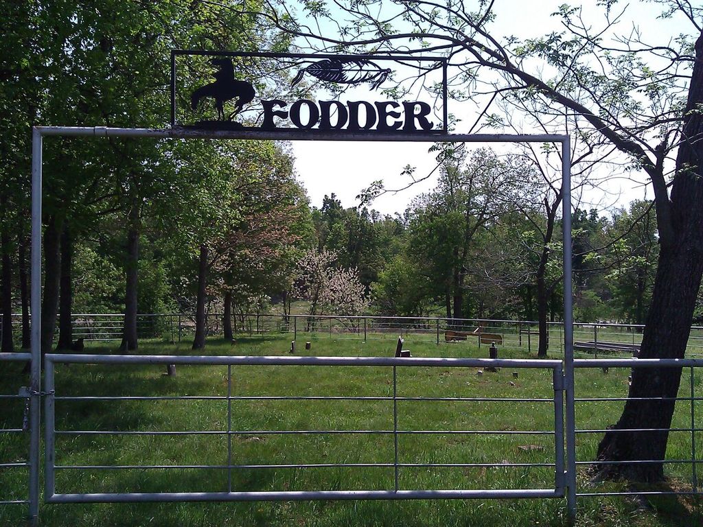
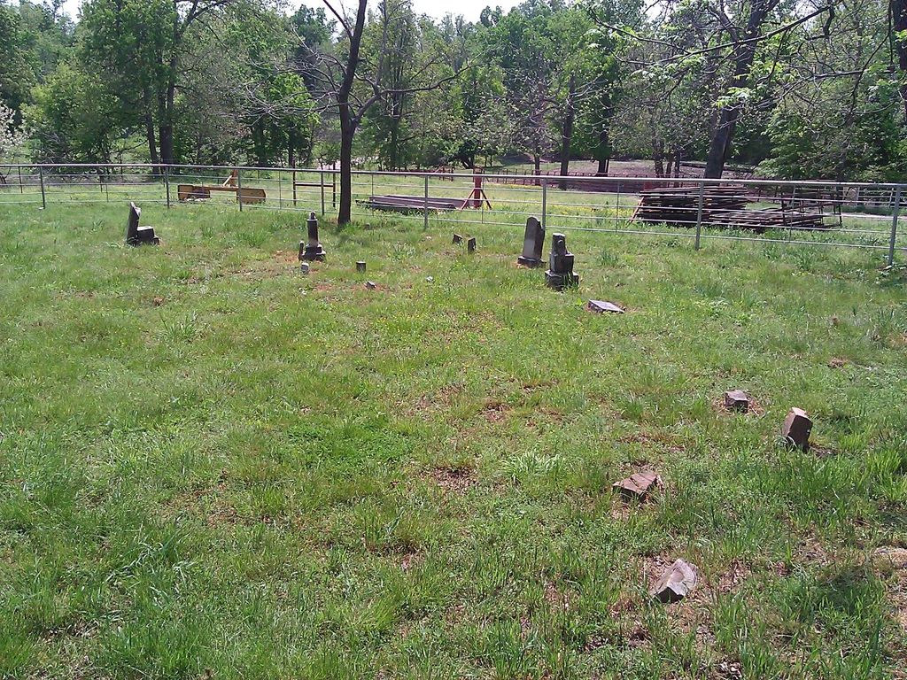
| Description | : | This cemetery is located in the NE4,SE4, NW4 of Section 2, Township 16N, Range 25E. It is located off Highway 62 approximately one and three-quarters of a mile west of Westville in Adair County, Oklahoma. In 1938, Gus Hummingbird and W.J.B. Bigby surveyed this cemetery through their work with the Works Progress Administration. They recorded the existence of approximately forty graves in this cemetery, none of which contained tombstones. They noted Che-We-Ski Fodder as the founder of the cemetery, which occurred about the year 1840. They stated, "This cemetery according to Mrs. Stephen... Read More |
frequently asked questions (FAQ):
-
Where is Fodder Cemetery?
Fodder Cemetery is located at Westville, Adair County ,Oklahoma ,USA.
-
Fodder Cemetery cemetery's updated grave count on graveviews.com?
0 memorials
-
Where are the coordinates of the Fodder Cemetery?
Latitude: 35.9826580
Longitude: -94.6159720
Nearby Cemetories:
1. Corntassel Cemetery
Westville, Adair County, USA
Coordinate: 35.9815250, -94.6213310
2. Old Green Cemetery
Westville, Adair County, USA
Coordinate: 35.9770000, -94.6260000
3. Foreman Cemetery
Westville, Adair County, USA
Coordinate: 35.9928017, -94.5830994
4. Ketcher Cemetery
Westville, Adair County, USA
Coordinate: 35.9911003, -94.6549988
5. Westville Cemetery
Westville, Adair County, USA
Coordinate: 36.0088997, -94.5753021
6. Thornton Cemetery
Addielee, Adair County, USA
Coordinate: 35.9378100, -94.6425280
7. Phillips Cemetery
Westville, Adair County, USA
Coordinate: 36.0024986, -94.5580978
8. Woodall Cemetery
Adair County, USA
Coordinate: 36.0230890, -94.5774360
9. Lacie Cemetery
Westville, Adair County, USA
Coordinate: 36.0336660, -94.6007720
10. Whitmire Cemetery
Christie, Adair County, USA
Coordinate: 35.9463889, -94.6641667
11. Downing Cemetery
Baron, Adair County, USA
Coordinate: 35.9271100, -94.6014100
12. Baptist Mission Cemetery
Westville, Adair County, USA
Coordinate: 36.0354620, -94.5835950
13. Alberty Cemetery
Westville, Adair County, USA
Coordinate: 35.9653015, -94.5441971
14. Wilkerson Cemetery
Christie, Adair County, USA
Coordinate: 35.9618750, -94.6887990
15. Rogers Family Cemetery
Westville, Adair County, USA
Coordinate: 36.0468520, -94.5995490
16. Lincoln England Family Cemetery
Stilwell, Adair County, USA
Coordinate: 35.9274200, -94.6613600
17. Crittenden Cemetery
Westville, Adair County, USA
Coordinate: 35.9919014, -94.5330963
18. Clyne Cemetery
Baron, Adair County, USA
Coordinate: 35.9139400, -94.6053700
19. Wolf Cemetery
Adair County, USA
Coordinate: 35.9166985, -94.6446991
20. Youngwolfe Cemetery
Christie, Adair County, USA
Coordinate: 35.9348090, -94.6828410
21. Parris Cemetery
Adair County, USA
Coordinate: 36.0327460, -94.5473640
22. Walkingstick Cemetery
Adair County, USA
Coordinate: 35.9108009, -94.6616974
23. Easky Cemetery
Baron, Adair County, USA
Coordinate: 35.9018150, -94.6183280
24. Knight Cemetery
Baron, Adair County, USA
Coordinate: 35.9107444, -94.6622000