
| Memorials | : | 3440 |
| Location | : | Lancaster, City of Lancaster, England |
| Coordinate | : | 54.0507360, -2.8057850 |
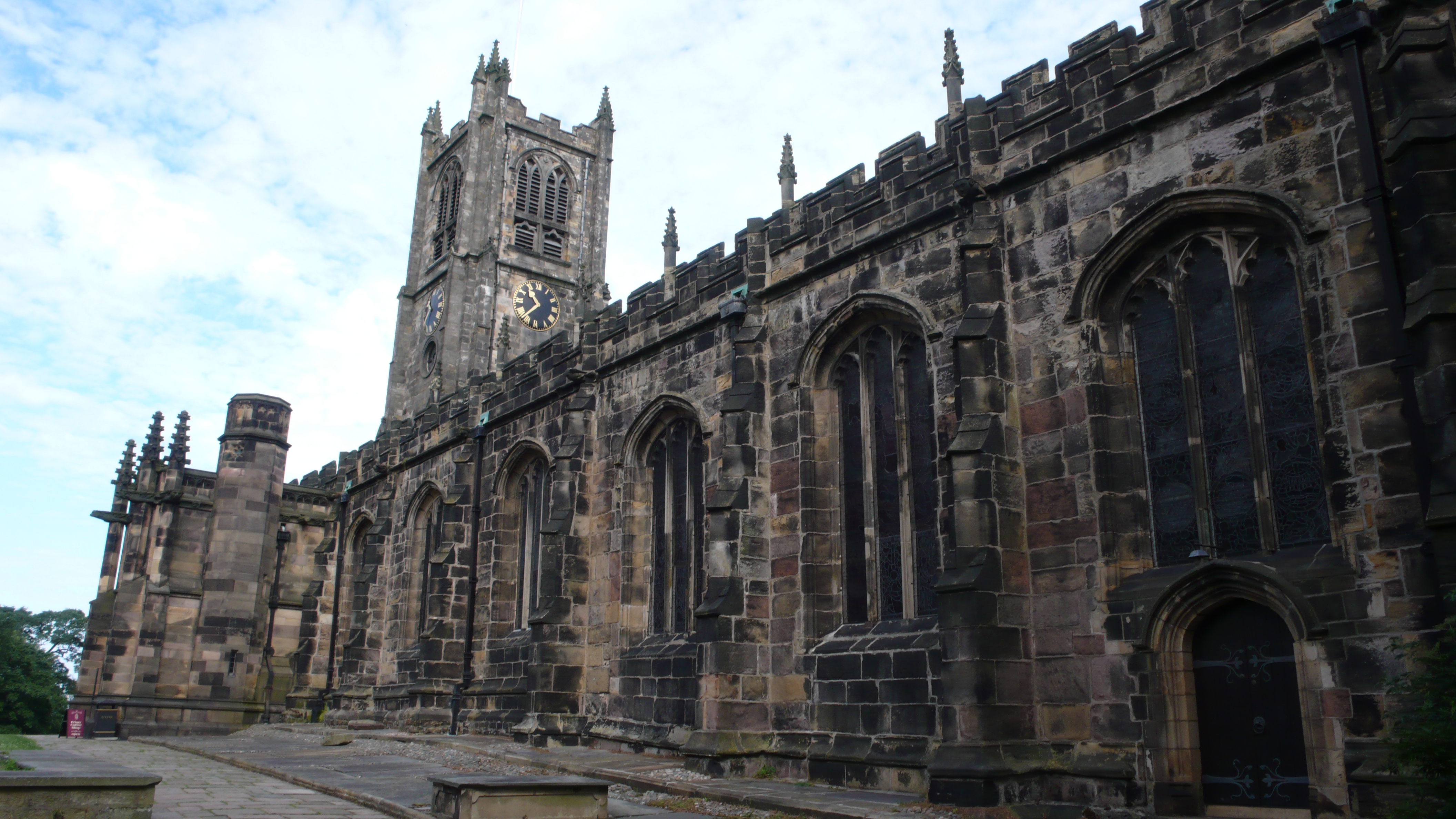
| Description | : | Lancaster Priory, formally the Priory Church of St Mary, is the Church of England parish church of the city of Lancaster, Lancashire, England. Lancaster Priory Church, which occupy the summit of Castle Hill, stand proudly above the city. It is likely that a Roman building existed on the site prior to others, possibly around the year 200. A Saxon church is thought to have stood on the site from the sixth century. The Church, which stands today, occupies the site of the original pre-1430s structure. Some of the old stone belonging to the original Priory building has been used in... Read More |
frequently asked questions (FAQ):
-
Where is Lancaster Priory?
Lancaster Priory is located at Priory Close Lancaster, City of Lancaster ,Lancashire , LA1 1YZEngland.
-
Lancaster Priory cemetery's updated grave count on graveviews.com?
3439 memorials
-
Where are the coordinates of the Lancaster Priory?
Latitude: 54.0507360
Longitude: -2.8057850
Nearby Cemetories:
1. Lancaster Castle Cemetery
Lancaster, City of Lancaster, England
Coordinate: 54.0494330, -2.8047890
2. Friends Meeting House Burial Ground
Lancaster, City of Lancaster, England
Coordinate: 54.0482500, -2.8058025
3. St. John the Evangelist Churchyard
Lancaster, City of Lancaster, England
Coordinate: 54.0504000, -2.7990000
4. Mount Street Congregational Chapel
Lancaster, City of Lancaster, England
Coordinate: 54.0468260, -2.8027430
5. St. Nicholas Street Chapel Churchyard
Lancaster, City of Lancaster, England
Coordinate: 54.0486900, -2.7987900
6. Saint Luke's Parish Churchyard
Skerton, City of Lancaster, England
Coordinate: 54.0564700, -2.7982600
7. Cathedral Cemetery of Lancaster
Lancaster, City of Lancaster, England
Coordinate: 54.0471170, -2.7942920
8. Skerton Cemetery
Lancaster, City of Lancaster, England
Coordinate: 54.0651430, -2.7951140
9. Lancaster and Morecambe Crematorium
Lancaster, City of Lancaster, England
Coordinate: 54.0650890, -2.8198420
10. Lancaster Cemetery
Lancaster, City of Lancaster, England
Coordinate: 54.0504210, -2.7768760
11. Scotforth Cemetery
Scotforth, City of Lancaster, England
Coordinate: 54.0282250, -2.8007170
12. Torrisholme Cemetery
Morecambe, City of Lancaster, England
Coordinate: 54.0638980, -2.8409800
13. St Wilfrid's Churchyard
Halton, City of Lancaster, England
Coordinate: 54.0759400, -2.7672600
14. Slyne Cemetery
Slyne, City of Lancaster, England
Coordinate: 54.0868185, -2.7969423
15. Holy Trinity Church Poulton-le-Sands
Morecambe, City of Lancaster, England
Coordinate: 54.0744769, -2.8569331
16. Morecambe Cemetery
Morecambe, City of Lancaster, England
Coordinate: 54.0759090, -2.8572610
17. St Peter's Churchyard
Quernmore, City of Lancaster, England
Coordinate: 54.0367200, -2.7375400
18. Hale Carr Lane Cemetery
Morecambe, City of Lancaster, England
Coordinate: 54.0520500, -2.8833940
19. Quernmore Methodist Churchyard
Quernmore, City of Lancaster, England
Coordinate: 54.0259440, -2.7361400
20. St. Helen's Churchyard
Overton, City of Lancaster, England
Coordinate: 54.0111620, -2.8552950
21. Christ Church United Reform Church
Bolton-le-Sands, City of Lancaster, England
Coordinate: 54.1015860, -2.7929000
22. Holy Trinity Churchyard
Bolton-le-Sands, City of Lancaster, England
Coordinate: 54.1027700, -2.7911700
23. St John’s Church Graveyard
Ellel, City of Lancaster, England
Coordinate: 53.9990010, -2.7846660
24. St. Peter Churchyard
Heysham, City of Lancaster, England
Coordinate: 54.0474180, -2.9019260