
| Memorials | : | 28 |
| Location | : | Ellel, City of Lancaster, England |
| Website | : | www.stjohnsellel.co.uk/church-heritage |
| Coordinate | : | 53.9990010, -2.7846660 |
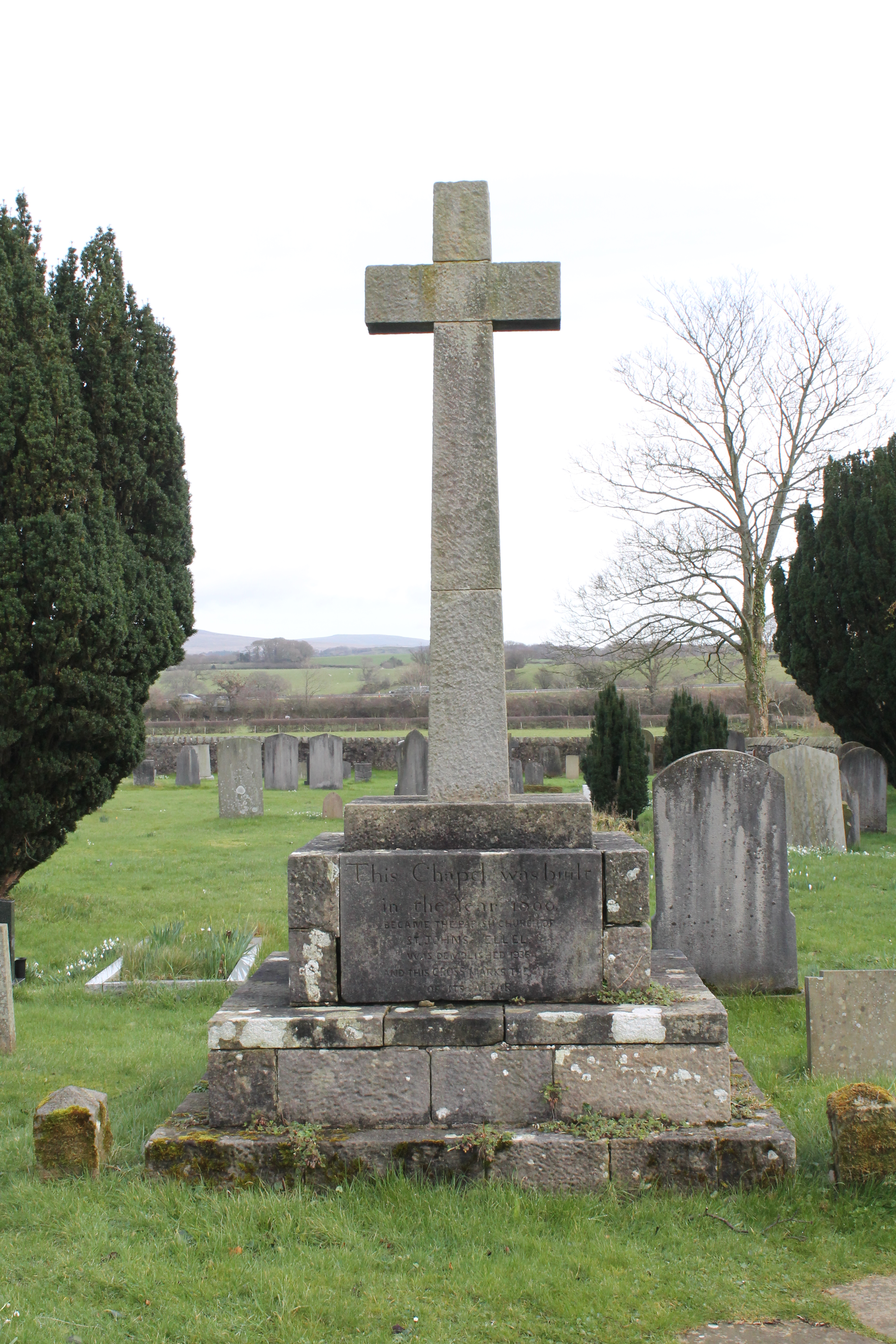
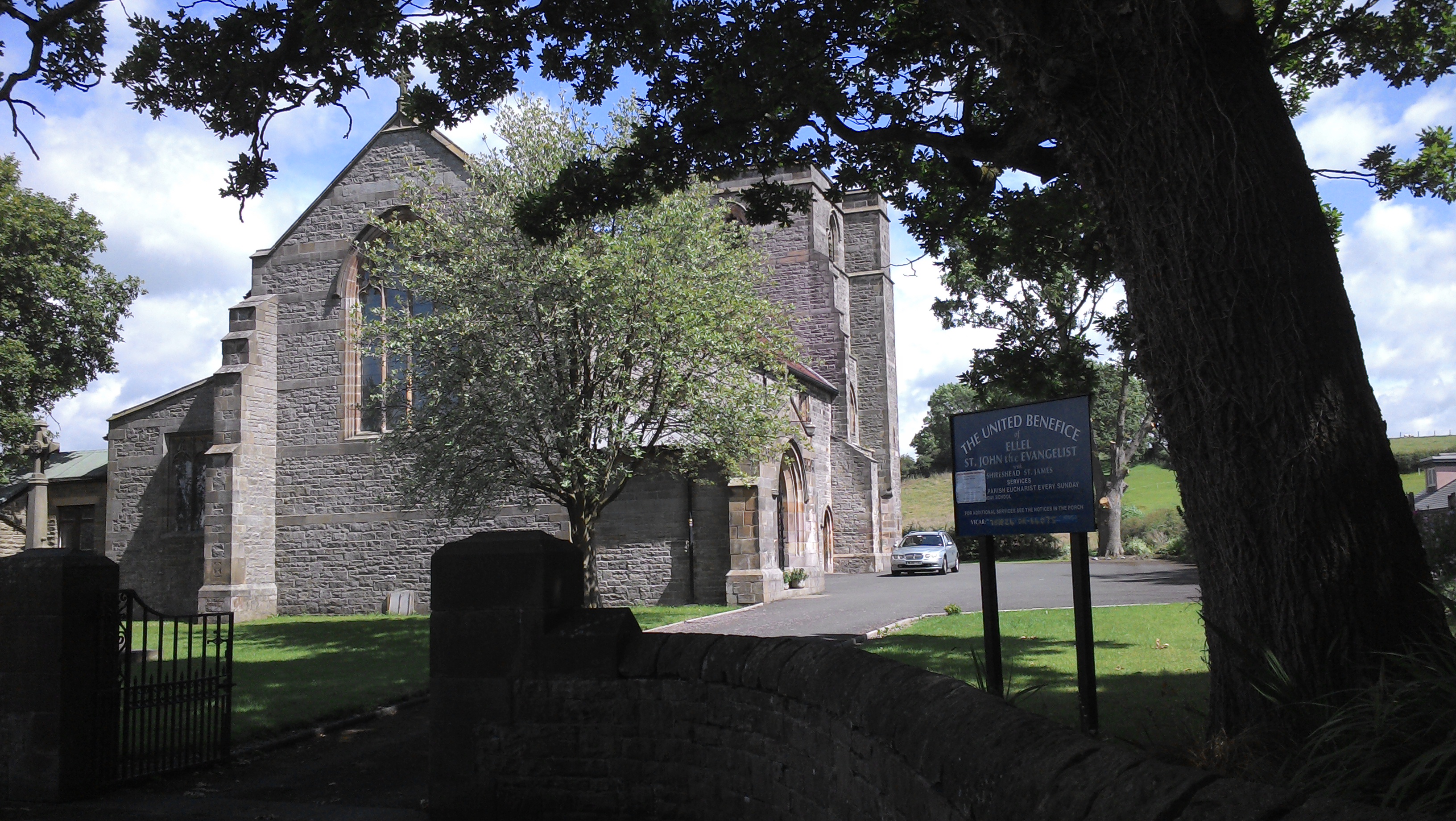
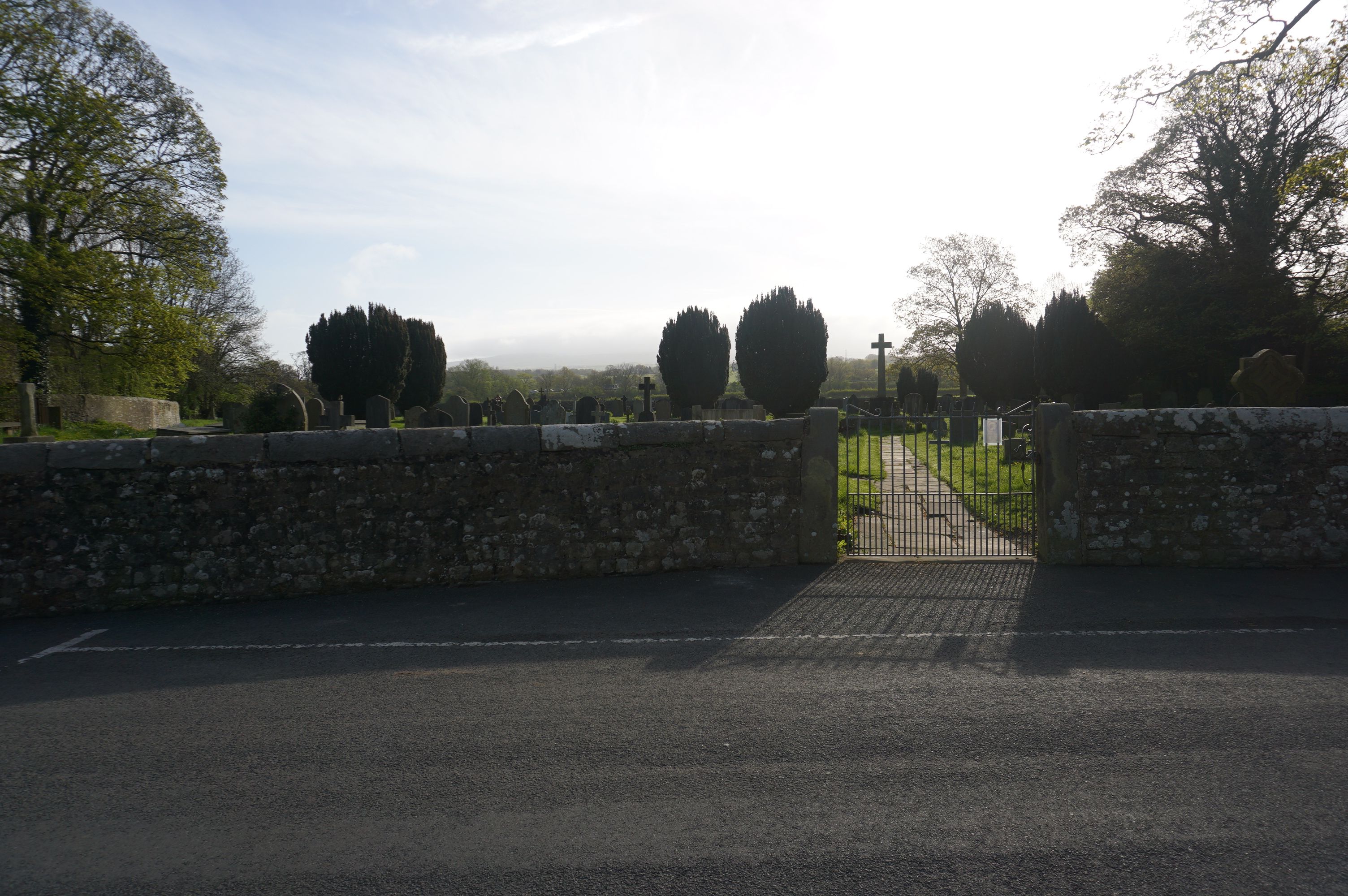
| Description | : | The Church Graveyard is the original site of St John's church. The first church at this location was there in 1156; it was demolished and rebuilt in 1800. That church building was replaced in 1907 by the new church a quarter mile to the south. The old church was disassembled, though there are some remnants in the graveyard. There are no burials in the present churchyard. |
frequently asked questions (FAQ):
-
Where is St John’s Church Graveyard?
St John’s Church Graveyard is located at Ellel, City of Lancaster ,Lancashire ,England.
-
St John’s Church Graveyard cemetery's updated grave count on graveviews.com?
18 memorials
-
Where are the coordinates of the St John’s Church Graveyard?
Latitude: 53.9990010
Longitude: -2.7846660
Nearby Cemetories:
1. St. Mary's Chapel Ellel Grange
Ellel, City of Lancaster, England
Coordinate: 53.9756944, -2.7918522
2. St Thomas with Elizabeth Churchyard
Thurnham, City of Lancaster, England
Coordinate: 53.9819990, -2.8159520
3. Scotforth Cemetery
Scotforth, City of Lancaster, England
Coordinate: 54.0282250, -2.8007170
4. Christ Church of Glasson Churchyard
Glasson, City of Lancaster, England
Coordinate: 53.9966870, -2.8421460
5. St Mark Churchyard
Dolphinholme, City of Lancaster, England
Coordinate: 53.9738730, -2.7378420
6. Quernmore Methodist Churchyard
Quernmore, City of Lancaster, England
Coordinate: 54.0259440, -2.7361400
7. St. Helen's Churchyard
Overton, City of Lancaster, England
Coordinate: 54.0111620, -2.8552950
8. Saint Michael's and All Angels Church Cemetery
Cockerham, City of Lancaster, England
Coordinate: 53.9602092, -2.8204877
9. Forton United Reform Church Cemetery
Forton, Wyre Borough, England
Coordinate: 53.9547940, -2.7813920
10. St Peter's Churchyard
Quernmore, City of Lancaster, England
Coordinate: 54.0367200, -2.7375400
11. St Paul's Churchyard
Forton, Wyre Borough, England
Coordinate: 53.9543760, -2.7605890
12. Cathedral Cemetery of Lancaster
Lancaster, City of Lancaster, England
Coordinate: 54.0471170, -2.7942920
13. Mount Street Congregational Chapel
Lancaster, City of Lancaster, England
Coordinate: 54.0468260, -2.8027430
14. St. Nicholas Street Chapel Churchyard
Lancaster, City of Lancaster, England
Coordinate: 54.0486900, -2.7987900
15. Friends Meeting House Burial Ground
Lancaster, City of Lancaster, England
Coordinate: 54.0482500, -2.8058025
16. Lancaster Cemetery
Lancaster, City of Lancaster, England
Coordinate: 54.0504210, -2.7768760
17. Lancaster Castle Cemetery
Lancaster, City of Lancaster, England
Coordinate: 54.0494330, -2.8047890
18. St. John the Evangelist Churchyard
Lancaster, City of Lancaster, England
Coordinate: 54.0504000, -2.7990000
19. Lancaster Priory
Lancaster, City of Lancaster, England
Coordinate: 54.0507360, -2.8057850
20. Quaker Burial Ground
Abbeystead, City of Lancaster, England
Coordinate: 53.9910820, -2.6912370
21. Saint Luke's Parish Churchyard
Skerton, City of Lancaster, England
Coordinate: 54.0564700, -2.7982600
22. Christ Church Churchyard
Over Wyresdale, City of Lancaster, England
Coordinate: 53.9839250, -2.6861150
23. Skerton Cemetery
Lancaster, City of Lancaster, England
Coordinate: 54.0651430, -2.7951140
24. Lancaster and Morecambe Crematorium
Lancaster, City of Lancaster, England
Coordinate: 54.0650890, -2.8198420