
| Memorials | : | 0 |
| Location | : | Douglasville, Douglas County, USA |
| Coordinate | : | 33.7515910, -84.6811150 |
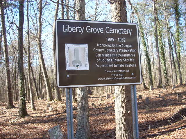
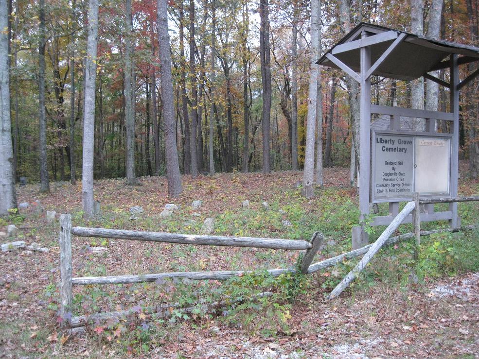
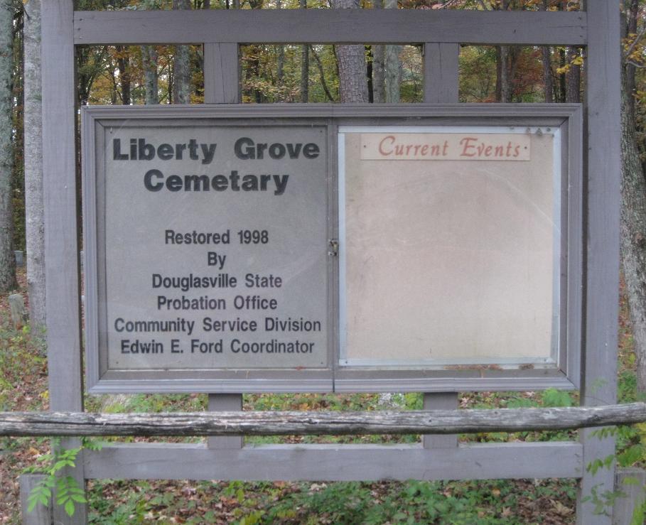
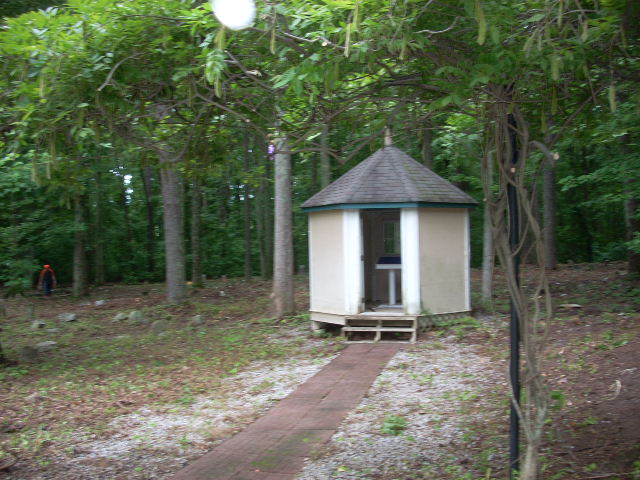
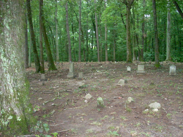
| Description | : | A small cemetery located on Mack Road near Deer Lick Park in Douglas County Georgia. Many gravestones are in poor condition, unreadable and overturned. Small building near the entrance with some historical information. |
frequently asked questions (FAQ):
-
Where is Liberty Grove Cemetery?
Liberty Grove Cemetery is located at Douglasville, Douglas County ,Georgia ,USA.
-
Liberty Grove Cemetery cemetery's updated grave count on graveviews.com?
0 memorials
-
Where are the coordinates of the Liberty Grove Cemetery?
Latitude: 33.7515910
Longitude: -84.6811150
Nearby Cemetories:
1. County Line Baptist Church Cemetery
Lithia Springs, Douglas County, USA
Coordinate: 33.7564210, -84.6734280
2. Mount Carmel Primitive Baptist Church Cemetery
Douglasville, Douglas County, USA
Coordinate: 33.7416600, -84.6823700
3. Pepper Family Cemetery
Douglas County, USA
Coordinate: 33.7412030, -84.6818960
4. Roberts Cemetery
Douglas County, USA
Coordinate: 33.7555660, -84.6998690
5. James Family Cemetery
Douglasville, Douglas County, USA
Coordinate: 33.7334600, -84.6792540
6. Fair View Church Cemetery
Douglasville, Douglas County, USA
Coordinate: 33.7367760, -84.6971520
7. Believers Church Cemetery
Douglasville, Douglas County, USA
Coordinate: 33.7240261, -84.6921704
8. Forsyth Family Cemetery
Douglasville, Douglas County, USA
Coordinate: 33.7769220, -84.7055930
9. Beulah Baptist Church Cemetery
Douglas County, USA
Coordinate: 33.7795000, -84.7037900
10. Stone Family Cemetery
Lithia Springs, Douglas County, USA
Coordinate: 33.7778900, -84.6553120
11. Mozley Memorial Gardens
Lithia Springs, Douglas County, USA
Coordinate: 33.7738410, -84.6464820
12. Sunrise Memorial Gardens
Lithia Springs, Douglas County, USA
Coordinate: 33.7867012, -84.6956024
13. Cannon Family Cemetery
Lithia Springs, Douglas County, USA
Coordinate: 33.7678720, -84.6373600
14. Owl Brothers-Cherokee Indians
Sweetwater Bluff, Douglas County, USA
Coordinate: 33.7408280, -84.6323200
15. Ben Hill Road Cemetery
Lithia Springs, Douglas County, USA
Coordinate: 33.7932200, -84.6912400
16. New River Community Church Cemetery
Douglasville, Douglas County, USA
Coordinate: 33.7109030, -84.6618760
17. Union Grove Baptist Church Cemetery
Lithia Springs, Douglas County, USA
Coordinate: 33.7971530, -84.6797000
18. Turner Family Cemetery
Lithia Springs, Douglas County, USA
Coordinate: 33.7677100, -84.6280800
19. Pleasant Grove Baptist Church Cemetery
Douglas County, USA
Coordinate: 33.7063751, -84.6582870
20. Old Salt Springs Cemetery
Lithia Springs, Douglas County, USA
Coordinate: 33.7922180, -84.6479780
21. Gorman Cemetery
Douglas County, USA
Coordinate: 33.7097851, -84.6477179
22. Sharpton Family Cemetery
Douglas County, USA
Coordinate: 33.7769890, -84.7365890
23. Bowden Family Cemetery
Lithia Springs, Douglas County, USA
Coordinate: 33.7967670, -84.6453300
24. Liberty Methodist Episcopal Church Cemetery
Douglasville, Douglas County, USA
Coordinate: 33.7543530, -84.7486210