
| Memorials | : | 0 |
| Location | : | Douglas County, USA |
| Coordinate | : | 33.7097851, -84.6477179 |
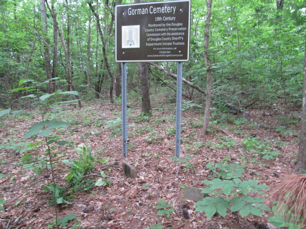
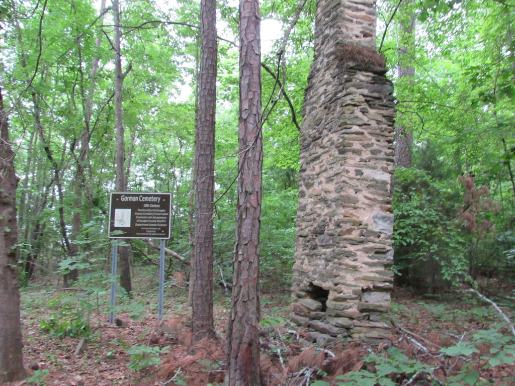
| Description | : | In the wooded area next to the school and across the street behind the fire station. It is the old Gorman homestead location with the chimney still standing. There are only 2 apparent graves marked with flat field stones and smaller foot stones. |
frequently asked questions (FAQ):
-
Where is Gorman Cemetery?
Gorman Cemetery is located at Old Lower River Rd near Riverside Pkwy, Douglas County Georgia Douglas County ,Georgia ,USA.
-
Gorman Cemetery cemetery's updated grave count on graveviews.com?
0 memorials
-
Where are the coordinates of the Gorman Cemetery?
Latitude: 33.7097851
Longitude: -84.6477179
Nearby Cemetories:
1. Pleasant Grove Baptist Church Cemetery
Douglas County, USA
Coordinate: 33.7063751, -84.6582870
2. New River Community Church Cemetery
Douglasville, Douglas County, USA
Coordinate: 33.7109030, -84.6618760
3. Connally Family Cemetery
Douglasville, Douglas County, USA
Coordinate: 33.6960240, -84.6344270
4. Boyd Slave Cemetery
Hilderbrand, Douglas County, USA
Coordinate: 33.6939590, -84.6661810
5. Victory Baptist Church Cemetery
Douglasville, Douglas County, USA
Coordinate: 33.6849340, -84.6616050
6. Moss Cemetery
Hilderbrand, Douglas County, USA
Coordinate: 33.6806710, -84.6672750
7. Owl Brothers-Cherokee Indians
Sweetwater Bluff, Douglas County, USA
Coordinate: 33.7408280, -84.6323200
8. James Family Cemetery
Douglasville, Douglas County, USA
Coordinate: 33.7334600, -84.6792540
9. Aderhold Kolb Cemetery
Fulton County, USA
Coordinate: 33.7105790, -84.6034810
10. Old Austell Plantation Cemetery
South Fulton, Fulton County, USA
Coordinate: 33.6726270, -84.6439580
11. Believers Church Cemetery
Douglasville, Douglas County, USA
Coordinate: 33.7240261, -84.6921704
12. Edenfield Family Cemetery
Douglas County, USA
Coordinate: 33.6758990, -84.6734880
13. Pepper Family Cemetery
Douglas County, USA
Coordinate: 33.7412030, -84.6818960
14. Mount Carmel Primitive Baptist Church Cemetery
Douglasville, Douglas County, USA
Coordinate: 33.7416600, -84.6823700
15. Fair View Church Cemetery
Douglasville, Douglas County, USA
Coordinate: 33.7367760, -84.6971520
16. Liberty Grove Cemetery
Douglasville, Douglas County, USA
Coordinate: 33.7515910, -84.6811150
17. County Line Baptist Church Cemetery
Lithia Springs, Douglas County, USA
Coordinate: 33.7564210, -84.6734280
18. Rocky Head United Methodist Church Cemetery
South Fulton, Fulton County, USA
Coordinate: 33.6952160, -84.5840030
19. Owl Rock Methodist Cemetery
Campbellton, Fulton County, USA
Coordinate: 33.6987877, -84.5801010
20. Cannon Family Cemetery
Lithia Springs, Douglas County, USA
Coordinate: 33.7678720, -84.6373600
21. Poplar Springs Baptist Church Cemetery
Lithia Springs, Douglas County, USA
Coordinate: 33.7569620, -84.6039640
22. Old Campbellton Baptist Church Cemetery
Campbellton, Fulton County, USA
Coordinate: 33.6525300, -84.6686100
23. Campbellton Baptist Church Cemetery
Fairburn, Fulton County, USA
Coordinate: 33.6530100, -84.6716300
24. Turner Family Cemetery
Lithia Springs, Douglas County, USA
Coordinate: 33.7677100, -84.6280800