
| Memorials | : | 7 |
| Location | : | Washington Township, Clinton County, USA |
| Coordinate | : | 39.3746986, -83.8244019 |
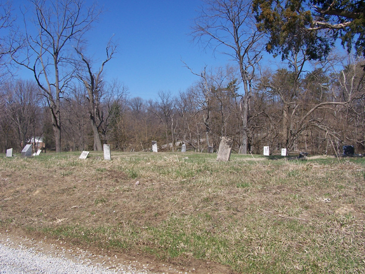
| Description | : | The cemetery is located on the southeast side of Brown Road (County Road 79) about 0.1 miles northeast of its intersection with Batson Road (County Road 102). The cemetery was established in 1818. The cemetery is located in Washington Township, Clinton County, Ohio, and is # 2021 (Lieurance Cemetery) in “Ohio Cemeteries 1803-2003”, compiled by the Ohio Genealogical Society. The U.S. Geological Survey (USGS) Geographic Names Information System (GNIS) feature ID for the cemetery is 1042556 (Lieurance Cemetery). |
frequently asked questions (FAQ):
-
Where is Lieurance Cemetery?
Lieurance Cemetery is located at Brown Road (County Road 79) Washington Township, Clinton County ,Ohio , 45177USA.
-
Lieurance Cemetery cemetery's updated grave count on graveviews.com?
6 memorials
-
Where are the coordinates of the Lieurance Cemetery?
Latitude: 39.3746986
Longitude: -83.8244019
Nearby Cemetories:
1. Bethel Lane Cemetery
Morrisville, Clinton County, USA
Coordinate: 39.3779984, -83.8059998
2. Mann Farm Cemetery
Washington Township, Clinton County, USA
Coordinate: 39.3478970, -83.8463420
3. Cowan Creek Cemetery
Washington Township, Clinton County, USA
Coordinate: 39.3670100, -83.7696500
4. Moore-Johns Cemetery
Cuba, Clinton County, USA
Coordinate: 39.3474600, -83.8772500
5. Martinsville Friends Cemetery
Martinsville, Clinton County, USA
Coordinate: 39.3229400, -83.8102800
6. Mount Pleasant Cemetery
Vernon Township, Clinton County, USA
Coordinate: 39.3806000, -83.8972015
7. Turner Cemetery
Martinsville, Clinton County, USA
Coordinate: 39.3188100, -83.8032770
8. Martinsville IOOF Cemetery
Martinsville, Clinton County, USA
Coordinate: 39.3189011, -83.8022003
9. Sugar Grove Cemetery
Wilmington, Clinton County, USA
Coordinate: 39.4408080, -83.8329850
10. New Antioch Cemetery
New Antioch, Clinton County, USA
Coordinate: 39.4103394, -83.7501984
11. Charles E Fife Farm Cemetery (Defunct)
Wilmington, Clinton County, USA
Coordinate: 39.4307650, -83.7528970
12. Johnson Family Cemetery
Farmers, Clinton County, USA
Coordinate: 39.3092000, -83.7596000
13. Lytle Creek Cemetery
Clarksville, Clinton County, USA
Coordinate: 39.4406320, -83.8921200
14. Rehobath Cemetery
Blanchester, Clinton County, USA
Coordinate: 39.3512000, -83.9292000
15. Jefferson Township Unidentified Cemetery #1
Jefferson Township, Clinton County, USA
Coordinate: 39.3143720, -83.9028310
16. Betterton Farm Cemetery
Clark Township, Clinton County, USA
Coordinate: 39.3002990, -83.7638850
17. Swingley Farm Cemetery
Green Township, Clinton County, USA
Coordinate: 39.3475370, -83.7105670
18. West Chapel Cemetery
Clark Township, Clinton County, USA
Coordinate: 39.2942009, -83.7605972
19. Jenks Cemetery
Clarksville, Clinton County, USA
Coordinate: 39.4233322, -83.9319534
20. Gaddis Cemetery
Wilmington, Clinton County, USA
Coordinate: 39.4700012, -83.7966995
21. Achor Cemetery
New Vienna, Clinton County, USA
Coordinate: 39.3059998, -83.7320023
22. Sewell Cemetery
Clarksville, Clinton County, USA
Coordinate: 39.3782997, -83.9552994
23. Sligo Cemetery
Adams Township, Clinton County, USA
Coordinate: 39.4384850, -83.9270960
24. East Fork Quaker Cemetery
New Vienna, Clinton County, USA
Coordinate: 39.3316000, -83.6968100