
| Memorials | : | 17 |
| Location | : | Vernon Township, Clinton County, USA |
| Coordinate | : | 39.3806000, -83.8972015 |
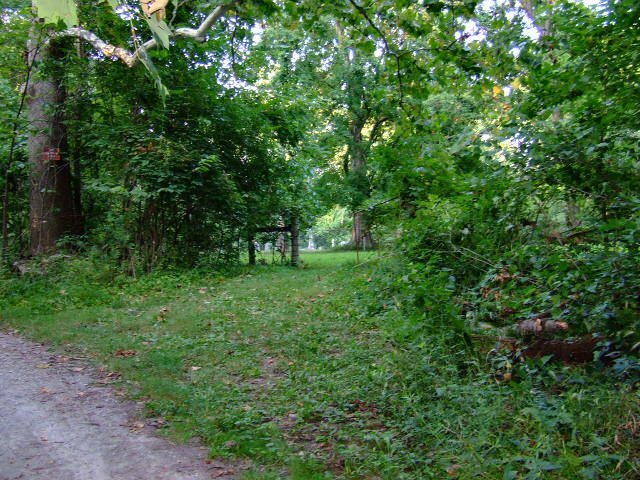
| Description | : | This cemetery is off the beat and path, semi-hidden behind trees and shrubbery. It is unmarked, no signs anywhere, except for a emergency vehicle only sign. The drive leading to the cemetery is located directly across the road from the entrance to the Beechwood Acres Camping Resort. The cemetery is located about 250 feet north of Yankee Road (Township Road 253) about 0.7 miles northeast of its intersection with Ohio State Route 350. The cemetery was established in 1817 and is 0.9 acres in size. The cemetery is located in Vernon Township, Clinton County, Ohio, and is #... Read More |
frequently asked questions (FAQ):
-
Where is Mount Pleasant Cemetery?
Mount Pleasant Cemetery is located at Yankee Road (Township Road 253) Vernon Township, Clinton County ,Ohio , 45177USA.
-
Mount Pleasant Cemetery cemetery's updated grave count on graveviews.com?
17 memorials
-
Where are the coordinates of the Mount Pleasant Cemetery?
Latitude: 39.3806000
Longitude: -83.8972015
Nearby Cemetories:
1. Moore-Johns Cemetery
Cuba, Clinton County, USA
Coordinate: 39.3474600, -83.8772500
2. Rehobath Cemetery
Blanchester, Clinton County, USA
Coordinate: 39.3512000, -83.9292000
3. Sewell Cemetery
Clarksville, Clinton County, USA
Coordinate: 39.3782997, -83.9552994
4. Jenks Cemetery
Clarksville, Clinton County, USA
Coordinate: 39.4233322, -83.9319534
5. Mann Farm Cemetery
Washington Township, Clinton County, USA
Coordinate: 39.3478970, -83.8463420
6. Vernon Baptist Cemetery
Vernon Township, Clinton County, USA
Coordinate: 39.3873890, -83.9667060
7. Lieurance Cemetery
Washington Township, Clinton County, USA
Coordinate: 39.3746986, -83.8244019
8. Lytle Creek Cemetery
Clarksville, Clinton County, USA
Coordinate: 39.4406320, -83.8921200
9. Sligo Cemetery
Adams Township, Clinton County, USA
Coordinate: 39.4384850, -83.9270960
10. Clarksville Friends Cemetery
Clarksville, Clinton County, USA
Coordinate: 39.4022835, -83.9749430
11. Stanfield Cemetery
Clarksville, Clinton County, USA
Coordinate: 39.4264720, -83.9562220
12. Harris Cemetery
Vernon Township, Clinton County, USA
Coordinate: 39.4196170, -83.9644500
13. Jefferson Township Unidentified Cemetery #1
Jefferson Township, Clinton County, USA
Coordinate: 39.3143720, -83.9028310
14. Clarksville Cemetery
Clarksville, Clinton County, USA
Coordinate: 39.3972900, -83.9841100
15. Bethel Lane Cemetery
Morrisville, Clinton County, USA
Coordinate: 39.3779984, -83.8059998
16. Smalley Clarksville Cemetery
Clarksville, Clinton County, USA
Coordinate: 39.4029570, -83.9869810
17. Yeazel Cemetery
Clarksville, Clinton County, USA
Coordinate: 39.4031000, -83.9872000
18. Springfield Friends Cemetery
Adams Township, Clinton County, USA
Coordinate: 39.4512990, -83.9375810
19. Sugar Grove Cemetery
Wilmington, Clinton County, USA
Coordinate: 39.4408080, -83.8329850
20. Second Creek Cemetery
Blanchester, Clinton County, USA
Coordinate: 39.3164800, -83.9551600
21. Branstator Farm Cemetery
Clarksville, Clinton County, USA
Coordinate: 39.4344690, -83.9833120
22. Martinsville Friends Cemetery
Martinsville, Clinton County, USA
Coordinate: 39.3229400, -83.8102800
23. Turner Cemetery
Martinsville, Clinton County, USA
Coordinate: 39.3188100, -83.8032770
24. Westboro Friends Cemetery
Westboro, Clinton County, USA
Coordinate: 39.2849998, -83.9013977