
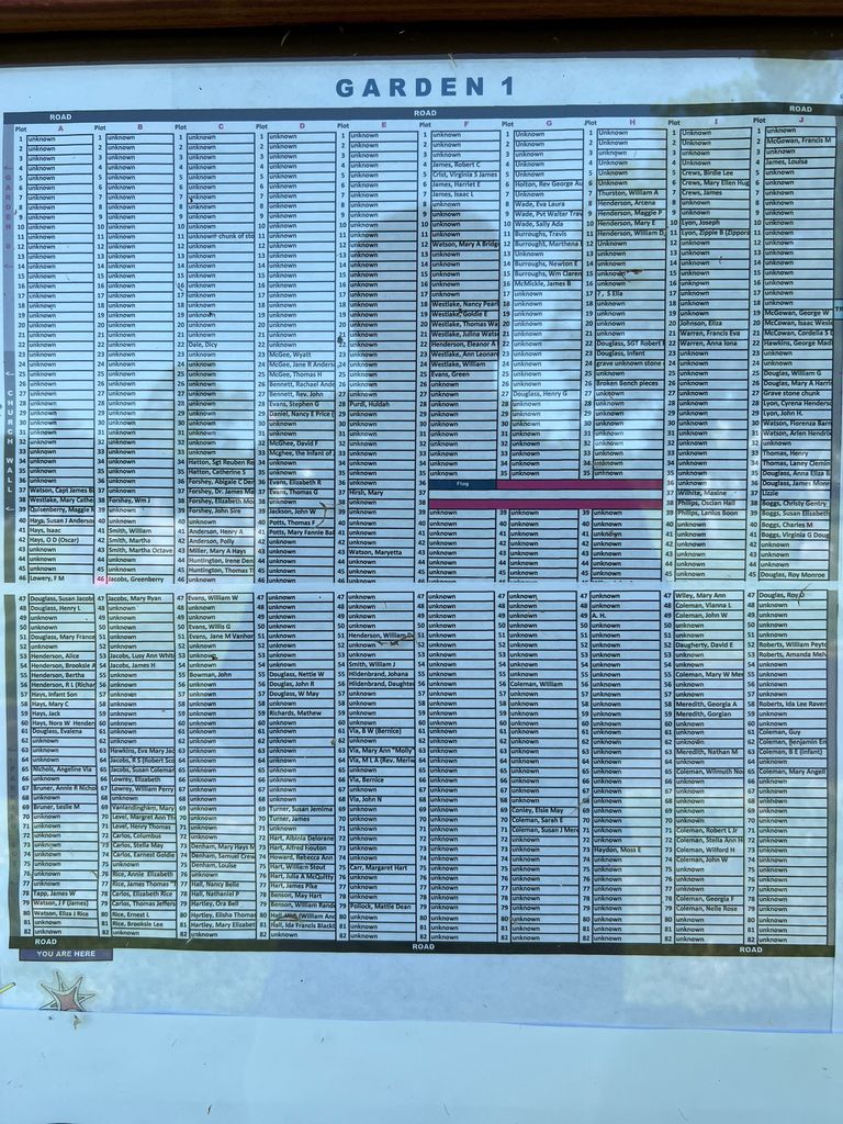
| Memorials | : | 4 |
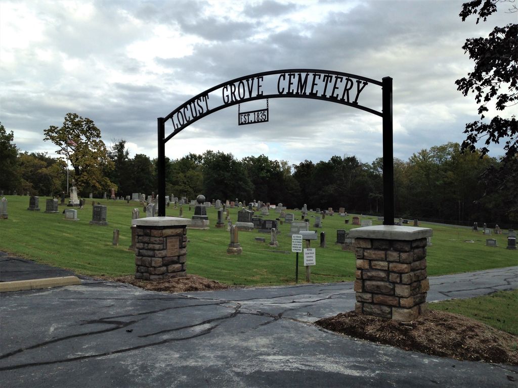
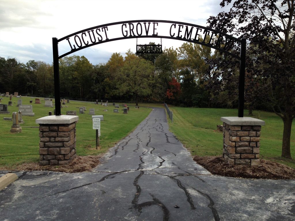
| Location | : | Midway, Boone County, USA |
| Coordinate | : | 38.9855120, -92.4485580 |
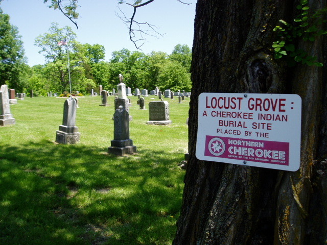
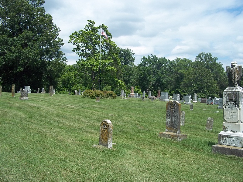
| Description | : | Midway derived its name from being the mid-point between Rocheport and Columbia. (Place Names in the Central Counties of Missouri” M.A. Thesis by Nadine Pace 1928) Rocheport retains is small village size and lies about 6 miles west of Midway. However, Columbia grew in population and geographically through extensive annexation and Columbia city limits now lie about 3 miles east of this cemetery. Coincidentally Midway is near the mid-point between St. Louis and Kansas City. To access the cemetery from Interstate 70, turn north on Highway 40-240 at Exit 121, locally known as the Midway exit. Travel northwest on 40-240... Read More |
frequently asked questions (FAQ):
-
Where is Locust Grove Cemetery?
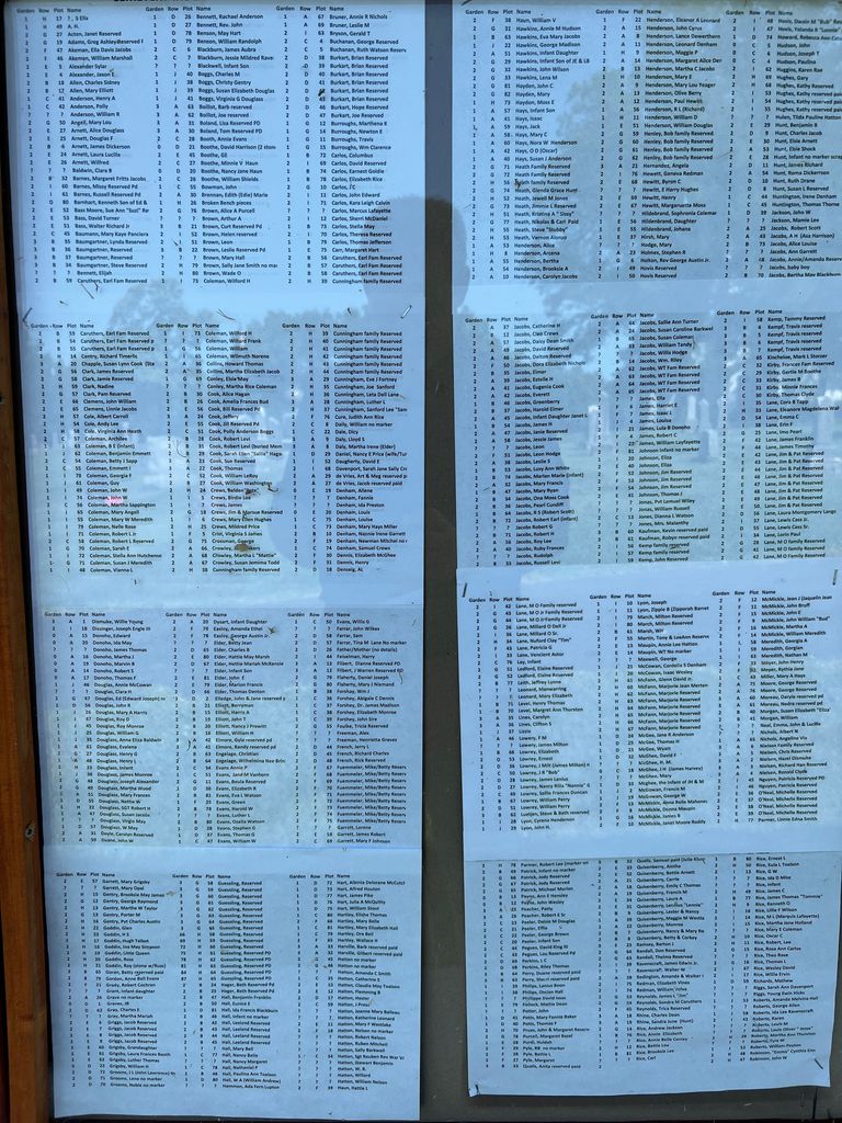
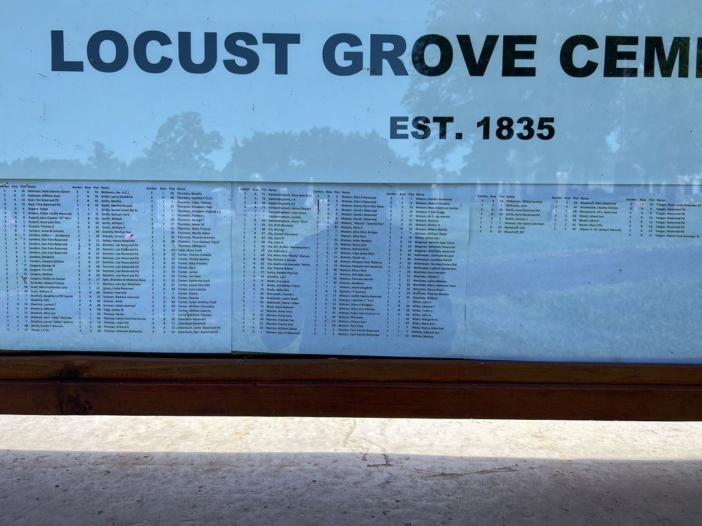
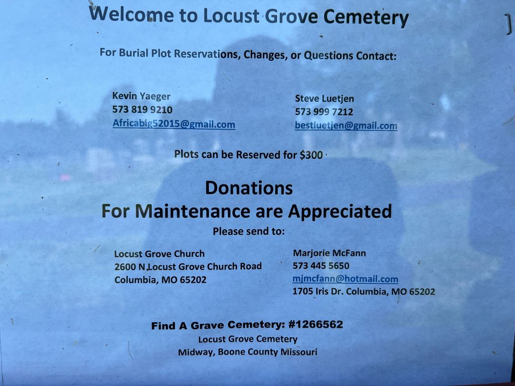
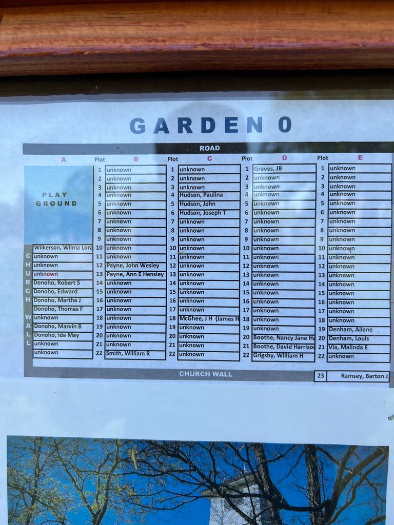
Locust Grove Cemetery is located at 2600 N. Locust Grove Church Rd. Midway, Boone County ,Missouri , 65202-7819USA.
-
Locust Grove Cemetery cemetery's updated grave count on graveviews.com?
3 memorials
-
Where are the coordinates of the Locust Grove Cemetery?
Latitude: 38.9855120
Longitude: -92.4485580
Nearby Cemetories:
1. Cochran Family Cemetery
Boone County, USA
Coordinate: 38.9724560, -92.4861290
2. Rural Jordan Cemetery
Rocheport, Boone County, USA
Coordinate: 38.9626376, -92.4810337
3. Valley Springs Cemetery
Columbia, Boone County, USA
Coordinate: 38.9486008, -92.4424973
4. New Providence Cemetery
Columbia, Boone County, USA
Coordinate: 39.0071500, -92.4019100
5. Sugar Creek Cemetery
Huntsdale, Boone County, USA
Coordinate: 38.9455986, -92.4721985
6. Green Acres Cemetery
Columbia, Boone County, USA
Coordinate: 38.9457300, -92.4732400
7. Lientz Cemetery
Midway, Boone County, USA
Coordinate: 39.0080400, -92.5050200
8. Goodin Cemetery
Boone County, USA
Coordinate: 38.9406400, -92.4025000
9. Taylor Family Cemetery
Columbia, Boone County, USA
Coordinate: 39.0392600, -92.4094900
10. Mount Nebo Cemetery
Boone County, USA
Coordinate: 38.9239006, -92.4610977
11. Broadway Christian Church Memorial Garden
Columbia, Boone County, USA
Coordinate: 38.9558000, -92.3779200
12. Walnut Grove Cemetery
Rocheport, Boone County, USA
Coordinate: 39.0125008, -92.5233002
13. Sprinkle Family Cemetery
Columbia, Boone County, USA
Coordinate: 38.9321100, -92.3854700
14. Payton-Goodrich-Willis-Shock Cemetery
Columbia, Boone County, USA
Coordinate: 38.9727560, -92.3566530
15. Fairview Cemetery
Columbia, Boone County, USA
Coordinate: 38.9354930, -92.3801810
16. Yahweh's Assembly In Messiah Cemetery
Rocheport, Boone County, USA
Coordinate: 38.9611995, -92.5397969
17. Memorial Park Cemetery
Columbia, Boone County, USA
Coordinate: 38.9696999, -92.3531036
18. Evert Church Cemetery
Woodlandville, Boone County, USA
Coordinate: 39.0615160, -92.4631690
19. Old Bethel Cemetery
Midway, Boone County, USA
Coordinate: 39.0414200, -92.5198800
20. Creasy Springs Road Burial Ground
Columbia, Boone County, USA
Coordinate: 38.9976500, -92.3484230
21. Cowden Family Cemetery
Woodlandville, Boone County, USA
Coordinate: 39.0598300, -92.4919100
22. Rocheport City Cemetery
Rocheport, Boone County, USA
Coordinate: 38.9809050, -92.5590420
23. Courtyard Memorial Garden
Columbia, Boone County, USA
Coordinate: 38.9418880, -92.3524030
24. Toalson Family Cemetery
Boone County, USA
Coordinate: 39.0128817, -92.3409784