
| Memorials | : | 0 |
| Location | : | Dent, South Lakeland District, England |
| Coordinate | : | 54.2785440, -2.4570070 |
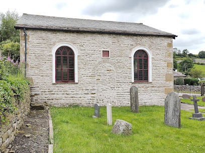
| Description | : | The area around Sedbergh, Kendal and Preston Patrick is known as 'the 1652 country', where Quakerism was born as an organised movement. George Fox, on reaching Sedbergh in summer 1652, found an existing community of Seekers led by dissenting preachers, who were particularly receptive to his message. The Westmorland Seekers formed the nucleus of the Valiant Sixty, the band of preachers who carried the Quaker message beyond the north of England in the mid 1650s. They were also crucial in developing the structure of the Society of Friends. Sedbergh Monthly Meeting dates from 1668 and has always been part of... Read More |
frequently asked questions (FAQ):
-
Where is Loneing-Dent Quaker Burial Ground?
Loneing-Dent Quaker Burial Ground is located at Dent, Cumbria, England Dent, South Lakeland District ,Cumbria ,England.
-
Loneing-Dent Quaker Burial Ground cemetery's updated grave count on graveviews.com?
0 memorials
-
Where are the coordinates of the Loneing-Dent Quaker Burial Ground?
Latitude: 54.2785440
Longitude: -2.4570070
Nearby Cemetories:
1. Dent Methodist Churchyard
Dent, South Lakeland District, England
Coordinate: 54.2786300, -2.4569800
2. St Andrew Churchyard
Dent, South Lakeland District, England
Coordinate: 54.2781540, -2.4542310
3. Dent Zion Chapel
Dent, South Lakeland District, England
Coordinate: 54.2766335, -2.4558426
4. Saint John the Evangelist Churchyard
Cowgill, South Lakeland District, England
Coordinate: 54.2752710, -2.4914250
5. Low Smithy Methodist Church Graveyard
Garsdale, South Lakeland District, England
Coordinate: 54.3003930, -2.3992090
6. Frostrow Methodist Chapel Churchyard
Sedbergh, South Lakeland District, England
Coordinate: 54.3175080, -2.4871590
7. St. John the Baptist Churchyard
Garsdale, South Lakeland District, England
Coordinate: 54.3008610, -2.3914140
8. Saint Andrews Churchyard
Sedbergh, South Lakeland District, England
Coordinate: 54.3230690, -2.5285180
9. Sedbergh Cemetery
Sedbergh, South Lakeland District, England
Coordinate: 54.3206230, -2.5361770
10. Cautley Methodist Churchyard
Sedbergh, South Lakeland District, England
Coordinate: 54.3419640, -2.4791850
11. Quaker Graveyard
Brigflatts, South Lakeland District, England
Coordinate: 54.3146190, -2.5533360
12. St. Mark's Churchyard
Cautley, South Lakeland District, England
Coordinate: 54.3456280, -2.4767630
13. Church of Holy Ghost
Middleton, South Lakeland District, England
Coordinate: 54.2697500, -2.5800700
14. St Gregory Churchyard
Sedbergh, South Lakeland District, England
Coordinate: 54.3240650, -2.5637360
15. St Bartholomew Churchyard
Barbon, South Lakeland District, England
Coordinate: 54.2365440, -2.5682800
16. St John the Evangelist Churchyard
Firbank, South Lakeland District, England
Coordinate: 54.3365050, -2.5737670
17. St Leonard Churchyard
Chapel-le-Dale, Craven District, England
Coordinate: 54.1897200, -2.4032880
18. Holy Trinity Churchyard
Sedbergh, South Lakeland District, England
Coordinate: 54.3494590, -2.5651420
19. Holy Trinity Churchyard
Casterton, South Lakeland District, England
Coordinate: 54.2113570, -2.5768860
20. St Peter's Churchyard
Mansergh, South Lakeland District, England
Coordinate: 54.2384190, -2.6118450
21. Saint Peter's Churchyard
Leck, City of Lancaster, England
Coordinate: 54.1836860, -2.5485980
22. St Mary the Virgin Churchyard
Kirkby Lonsdale, South Lakeland District, England
Coordinate: 54.2036550, -2.5976790
23. St Oswald Churchyard
Thornton-in-Lonsdale, Craven District, England
Coordinate: 54.1573600, -2.4830810
24. St Mary Churchyard
Ingleton, Craven District, England
Coordinate: 54.1540480, -2.4682980