
| Memorials | : | 1 |
| Location | : | Cowgill, South Lakeland District, England |
| Coordinate | : | 54.2752710, -2.4914250 |
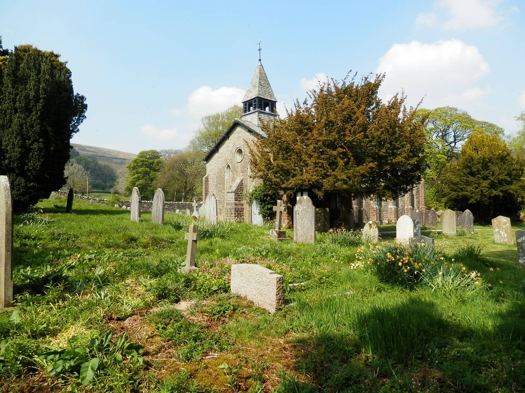
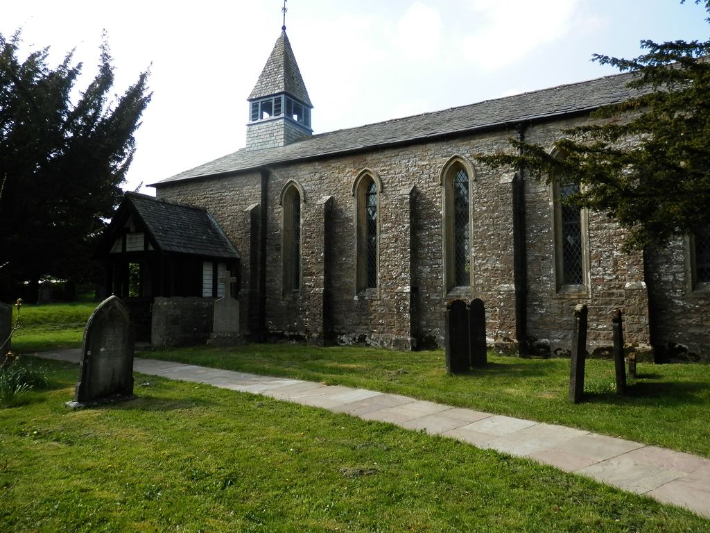
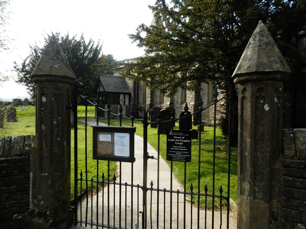
| Description | : | The Church of St. John the Evangelist is in the village of Cowgill. The old Cowgill parish was joined to the Dent parish, sometimes called the Dent-Cowgill parish. A photograph and information are available at online sites including Wikipedia. The church is listed on the English Heritage website: "This building is listed under the Planning (Listed Buildings and Conservation Areas) Act 1990 as amended for its special architectural or historic interest." "Formerly known as: Kirkthwaite Chapel DENTDALE. Formerly known as: Cowgill Chapel DENTDALE. Church. 1837-8. Coursed sandstone rubble, slate roof. Early English style. . . . INTERIOR: . . . The south... Read More |
frequently asked questions (FAQ):
-
Where is Saint John the Evangelist Churchyard?
Saint John the Evangelist Churchyard is located at Cowgill, South Lakeland District ,Cumbria ,England.
-
Saint John the Evangelist Churchyard cemetery's updated grave count on graveviews.com?
1 memorials
-
Where are the coordinates of the Saint John the Evangelist Churchyard?
Latitude: 54.2752710
Longitude: -2.4914250
Nearby Cemetories:
1. Loneing-Dent Quaker Burial Ground
Dent, South Lakeland District, England
Coordinate: 54.2785440, -2.4570070
2. Dent Methodist Churchyard
Dent, South Lakeland District, England
Coordinate: 54.2786300, -2.4569800
3. Dent Zion Chapel
Dent, South Lakeland District, England
Coordinate: 54.2766335, -2.4558426
4. St Andrew Churchyard
Dent, South Lakeland District, England
Coordinate: 54.2781540, -2.4542310
5. Frostrow Methodist Chapel Churchyard
Sedbergh, South Lakeland District, England
Coordinate: 54.3175080, -2.4871590
6. Church of Holy Ghost
Middleton, South Lakeland District, England
Coordinate: 54.2697500, -2.5800700
7. Sedbergh Cemetery
Sedbergh, South Lakeland District, England
Coordinate: 54.3206230, -2.5361770
8. Saint Andrews Churchyard
Sedbergh, South Lakeland District, England
Coordinate: 54.3230690, -2.5285180
9. Quaker Graveyard
Brigflatts, South Lakeland District, England
Coordinate: 54.3146190, -2.5533360
10. St Bartholomew Churchyard
Barbon, South Lakeland District, England
Coordinate: 54.2365440, -2.5682800
11. Low Smithy Methodist Church Graveyard
Garsdale, South Lakeland District, England
Coordinate: 54.3003930, -2.3992090
12. St. John the Baptist Churchyard
Garsdale, South Lakeland District, England
Coordinate: 54.3008610, -2.3914140
13. St Gregory Churchyard
Sedbergh, South Lakeland District, England
Coordinate: 54.3240650, -2.5637360
14. Cautley Methodist Churchyard
Sedbergh, South Lakeland District, England
Coordinate: 54.3419640, -2.4791850
15. St. Mark's Churchyard
Cautley, South Lakeland District, England
Coordinate: 54.3456280, -2.4767630
16. St John the Evangelist Churchyard
Firbank, South Lakeland District, England
Coordinate: 54.3365050, -2.5737670
17. St Peter's Churchyard
Mansergh, South Lakeland District, England
Coordinate: 54.2384190, -2.6118450
18. Holy Trinity Churchyard
Casterton, South Lakeland District, England
Coordinate: 54.2113570, -2.5768860
19. Holy Trinity Churchyard
Sedbergh, South Lakeland District, England
Coordinate: 54.3494590, -2.5651420
20. St Mary the Virgin Churchyard
Kirkby Lonsdale, South Lakeland District, England
Coordinate: 54.2036550, -2.5976790
21. Saint Peter's Churchyard
Leck, City of Lancaster, England
Coordinate: 54.1836860, -2.5485980
22. St Leonard Churchyard
Chapel-le-Dale, Craven District, England
Coordinate: 54.1897200, -2.4032880
23. St. Stephen's Churchyard
New Hutton, South Lakeland District, England
Coordinate: 54.3156560, -2.6747130
24. All Saints Churchyard
Lupton, South Lakeland District, England
Coordinate: 54.2217340, -2.6649730