
| Memorials | : | 674 |
| Location | : | Johnson County, USA |
| Coordinate | : | 41.5381012, -91.7985992 |
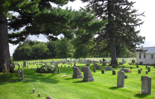
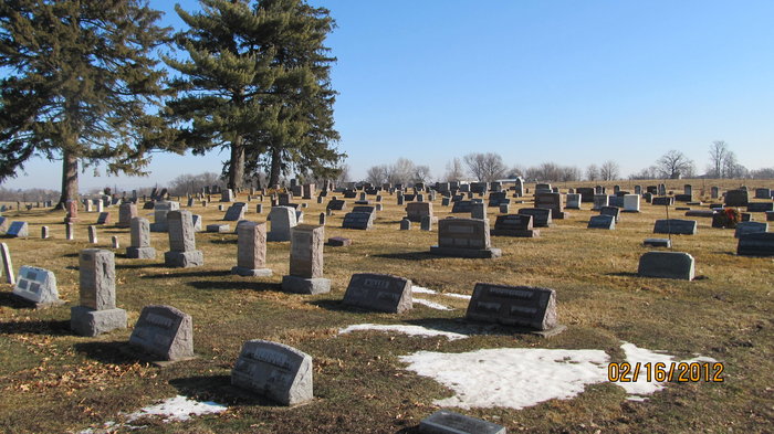
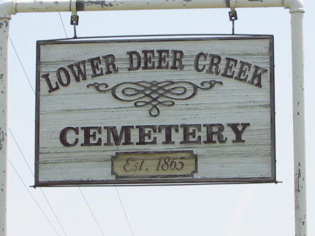
| Description | : | The family of Daniel P and Susanna (Miller) Guengerich, along with another family and a single man, were the first Amish to settle west of the Mississippi in 1846. Their one-year-old daughter, Christena, died that same year and was buried near the log cabin that stood outside the presently existing Lower Deer Creek Cemetery. Hers was the first Amish burial in Johnson County, Iowa. The location of her grave site is not known because the cemetery was established in 1865 when John Schlabaugh was the first to be buried in the cemetery proper. This cemetery is used largely by the... Read More |
frequently asked questions (FAQ):
-
Where is Lower Deer Creek Cemetery?
Lower Deer Creek Cemetery is located at Johnson County ,Iowa ,USA.
-
Lower Deer Creek Cemetery cemetery's updated grave count on graveviews.com?
673 memorials
-
Where are the coordinates of the Lower Deer Creek Cemetery?
Latitude: 41.5381012
Longitude: -91.7985992
Nearby Cemetories:
1. Pleasant Hill Cemetery
Johnson County, USA
Coordinate: 41.5346170, -91.7884060
2. Schottler Cemetery
Amish, Johnson County, USA
Coordinate: 41.5348950, -91.8118270
3. Wertz Cemetery
Amish, Johnson County, USA
Coordinate: 41.5486500, -91.7939000
4. Upper Deer Creek Mennonite Church Cemetery
Iowa County, USA
Coordinate: 41.5408300, -91.8398500
5. Brenneman Cemetery
Amish, Johnson County, USA
Coordinate: 41.5166702, -91.7611084
6. West Union Mennonite Cemetery
Parnell, Iowa County, USA
Coordinate: 41.5631866, -91.8408966
7. Bethel Cemetery
Johnson County, USA
Coordinate: 41.5835991, -91.8082962
8. Haven Cemetery
Johnson County, USA
Coordinate: 41.5558080, -91.7320500
9. Angels Rest Cemetery
Washington Township, Johnson County, USA
Coordinate: 41.5896000, -91.7648000
10. Coffman Cemetery
English River Township, Washington County, USA
Coordinate: 41.4889045, -91.7585030
11. Frytown Cemetery
Johnson County, USA
Coordinate: 41.5718000, -91.7355000
12. Wassonville Cemetery
Daytonville, Washington County, USA
Coordinate: 41.4846992, -91.8317032
13. South Gingerich Mennonite Cemetery
Kalona, Washington County, USA
Coordinate: 41.5076294, -91.7227936
14. McArtor Cemetery
Holbrook, Iowa County, USA
Coordinate: 41.5520134, -91.8852692
15. Sharon Bethel Cemetery
Williamstown, Johnson County, USA
Coordinate: 41.5558000, -91.7086000
16. Snider Cemetery
Kalona, Washington County, USA
Coordinate: 41.4997386, -91.7196131
17. East Union Mennonite Cemetery
Sharon Center, Johnson County, USA
Coordinate: 41.5258179, -91.7049484
18. Graper Farm Cemetery
Iowa City, Johnson County, USA
Coordinate: 41.5904360, -91.7317740
19. North Gingerich Sharon Cemetery
Johnson County, USA
Coordinate: 41.5553017, -91.7024994
20. Windham Cemetery
Johnson County, USA
Coordinate: 41.6116982, -91.7667007
21. Wellman Mennonite Cemetery
Wellman, Washington County, USA
Coordinate: 41.4658012, -91.8478012
22. Sharon Hill Cemetery
Kalona, Washington County, USA
Coordinate: 41.4928017, -91.7071991
23. Wellman Cemetery
Wellman, Washington County, USA
Coordinate: 41.4636002, -91.8475037
24. Saint Peters Cemetery
Windham, Johnson County, USA
Coordinate: 41.6091995, -91.7407990